Sunday, February 26, 2006

[trip] Sharps Cave

The Mon Grotto took an enjoyable trip to Sharps Cave Sat. Feb 25, 2006. Three ladies from the Parkersburg Area Grotto joined us, as well as a few beginners - two were students from my high school alma mater.

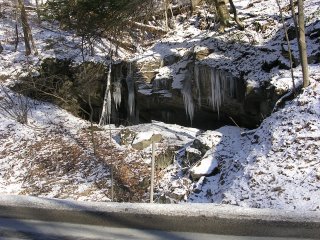
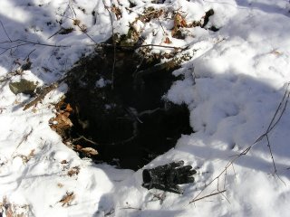
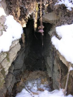
Brian and I got there early and went looking for Pinnacle Cave. Since I forgot to bring the coordinates with me, we went from my memory... in other words, we couldn't find it. We followed the limestone outcrops along the ridge for a bit and found several interesting spots that could use some digging.

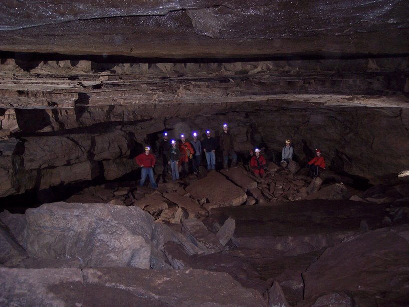
Our group of 12 cavers suited up, descended the entrance slot, and met up in the first big room. Brian brought three slave flash units, so we spent a lot of time setting up and taking photos in this cave. We took some more photos in Halloween Hall, then headed over the breakdown area to the left and went to the mud sculpture room where we rested for a bit.


A nice group photo in the entrance room


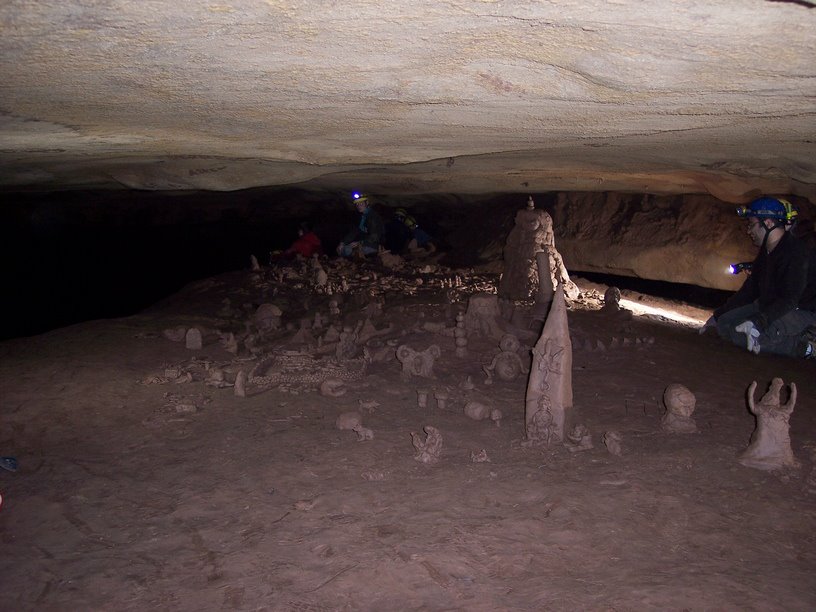
Checking out the mud sculptures

Afterwards, we headed below to the stream passage and walked upstream to the double waterfall, which was moving a good bit of water. We took some more photos, and a few people went up the lefthand stream tunnel to check it out. The group headed back downstream, and eventually back to Halloween Hall... for some more photos.


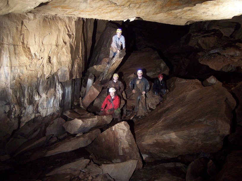
Climbing Sharps waterfall

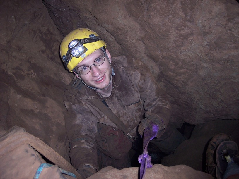
Since it was still early, we decided to check out the other half of the cave. We dropped down into the canyon passage to the right of Halloween Hall. This passage is an abandoned stream passage, but shortly exposes in a few small pits where the active stream is flowing directly beneath it. The stream flows from here, under the canyon passage, and eventually reappears as the top stream at the waterfall. Moving forward, you are eventually walking in the stream, but it's mostly dry travel.

After about 15 minutes, the passage opens up into a large room, Catfish Hall. As I cleared the breakdown and looked up into it, I saw a dozen lights pointed at me - I was completely surprised and couldn't figure out how our entire party had passed me and was now staring at me from the next room. It turned out to be the Pittsburgh Grotto, 11 strong, waiting there to surprise us! We mingled for a few minutes, then couldn't turn down the chance for another photo.

We're a happy family

We're a happy family - Mon Grotto, Pittsburgh Grotto meet underground

The Pittsburgh group headed back the way we'd just come, and some of our party headed out of the cave. The rest went forward, over some more very large breakdown, to find another impressively-sized room, the Z Room. Brian and I stayed here to take some more photos, while Doug and the remainder of the group explored for a bit beyond.


Lighting up the last big room

We headed back out, exited the cave to find daylight and very nice weather waiting for us.

All photos by Brian Masney

Alternate trip report: Doug McCarty, Additional photos: Mon Grotto Sharps page

Sunday, February 19, 2006

[trip] Ridge Walking Rt. 7

The roads were pretty slick yesterday morning; after sliding off Rt. 7 (between Dellslow and Masontown) several times, I decided that it was probably not the best idea to drive all the way to Parsons for the Tucker County Survey. I turned my car around at a pull-off and noticed what looked like a cave on the side of the road. Since I was pretty close to Maiden Run Cave, and I was itching to do something caving-related, I decided that it was the perfect opportunity and location to do a bit of ridge walking along Rt. 7.

I checked out the shelter cave, which had a good bit of water coming down from inside. It turns out that it has a tiny bit of solutionally-formed pseudo-cave moving water visible from the underside. A stream also flows over the top and down.


Limestone shelter cave from the road

Following the stream up from this shelter cave took me to a real FRO cave. It didn't seem to move air, but there's a good bit of water flowing out and the small cave passage definitely goes back into the hillside. Unfortunately, the caver-sized passage goes back less than a body-length.


FRO cave with glove for size reference

The next drainage valley over was also very interesting. Here I found some small cave passage which connects to a 3' deep limestone sinkhole. The small passage at the bottom of the sinkhole appears to go back into the hillside also. I moved some of the fluted limestone breakdown, like the kind you find at the bottom of a dome-pit, but it'd take some tools to clean it out enough to get a good idea of what's below and beyond.


Sinkhole with glove for size reference


Small cave passage down the hill from sinkhole

I also walked along the road for a bit just checking out the outcrops for geologically interesting features.


Limestone crossbedding seen from the road

Much more photos with individual descriptions are available at: http://gl1tch.com/gallery/WalkingRt7

All in all, it was enjoyable and interesting considering that I didn't walk more than half a mile. I wish I had a copy of the North Central West Virginia WVASS bulletin to compare with.

Wednesday, February 15, 2006

[gear] WVU Student Grotto Shirts

The WVU Student Grotto shirts, designed by John Tudek, came in and look really good. They're $15, cotton, and come in any colour you like (as long as you like WVU gold).


Yes, he's really using Woodburn Hall as a rig point, but at least he didn't bolt it

Thursday, February 09, 2006

[trip] Simmons-Mingo Cave

Last Saturday I drove down to the Elk River Valley and met up with the WVU Student Grotto to hit Simmons-Mingo Cave. Most of them had camped out at Oildrum Falls the night before.

Brian and Jason squeezed their way into the Oildrum Falls entrance, a very narrow tunnel with a stream flowing through part, and decided it was not worth rigging and dropping. We trudged up the Dry Branch a bit and peeked into the Stan's Blowing Rock entrance, which requires vert gear. After first thinking it'd been filled in, we crawled down the Zarathustra... Zurothoarsty... Zerostoaster... the other entrance.

The entrance tunnel goes down and to the left, then down a slot to a small muddy room, then down a 15' molehole which has a handline rigged. You come out on a large breakdown slope which takes you down to Edigar's Dome, an impressive 90' dome-pit that drops from the passage above at the Stan's Blowing entrance. Another smaller dome-pit faces it on the opposite side - this room had lots of bats clustered close together along crevices in the ceiling.


Edigar's Dome, as seen on the NSS 2000 Convention Guidebook

We followed the passage up to the top level, then down a narrow slot in the floor. A narrow phreatic tube goes forward for a ways, but we turned left into a very large and long paleo-passage. We followed it to its end, down some breakdown and back up into a room with very strong airflow but no leads out. Backtracking, we dropped down a hole in the floor to a smaller tunnel. There's a hole in the floor here with an old, twisted strand rope etrier rigged. We put some backup lines in place and climbed down.

This lower level contains a steep muddy bank which opens up to a very large room containing the underground Elk River - called the Canadian River here - this was an impressive sight. We travelled upstream, crossing the icy water too many times, for a bit. The roof lowers and the water sumps out, so we didn't travel far. Going back to the right we followed the river to where the Oildrum Falls stream comes pouring out of the ceiling as a 35' waterfall. The water started getting deeper at this end, it sumps and connects to My Cave here, so we headed back.

Going back up the etrier was quite a pain. It's an unforgiving rock crotch with nowhere to put your feet - it probably didn't help that I tried to do it with a pack strapped to my back. The climb back out the entrance passage was tiring as well, but everyone made it out in short time. We were probably in cave less than 4 hours. Since the weather was not on our side, everyone packed up camp and headed to Mama's Kitchen for some dinner.


Me climbing back up the etrier. Photo by Brian Masney

Tuesday, February 07, 2006

Know Your NADs

Are those GPS coordinates NAD27? NAD83? WGS84?? What I'm talking about is the "datum", or ellipse model used to approximate the shape of the earth - it's not a sphere because it bulges around the equator. Coordinates for the same location, but using a different datum, will have different values.

Way back in 1866, somebody started in Kansas and manually surveyed across the continent. The government used that data back in 1927 to come up with a model of the earth's shape, NAD27 for North American Datum 1927, and that's what the USGS used for all their maps. Believe it or not, manually surveying the planet back in 1866 turned out to not be exactly correct, so in the 80's they used all that Star Wars technology to make a new model of the earth, NAD83. This model was expanded to work for the entire planet instead of just our continent, that's called WGS84.

I use WGS84 because that's what Google Maps uses, and it's probably what most GPS devices default to. However, all the old USGS maps use NAD27. My GPS stores waypoints in some agnostic format so all I have to do is switch the datum it's using and all my points are magically converted for me.

As chance would have it, WV's location happens to fall so that both NAD27 and NAD83/WGS84 are pretty close together - within tens of meters. They're almost the same near TAG, but 300 meters off towards the West coast, as seen below.

NAD27 NAD83 Difference

The difference between NAD27 and NAD83 coordinates by location