I checked out the shelter cave, which had a good bit of water coming down from inside. It turns out that it has a tiny bit of solutionally-formed pseudo-cave moving water visible from the underside. A stream also flows over the top and down.
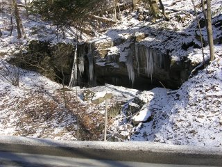
Limestone shelter cave from the road
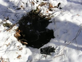
Following the stream up from this shelter cave took me to a real FRO cave. It didn't seem to move air, but there's a good bit of water flowing out and the small cave passage definitely goes back into the hillside. Unfortunately, the caver-sized passage goes back less than a body-length.

FRO cave with glove for size reference
The next drainage valley over was also very interesting. Here I found some small cave passage which connects to a 3' deep limestone sinkhole. The small passage at the bottom of the sinkhole appears to go back into the hillside also. I moved some of the fluted limestone breakdown, like the kind you find at the bottom of a dome-pit, but it'd take some tools to clean it out enough to get a good idea of what's below and beyond.
Sinkhole with glove for size reference
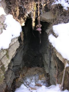
Small cave passage down the hill from sinkhole
I also walked along the road for a bit just checking out the outcrops for geologically interesting features.
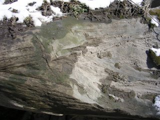
Limestone crossbedding seen from the road
Much more photos with individual descriptions are available at: http://gl1tch.com/gallery/WalkingRt7
All in all, it was enjoyable and interesting considering that I didn't walk more than half a mile. I wish I had a copy of the North Central West Virginia WVASS bulletin to compare with.


No comments:
Post a Comment