Getting a later start for our monthly Tucker County survey than usual, the usual suspects rolled into Parsons around 10am for breakfast. In addition to Kevin Keplinger, Brian Masney, Dave Riggs, John Harman, and Cullen Hencke were Jeff Stutler and Bill Good, as well Nikki Green (from U. of MD). Our goal of the day was to reinvestigate the Bonner property and try once again to find a back connection to another nearby cave.
We arrived at the Bonner property at around 11am. Kevin, Bill, and Jeff took advantage of the beautiful weather and went ridge-walking, which (I believe) resulted in no new discoveries. They also bounced Bonner Forty Footer, which they confirmed was a dead-bottom pit.
Dave, Brian, John, Cullen, and Nikki loaded up and prepared to push Bonner Cave. We were surprised to find that the cave is no longer enshrouded in fortress of briers and barbed wire, but is now very easily accessible with a small 4-wheeler road going right beneath the entrance. We rigged a hand-line and descended the steep entrance slope and free-climbed down the slot with compressed cave-air blowing up into our faces. We quickly followed the main stream passage (which had very little water flowing) to the Waiting Room.
Dave and Nikki pushed the low main passage, which starts as a belly-crawl in a shallow stream perched on the "Tucker County Asphalt", an impermeable black conglomerate with embedded rounded, white quartz pebbles. After several tens of feet, it is no longer possible to stay on the floor, and the unfortunate caver is forced to attempt to squeeze/crawl/pull/twist on top and through an ever-changing keyhole/slot/canyon. It should be noted that there are several small "rooms" throughout the passage in which one can sit and turn around easily. I eventually became so frustrated dragging my cave pack through this passage that I left it behind at around the half-way point. Flowstone, soda straws, and small stalactites are found throughout this passage. We came to what appears to have been a flowstone choke at one point, but has been hammered on one edge. Nikki squirmed over it with her helmet off, and I squirmed under it with my helmet off, one ear in the stream and one pressed against the rock overhead.
Unfortunately, we found large breakdown blocking further progress. Obvious cave of similar proportion can be seen beyond, and a strong wind blows from it, but we were unable to squeeze around the breakdown, despite our best efforts - Nikki made a struggled attempt, there was no chance of me getting around it. The stream flows beneath it, but this lowest level is only inches high. Breaking the rock would be extremely difficult, as it lays in the canyon passage lengthwise and is stacked high. I'm still personally convinced that connection to a large cave lies just a few hundred feet beyond this breakdown. Soaked, sore, and exhausted we headed back to the Waiting Room where the others were waiting.
Brian, John, and Cullen explored the upper passage, accessed by climbing up at the Waiting Room. An immediate lead on the left, which appears to be an infeeder to Bonner, is choked with flowstone and small rimstone dams, both at the upper and lower level. Heading straight, a very-dry, rounded crawlway heads off to the right and zig-zags from joint to joint. John pushed this passage to a flat room 18 inches high, where the thinly-bedded ceiling peels off and hangs dangerously over ones head. I did not note airflow in this dry passage, and we didn't deem this lead important enough to risk disturbing the ceiling flakes.
We exited the cave to daylight and sunshine, a welcome change for a February TCSS. We were packed and in the vehicles by 4pm, met the surface team on the road, and all headed to CJ's for a pizza dinner.
Showing posts with label tcss. Show all posts
Showing posts with label tcss. Show all posts
Saturday, February 16, 2008

Saturday, January 19, 2008
[trip] Chilly Tucker County Survey
On Saturday, January 19 2008, the Tucker County Speleological Survey returned to MR Cave for the first time in over a year. With five people present, we split into two teams: Doug McCarty and Doug Bell would re-survey a side-lead towards the front of the cave, while John Harman, Cullen Hencke, and myself - Dave Riggs - would push one mile into the cave to continue the survey of the main cave passage.
After meeting for breakfast in Parsons, we headed to the cave and suited up as snow fell on our heads. We entered the cave at approximately 10AM, rigged the waterfall drop with a webbing handline and quickly crawled past the dripping water into the cave's main stream passage.
Several-hundred feet up the main passage, we reached Doug and Doug's side lead. Our groups parted, and this was the last that we saw of each other. They surveyed 275 feet of passage and were back on the surface by 4PM.
John, Cullen, and I continued on to the Swimming Pool, where we got soaked nearly to our waists. 1000-grueling-feet further, we stopped for water and John discovered that the tight Tucker County passage had cracked and broken his water bottle. We would have to share 2 liters of water between three people over the course of a long survey trip.
Another 1000-feet-or-two later and we were at our destination... and exhausted! One mile of Tucker County cave typically means thousands of feet of crawling or duck-walking in narrow stream passage, and MR Cave is a fine example of Tucker County's best. John and Cullen changed into dry clothes and ate, while I pushed ahead in the main passage to determine where our survey should head: the main route went low as a very-wet stream crawl, or high as a tight stooping passage with sketchy, gypsum-wedged breakdown, while a side lead followed an infeeder canyon coming in at a right angle. Surprisingly, I found carbide graffiti in the low main passage: "π 69" - meaning that the Pi Kappa Alpha fraternity from WVU had been all the way back here in 1969. Had they come in all this way from the main entrance, or had they come in some rear entrance that we've not yet found?
We decided to survey the side-lead first, to knock it off the lead list, and expecting it to pinch out within 100 feet or so, as all the other known infeeders do. John and Cullen were on instrument, and I was trying my hand at keeping book and sketching. We slowly worked our way upstream, choosing the easiest route through up-to-three levels of meandering canyon. At times the passage was 4 feet high, at times it was 25 feet from stream to ceiling. We found a few nice formations along the way and the remains of some sort of small mammal. Eventually, the ceiling came down to meet the stream and the cave continued as a 2-foot-high crawl with a small upper passage, with definite air movement. We wound up surveying 502 feet in a passage that we didn't expect to continue.
After heading back to the junction, eating a much-needed meal, and gulping down our rations of water, we started the trek back out of the cave. The trip out took much less time than the trip in, perhaps because it was downhill and downstream, perhaps because we were so intent on getting out of the cave. As we came closer and closer to the entrance, the frigid wind blowing in our faces felt colder and colder.
Completely soaking wet, we exited the cave at 1:15AM, after 15 hours underground. The ground was covered with snow and ice, the temperature was 5°F - our coveralls immediately started to freeze, our wet hands and feet went instantly numb, we could feel ice crystals forming in our noses as we ran approximately 1/4 mile to the car. John arrived first and started it up, Cullen and I went the long, uphill way and both dove to the warm exhaust to thaw out our hands. We changed as quickly as possible, left a note at Kevin K's house, and then drove to Germany Valley, finally getting some sleep at around 4AM. MR Cave is now 7357 feet (1.4 miles) long.
After meeting for breakfast in Parsons, we headed to the cave and suited up as snow fell on our heads. We entered the cave at approximately 10AM, rigged the waterfall drop with a webbing handline and quickly crawled past the dripping water into the cave's main stream passage.
Several-hundred feet up the main passage, we reached Doug and Doug's side lead. Our groups parted, and this was the last that we saw of each other. They surveyed 275 feet of passage and were back on the surface by 4PM.
John, Cullen, and I continued on to the Swimming Pool, where we got soaked nearly to our waists. 1000-grueling-feet further, we stopped for water and John discovered that the tight Tucker County passage had cracked and broken his water bottle. We would have to share 2 liters of water between three people over the course of a long survey trip.
Another 1000-feet-or-two later and we were at our destination... and exhausted! One mile of Tucker County cave typically means thousands of feet of crawling or duck-walking in narrow stream passage, and MR Cave is a fine example of Tucker County's best. John and Cullen changed into dry clothes and ate, while I pushed ahead in the main passage to determine where our survey should head: the main route went low as a very-wet stream crawl, or high as a tight stooping passage with sketchy, gypsum-wedged breakdown, while a side lead followed an infeeder canyon coming in at a right angle. Surprisingly, I found carbide graffiti in the low main passage: "π 69" - meaning that the Pi Kappa Alpha fraternity from WVU had been all the way back here in 1969. Had they come in all this way from the main entrance, or had they come in some rear entrance that we've not yet found?
We decided to survey the side-lead first, to knock it off the lead list, and expecting it to pinch out within 100 feet or so, as all the other known infeeders do. John and Cullen were on instrument, and I was trying my hand at keeping book and sketching. We slowly worked our way upstream, choosing the easiest route through up-to-three levels of meandering canyon. At times the passage was 4 feet high, at times it was 25 feet from stream to ceiling. We found a few nice formations along the way and the remains of some sort of small mammal. Eventually, the ceiling came down to meet the stream and the cave continued as a 2-foot-high crawl with a small upper passage, with definite air movement. We wound up surveying 502 feet in a passage that we didn't expect to continue.
After heading back to the junction, eating a much-needed meal, and gulping down our rations of water, we started the trek back out of the cave. The trip out took much less time than the trip in, perhaps because it was downhill and downstream, perhaps because we were so intent on getting out of the cave. As we came closer and closer to the entrance, the frigid wind blowing in our faces felt colder and colder.
Completely soaking wet, we exited the cave at 1:15AM, after 15 hours underground. The ground was covered with snow and ice, the temperature was 5°F - our coveralls immediately started to freeze, our wet hands and feet went instantly numb, we could feel ice crystals forming in our noses as we ran approximately 1/4 mile to the car. John arrived first and started it up, Cullen and I went the long, uphill way and both dove to the warm exhaust to thaw out our hands. We changed as quickly as possible, left a note at Kevin K's house, and then drove to Germany Valley, finally getting some sleep at around 4AM. MR Cave is now 7357 feet (1.4 miles) long.
Saturday, August 18, 2007
[trip] Bennett Cave Survey Part 4
We thought that this weekend would be the final trip into Tucker County's Bennett Cave, but the cave refused to let us finish it up. The TCSS met up Saturday morning at the Tucker Country Inn in Parsons and headed to the cave to gear up. Kevin and Justin K. met us in the morning but didn't go underground due to a skateboard-induced injury (Justin was skating, not Kevin).
Doug McCarty, Josh Flaugher, and Cullen Hencke started surveying into the high lead in the downclimb from the upper to lower level. Everyone thought that this small lead would pinch out within a few tens of feet, but they surveyed over 200 feet and finding the inside of the stream resurgence that we found on the surface. They named the room with sunlight shining in from above the "Spider Room"... that's one that I'm glad to have not surveyed myself. Doug was able to reach his hand completely outside the cave from here.
Brian Masney, John Harman, and myself (Dave Riggs) tried to finish the survey above the main waterfall. John scaled the waterfall first, getting soaked in the process, and put a tarp in place to try and cut down on the spray. While the tarp helped, we all still got plenty wet on the climb. We climbed up to the next level, where we found a large lead to the right and a low lead to the left.
The left lead went to a stair-stepped dome/canyon series consisting of two waterfall climbs, and ending in surface valley breakdown. We began to survey and realized that we did not have a pencil - oops! While Brian descended to go beg the other survey team for a pencil, John and I scooped the left passage.
A quick climb up and back down led to another waterfall climb on the right which ended in surface valley breakdown. To the left, we followed a canyon downstream, checking out a dome lead on the way, then I followed a low crawl which curved back around and turned out to be the smallest of the three waterfalls in the main waterfall room. John followed a low tube to the right which popped him out at the top of the Trash Dome, under and behind the main waterfall. The tight, water-carved passage also did a serious number on his cave suit.
Brian finally returned with a pencil, and we began to survey the right lead, then started on the left lead. We surveyed the upstream waterfall climb and the dome side lead, where I hammered my way into about 20 feet of miserable, muddy virgin passage. Cold, wet, and shivering, we decided to start tying our survey in to the rest of the cave before we were forced to leave it hanging. We did a 20 foot plumb shot down to the middle level, and surveyed to the main waterfall just as the second team showed up to find us. We shot down the main waterfall and tied into a known station down at base level, packed up, and left the cave.

Bennett Cave plan lineplot, as of August 2007.

Bennett Cave profile lineplot, rotated to show hypothesized fault plane. The limestone is bedded nearly horizontally.
While we racked up well over 400 feet of survey, the cave will still require at least one more good survey trip to complete. That's fine with me, as I've still got to do the map! We changed clothes after a good 7 hour trip and headed to CJ's for pizza. Afterwards, I drove to Oildrum Falls to camp for the night and head into Bradshaw Run Cave the next day.
Bennett Cave now stands at over 1800 feet long, 96 feet deep - 2nd deepest and 15th longest cave in Tucker County (exact numbers pending delivery of survey data to cartographer).
Bennett Cave is CLOSED by the landowner, and permission has been granted to the TCSS only to survey the cave.
Doug McCarty, Josh Flaugher, and Cullen Hencke started surveying into the high lead in the downclimb from the upper to lower level. Everyone thought that this small lead would pinch out within a few tens of feet, but they surveyed over 200 feet and finding the inside of the stream resurgence that we found on the surface. They named the room with sunlight shining in from above the "Spider Room"... that's one that I'm glad to have not surveyed myself. Doug was able to reach his hand completely outside the cave from here.
Brian Masney, John Harman, and myself (Dave Riggs) tried to finish the survey above the main waterfall. John scaled the waterfall first, getting soaked in the process, and put a tarp in place to try and cut down on the spray. While the tarp helped, we all still got plenty wet on the climb. We climbed up to the next level, where we found a large lead to the right and a low lead to the left.
The left lead went to a stair-stepped dome/canyon series consisting of two waterfall climbs, and ending in surface valley breakdown. We began to survey and realized that we did not have a pencil - oops! While Brian descended to go beg the other survey team for a pencil, John and I scooped the left passage.
A quick climb up and back down led to another waterfall climb on the right which ended in surface valley breakdown. To the left, we followed a canyon downstream, checking out a dome lead on the way, then I followed a low crawl which curved back around and turned out to be the smallest of the three waterfalls in the main waterfall room. John followed a low tube to the right which popped him out at the top of the Trash Dome, under and behind the main waterfall. The tight, water-carved passage also did a serious number on his cave suit.
Brian finally returned with a pencil, and we began to survey the right lead, then started on the left lead. We surveyed the upstream waterfall climb and the dome side lead, where I hammered my way into about 20 feet of miserable, muddy virgin passage. Cold, wet, and shivering, we decided to start tying our survey in to the rest of the cave before we were forced to leave it hanging. We did a 20 foot plumb shot down to the middle level, and surveyed to the main waterfall just as the second team showed up to find us. We shot down the main waterfall and tied into a known station down at base level, packed up, and left the cave.

Bennett Cave plan lineplot, as of August 2007.

Bennett Cave profile lineplot, rotated to show hypothesized fault plane. The limestone is bedded nearly horizontally.
While we racked up well over 400 feet of survey, the cave will still require at least one more good survey trip to complete. That's fine with me, as I've still got to do the map! We changed clothes after a good 7 hour trip and headed to CJ's for pizza. Afterwards, I drove to Oildrum Falls to camp for the night and head into Bradshaw Run Cave the next day.
Bennett Cave now stands at over 1800 feet long, 96 feet deep - 2nd deepest and 15th longest cave in Tucker County (exact numbers pending delivery of survey data to cartographer).
Bennett Cave is CLOSED by the landowner, and permission has been granted to the TCSS only to survey the cave.
Saturday, May 19, 2007
[trip] Bennett Cave Survey Part 3
This month at Tucker County, we had only one survey team in Bennett Cave. Brian Masney, Josh Flaugher, and I (Dave Riggs) first surveyed the remainder of the downstream trunk passage. It meanders a bit, and the main stream juts in and out from under the wall a couple times. The ceiling gets very low - about 12 - 18 inches - and you must crawl for a few feet in the wide, shallow stream to pass it... but then it opens back up to 12 foot high trunk passage with high sediment walls. This big passage abruptly ends at a big sump pool with very slowly swirling water, depth unknown. Given the massive mounds of sediment around the pool, I suspect that even in low water (the water was relatively high today) the sump is impassable by lunged cavers. We did encounter two very large frogs here at the sump pool, hence it's dubbed name, the "Frog Pond".
We then headed back upstream to the waterfall room to knock out the lower two leads. We started from the red painted station on the ceiling under the waterfall and surveyed the left passage. This low, winding passage starts out small but opens up to crawling height shortly. Dry at first, a small stream is encountered, then old cans and bottles, a large salamander, followed by... a beautiful 15 foot high domepit. Brian did a sketchy climbup and checked a lead to the right, which he said was too tight. The water was coming from the left, and his view made it appear that attempting to push the low, wet lead would be torturous (so we didn't even try). My ability to survey backwards through this lead earned a name in my honor (which will not be uttered here).
Finally, we surveyed the right lead under the waterfall. This lead is never higher than 3 feet, but is extremely wide. It is fed by two infeeders, a too tight stream on the left, and a waterfall over frightening sandstone breakdown and surface debris from the ceiling on the right. I suspect that this right passage is fed directly from the surface stream above, while the left lead is fed from further upstream, closer to (or directly from) the garbage-filled FRO.

Bennett Cave lineplot as of May 2007
We netted about 400 feet of survey, the last of the major survey effort with the exception of the passage above the big waterfall. Several very small sections need mopped up, but these are trivial. If we can muster two survey groups next month, we should be able to complete the survey of Bennett Cave.
After meeting up with Doug McCarty and Kevin Keplinger, who had just finished surveying the small new cave on the Bennett property (which while only 35 foot long, apparently got them soaked with dripping water), we headed to CJ's for pizza. Brian and I then drove to Dolly Sods, which supposedly got a large amount of snow the previous night. We didn't find any snow, but the wind was absolutely incredible! I tested out my new Hennessy Hammock, which did an excellent job of keeping me dry in the rain and wind. In the morning, Brian and I hiked around 8 beautiful miles in excellent weather.
We then headed back upstream to the waterfall room to knock out the lower two leads. We started from the red painted station on the ceiling under the waterfall and surveyed the left passage. This low, winding passage starts out small but opens up to crawling height shortly. Dry at first, a small stream is encountered, then old cans and bottles, a large salamander, followed by... a beautiful 15 foot high domepit. Brian did a sketchy climbup and checked a lead to the right, which he said was too tight. The water was coming from the left, and his view made it appear that attempting to push the low, wet lead would be torturous (so we didn't even try). My ability to survey backwards through this lead earned a name in my honor (which will not be uttered here).
Finally, we surveyed the right lead under the waterfall. This lead is never higher than 3 feet, but is extremely wide. It is fed by two infeeders, a too tight stream on the left, and a waterfall over frightening sandstone breakdown and surface debris from the ceiling on the right. I suspect that this right passage is fed directly from the surface stream above, while the left lead is fed from further upstream, closer to (or directly from) the garbage-filled FRO.

Bennett Cave lineplot as of May 2007
We netted about 400 feet of survey, the last of the major survey effort with the exception of the passage above the big waterfall. Several very small sections need mopped up, but these are trivial. If we can muster two survey groups next month, we should be able to complete the survey of Bennett Cave.
After meeting up with Doug McCarty and Kevin Keplinger, who had just finished surveying the small new cave on the Bennett property (which while only 35 foot long, apparently got them soaked with dripping water), we headed to CJ's for pizza. Brian and I then drove to Dolly Sods, which supposedly got a large amount of snow the previous night. We didn't find any snow, but the wind was absolutely incredible! I tested out my new Hennessy Hammock, which did an excellent job of keeping me dry in the rain and wind. In the morning, Brian and I hiked around 8 beautiful miles in excellent weather.
Saturday, April 21, 2007
[trip] Bennett Cave Survey Part 2
Tucker County Speleological Survey headed back into Bennett Cave this month. Our team - Dave Riggs, Brian Masney, John Harman, and Josh Flaugher - headed in to survey above the waterfall. I scaled the questionably-old rope first, getting soaked in the process. One bye one, everyone climbed the 20ft waterfall, each being drenched with cold water in the process. At the top, we found a small chamber with a sketchy 15ft chimney rigged with a length of webbing. Brian scaled up it and examined the passage above - another waterfall climb. Already chilled, we decided to abort the waterfall survey until next month (with wetsuits and extra dry polypro).
We then headed downstream and surveyed about 150ft of muddy passage, (almost) killing the left side lead. Doug McCarty's team surveyed from the big room into the waterfall room, then under and towards the left.

Bennett Cave lineplot as of April, 2007.
After exiting the cave, a local took us to a "hole" which had recently opened on the property. We walked over with him, and I went in to check out this new virgin cave. It consists of a single 40ft gothic-shaped passage, with nice vertical fluting. The ceiling is between 10 and 20ft tall, but the cave is never more than 4ft wide. With a bit of digging in the floor, it may be pushed further - but no air movement was noted.

Dave Riggs exiting the small new Tucker County cave. Photo by Brian Masney.
Finally, John, Josh, and I did a surface survey from the trash-filled FRO to an insurgance point where the stream drops 10ft down enlarged joints, to the Bennett Cave entrance.
Bennett Cave is now just over 800ft long. Remaining leads are the downstream main passage, under waterfall right passage (low and wide), and whatever wet passage exists above the waterfall.
Bennett Cave is located on private property and is CLOSED for recreational caving. The Tucker County Speleological Survey has been granted permission explicitly to survey this cave.
See also: Brian Masney's photos
We then headed downstream and surveyed about 150ft of muddy passage, (almost) killing the left side lead. Doug McCarty's team surveyed from the big room into the waterfall room, then under and towards the left.

Bennett Cave lineplot as of April, 2007.
After exiting the cave, a local took us to a "hole" which had recently opened on the property. We walked over with him, and I went in to check out this new virgin cave. It consists of a single 40ft gothic-shaped passage, with nice vertical fluting. The ceiling is between 10 and 20ft tall, but the cave is never more than 4ft wide. With a bit of digging in the floor, it may be pushed further - but no air movement was noted.

Dave Riggs exiting the small new Tucker County cave. Photo by Brian Masney.
Finally, John, Josh, and I did a surface survey from the trash-filled FRO to an insurgance point where the stream drops 10ft down enlarged joints, to the Bennett Cave entrance.
Bennett Cave is now just over 800ft long. Remaining leads are the downstream main passage, under waterfall right passage (low and wide), and whatever wet passage exists above the waterfall.
Bennett Cave is located on private property and is CLOSED for recreational caving. The Tucker County Speleological Survey has been granted permission explicitly to survey this cave.
See also: Brian Masney's photos
Saturday, March 17, 2007
[trip] Bennett Cave Survey
This month, the Tucker County Speleological Survey had a huge turnout - Kevin Keplinger, Brian Masney, Dave Riggs, Justin Keplinger, Doug Bell, Jesse Miller, Josh Flaugher, John Harman and Doug McCarty all showed up even though the roads were covered with snow and ice. Thanks to the incredible hospitality of the landowners, we were permitted to survey Bennett Cave, and were given a warm, dry place to change clothes - thanks very much!
The entrance to Bennett Cave is a six foot deep crevice opening in a small limestone outcrop in the middle of a valley wall. A muddy talus slope leads down into a large entrance room with dimensions roughly 45x25 feet, and a height of up to 20 feet. A free-climbable twisted pit leads down to a lower room of about 10 foot in diameter with a 15 foot ceiling. The entrance slope and climbdown are both littered with broken glass, discarded small appliances, and animal remains. A 100' rope rigged outside the entrance serves as a useful handline for exploring the cave.

Josh Flaugher in the entrance to Bennett Cave. Photo by Brian Masney.
From this lower room, a very tight pinch in the floor leads to a low, wide crawl, which then opens up into breakdown into another large room. This breakdown-floored room is 45x35 feet, and up to 25 feet tall. To the right, one may climb down through breakdown to a chamber featuring a pair of 20 foot tall waterfalls. One waterfall is rigged with rope, and has going passage at the top. The waterfall room appears to be formed along a small fault or angular unconformity. To the left, one may follow the trunk stream passage, up to 8 foot in diameter, for over 200 feet. The floor is lined with large cobbles and the stream meanders back and forth, eventually disappearing under the right wall. Two high leads go in opposite directions at the end of the dry stream passage, as another small infeeder joins the passage.

Brian Masney, Johsh Flaugher, John Harman, and Jesse Miller at the base of the left waterfall. Photo by John Harman.

Right waterfall showing possible fault from upper left to lower right. Photo by John Harman.
We split up into two survey teams, with one team surveying the upper passages, and my team starting below. Our (lower) team thought that we had gotten the short end of the stick as we surveyed through a steep, tight pinch and into very low passage. However, as soon as we broke into the lower big room and saw the two waterfalls and booming trunk passage, we were all completely elated! Combined, our groups surveyed over 400 feet of passage in the two levels of the cave. We will return next month to complete the survey, mopping up the two leads at the end of the stream passage and the lead atop the waterfall.

Josh Flaugher in the lower stream trunk. Photo by Brian Masney.
Bennett Cave is located on private property and is CLOSED for recreational caving. The Tucker County Speleological Survey has been granted permission explicitly to survey this cave.
See also: Brian Masney's photos, John Harman's photos.
The entrance to Bennett Cave is a six foot deep crevice opening in a small limestone outcrop in the middle of a valley wall. A muddy talus slope leads down into a large entrance room with dimensions roughly 45x25 feet, and a height of up to 20 feet. A free-climbable twisted pit leads down to a lower room of about 10 foot in diameter with a 15 foot ceiling. The entrance slope and climbdown are both littered with broken glass, discarded small appliances, and animal remains. A 100' rope rigged outside the entrance serves as a useful handline for exploring the cave.

Josh Flaugher in the entrance to Bennett Cave. Photo by Brian Masney.
From this lower room, a very tight pinch in the floor leads to a low, wide crawl, which then opens up into breakdown into another large room. This breakdown-floored room is 45x35 feet, and up to 25 feet tall. To the right, one may climb down through breakdown to a chamber featuring a pair of 20 foot tall waterfalls. One waterfall is rigged with rope, and has going passage at the top. The waterfall room appears to be formed along a small fault or angular unconformity. To the left, one may follow the trunk stream passage, up to 8 foot in diameter, for over 200 feet. The floor is lined with large cobbles and the stream meanders back and forth, eventually disappearing under the right wall. Two high leads go in opposite directions at the end of the dry stream passage, as another small infeeder joins the passage.

Brian Masney, Johsh Flaugher, John Harman, and Jesse Miller at the base of the left waterfall. Photo by John Harman.

Right waterfall showing possible fault from upper left to lower right. Photo by John Harman.
We split up into two survey teams, with one team surveying the upper passages, and my team starting below. Our (lower) team thought that we had gotten the short end of the stick as we surveyed through a steep, tight pinch and into very low passage. However, as soon as we broke into the lower big room and saw the two waterfalls and booming trunk passage, we were all completely elated! Combined, our groups surveyed over 400 feet of passage in the two levels of the cave. We will return next month to complete the survey, mopping up the two leads at the end of the stream passage and the lead atop the waterfall.

Josh Flaugher in the lower stream trunk. Photo by Brian Masney.
Bennett Cave is located on private property and is CLOSED for recreational caving. The Tucker County Speleological Survey has been granted permission explicitly to survey this cave.
See also: Brian Masney's photos, John Harman's photos.
Saturday, January 20, 2007
Elklick Ridge Walking
The Tucker County Speleological Survey met and spent a cold day ridge walking along Elklick Valley. We spent a few hours tracking down the landowners for permission, then rediscovered some very cool caves, which we'll re-visit when we're more prepared for a wet and vertical trip.

Jason Thomas looks for cave passage in Elklick Spring.
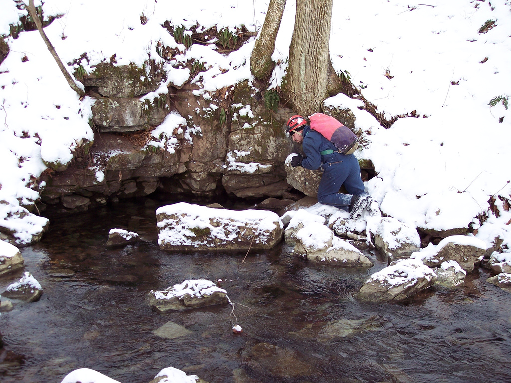
Jason Thomas looks for cave passage in Elklick Spring.
Sunday, September 24, 2006
[trip] Tucker County Survey
Brian Masney, Mary Schmidt and I went into our current Tucker County cave this weekend (2006-09-16) with the original intention of resuming the survey from where we left off last time - about 2.5 - 3 hours back into the cave. We were in cave around 10:30am, and the water level was the lowest I have ever seen it in the cave (which is also what I said last time).
We made it to the end of the main survey in 3 hours, 45 minutes, including two side-excursions to push tributary leads. Frustrated with the time and effort required to get back here, we decided to abort the survey trip and push forward to either find better passage or another entrance. The upper, main passage continues forward for a ways, and goes from walking passage to stooping passage to crawling on breakdown flakes. It primarily zig-zags following regular joint sets. At some point we dropped down the the middle level, but were kept up off the stream level the entire time. Travel became slow and painful through the breakdown flakes. We passed several right-hand side passages, though none looked very promising. Airflow was very weak and we were not having fun.
We eventually came to another right-hand side lead, this one very curiously keyhole shaped, while the "main passage" continued as a nasty breakdown crawl. Both appeared to be virgin passage - we chose the keyhole. This passage went for 30' or so, then got wider and more rectangular with one or two small, meandering, phreatic tubes in its side. We found a window in the floor, for the first time in several hundred feet revealing water to us again. Excitedly, I rushed on to find a way down, scurried down a nice chute, and shouted back up "we've got cave!" This interesting passage has almost vertical walls, about 3' wide, and almost completely parallel, making it look like an aqueduct (at least, it would have had the cave not been so dry - it was more of a mudduct). The passage had faint airflow. Mary took the lead and scooped about 150' - 200' of walking passage which kept getting larger and eventually taking on a meandering shape. Deciding that we needed something to coax us back into this cave again, we turned around in nice walking passage. We had travelled at least 500 (unpleasant) feet from the current survey.
We were out of the cave at 7:45pm, stopped by Kevin's house to check in, and then had pizza at CJ's.
We made it to the end of the main survey in 3 hours, 45 minutes, including two side-excursions to push tributary leads. Frustrated with the time and effort required to get back here, we decided to abort the survey trip and push forward to either find better passage or another entrance. The upper, main passage continues forward for a ways, and goes from walking passage to stooping passage to crawling on breakdown flakes. It primarily zig-zags following regular joint sets. At some point we dropped down the the middle level, but were kept up off the stream level the entire time. Travel became slow and painful through the breakdown flakes. We passed several right-hand side passages, though none looked very promising. Airflow was very weak and we were not having fun.
We eventually came to another right-hand side lead, this one very curiously keyhole shaped, while the "main passage" continued as a nasty breakdown crawl. Both appeared to be virgin passage - we chose the keyhole. This passage went for 30' or so, then got wider and more rectangular with one or two small, meandering, phreatic tubes in its side. We found a window in the floor, for the first time in several hundred feet revealing water to us again. Excitedly, I rushed on to find a way down, scurried down a nice chute, and shouted back up "we've got cave!" This interesting passage has almost vertical walls, about 3' wide, and almost completely parallel, making it look like an aqueduct (at least, it would have had the cave not been so dry - it was more of a mudduct). The passage had faint airflow. Mary took the lead and scooped about 150' - 200' of walking passage which kept getting larger and eventually taking on a meandering shape. Deciding that we needed something to coax us back into this cave again, we turned around in nice walking passage. We had travelled at least 500 (unpleasant) feet from the current survey.
We were out of the cave at 7:45pm, stopped by Kevin's house to check in, and then had pizza at CJ's.
Monday, March 27, 2006
[trip] Tucker Co. Mar. 25, 2006
Brian Masney, Doug McCarty and I surveyed in the back of M*R cave this Saturday. We were in cave by 10am, and took probably close to 2 hours to get back to the end of the survey. We surveyed past the farthest point I'd previously been back in, past the end of the 1955 survey, and stayed close to the floor for longer straight shots rather than high and dry. The cave amazingly opened up into tall, 4' wide passage for probably 175' - a big relief after spending most of the day on our bellies in the water. We surveyed 420' of passage, then conveniently hit some low passage that inspired us to call it a day. Doug booked it out and had already changed clothes by the time Brian and I made it out of the cave around 9pm!
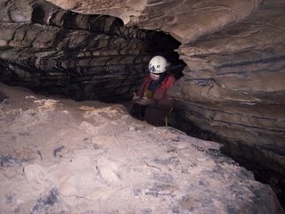
Doug McCarty sketching, photo by Brian Masney
Alternate trip report: Doug McCarty (includes excellent working lineplot of M*R)

Doug McCarty sketching, photo by Brian Masney
Alternate trip report: Doug McCarty (includes excellent working lineplot of M*R)
Monday, January 09, 2006
[trip] Bonner Cave #1
Tucker County Survey took an off-week trip to check out the Bonner Caves. Brian Masney and Aaron Bird worked an above-ground survey, while myself, Josh and Kevin Keplinger pushed Bonner Cave #1.
Bonner #1 is a smallish sink on the side of the hill, surrounded by briars, but not difficult to find. There are several good rigging trees lining the opening to the sink. The entrance is a very steep drop - if not vertical, then pretty close. We needed ascenders to get back out, and kicked ouselves for not ascending in full vert gear. The view back out the side of the hill is quite beautiful, with just a bit of water dripping down from the entrance.
The the entrance room continues sloping down. The floor is lots of small breakdown and large animal bones, however it does not stink like Bonner #2 (Josh and Aaron dropped this carcass-filled pit first and recommended that we not follow). This entrance room slope goes down to a slot in the floor where the wind whips out furiously - Josh's hair was literally blowing. This slot drops about 7 feet onto some sloping breakdown which continues down a few more feet to rubble and more large bones. The slot can be hand-climbed, but a rappelling rack definitely helped here too. It should be noted that this room and the entrance room contain the largest spiders that I've ever seen in my life.
The cave at this point is about 25' tall canyon passage with some shelves at about head-height and up towards the ceiling. A small stream appears here from beneath the slot and under the breakdown, and it more or less stays with the main passage the entire cave length. The existing maps says that there's an upper level to the cave, but it doesn't look like you could travel it here at the beginning of the cave, at least not a human (hint: this is what writers call "foreshadowing"). It winds for a bit, but generally follows the same straight path set out from the start.
After a few hundred feet of walking, a large 25' - 30' dome is encountered. A small stream pours out of the top, from the direction of Bonner Garbage Cave. It looks like a bolt climb or scaling pole would be necessary to reach passage at this level. Several interesting scratch marks were noted on the wall here, looking not unlike the claws of some animal...
The walking passage continues, from this point frequently interrupted by breakdown blocks in the passage which must be scaled over or snuck around, but movement is still easy. The cave then does a short zig-zag. In this zig-zag, there's a layer of white calcite crystals on the wall - not nearly as pretty as Cave Mountain, but cool to see. The water flows underneath the floor by about two or three feet, and is occasionally visible. There's a nice resting spot, a shelf table, a couple hundred feet ahead. There's also a side lead ahead and to the left, but the water and air continue forward, so we did as well. According to the map, which I didn't see until after we'd exited the cave, there's a traversable upper passage somewhere along this point - we did not notice it.
Here, the walking passage gets constricted and the water passage gets crawlable. This was the first time we really got wet in the cave. It's hands-and-knees at first, but eventually becomes a chest-in-the-water crawl. The water is only an inch or two deep, but it's just enough to be a pain. At this point, Kevin wisely chose to wait for Josh and I back at the resting area.
We crawled forward, scooting across the Tucker County asphalt, observing lots of white soda straws and small formations up towards the ceiling, and wishing it were big enough for us to stay out of the water. There's a kneeling point where we believe the final survey station, some orange tape, is placed. The ceiling here is filled with formations, including a 3' long soda straw. From here, the floor is too low to continue crawling, but the middle tube - about 10" by 10" with side, top, and bottom slots - is big enough to continue. Movement is very constricted, and is made especially annoying by how rough the sides of the passage are. We both eventually had to ditch our packs to keep going. Josh was 30' - 40' ahead of me, and we were both concerned that we'd have to try and back out of this tube. I waited at a "convenient" spot, he rounded a bend to where the passage gets a bit wider with some more soda straws, but continues as a nasty tube crawl. The wind in this constricted passage is incredibly strong, visibly blowing the orange survey tape around.
We managed to get turned around, eventually went back to meet Kevin, and headed back out. At the big dome, Josh and I examined the claw marks on the wall, speculating about what sort of animal would make them. As we headed forward to leave, I shined my lamp out towards the canyon ceiling, and Kevin shouted "Look at those eyes!" Two pair of glowing yellow eyes, moving around up above, were watching us. Raccoons! While the Keplingers are the kind of folks that hunt 'coon with their bare hands, I was just a bit nervous thinking about how my accident report was going to sound..."150lb City-boy Caver Mauled By Rabid Cave Coons". Apparently these raccoons were well-fed at the time, because they chose not to attack us as we briskly jogged the rest of the canyon passage back to the slot. I kept my light pointed towards the ceiling just in case.
We used hand ascenders to climb back up the slot, then each slowly and un-gracefully climbed back up the wet sinkhole entrance. We probably spent only 3 hours in cave. Josh and I walked around the area afterwards, finding a very small sinkhole that didn't move air on the far side of the hill, and a tiny resurgance with no cave passage on the bottom of that hillside.
Bonner #1 is a smallish sink on the side of the hill, surrounded by briars, but not difficult to find. There are several good rigging trees lining the opening to the sink. The entrance is a very steep drop - if not vertical, then pretty close. We needed ascenders to get back out, and kicked ouselves for not ascending in full vert gear. The view back out the side of the hill is quite beautiful, with just a bit of water dripping down from the entrance.
The the entrance room continues sloping down. The floor is lots of small breakdown and large animal bones, however it does not stink like Bonner #2 (Josh and Aaron dropped this carcass-filled pit first and recommended that we not follow). This entrance room slope goes down to a slot in the floor where the wind whips out furiously - Josh's hair was literally blowing. This slot drops about 7 feet onto some sloping breakdown which continues down a few more feet to rubble and more large bones. The slot can be hand-climbed, but a rappelling rack definitely helped here too. It should be noted that this room and the entrance room contain the largest spiders that I've ever seen in my life.
The cave at this point is about 25' tall canyon passage with some shelves at about head-height and up towards the ceiling. A small stream appears here from beneath the slot and under the breakdown, and it more or less stays with the main passage the entire cave length. The existing maps says that there's an upper level to the cave, but it doesn't look like you could travel it here at the beginning of the cave, at least not a human (hint: this is what writers call "foreshadowing"). It winds for a bit, but generally follows the same straight path set out from the start.
After a few hundred feet of walking, a large 25' - 30' dome is encountered. A small stream pours out of the top, from the direction of Bonner Garbage Cave. It looks like a bolt climb or scaling pole would be necessary to reach passage at this level. Several interesting scratch marks were noted on the wall here, looking not unlike the claws of some animal...
The walking passage continues, from this point frequently interrupted by breakdown blocks in the passage which must be scaled over or snuck around, but movement is still easy. The cave then does a short zig-zag. In this zig-zag, there's a layer of white calcite crystals on the wall - not nearly as pretty as Cave Mountain, but cool to see. The water flows underneath the floor by about two or three feet, and is occasionally visible. There's a nice resting spot, a shelf table, a couple hundred feet ahead. There's also a side lead ahead and to the left, but the water and air continue forward, so we did as well. According to the map, which I didn't see until after we'd exited the cave, there's a traversable upper passage somewhere along this point - we did not notice it.
Here, the walking passage gets constricted and the water passage gets crawlable. This was the first time we really got wet in the cave. It's hands-and-knees at first, but eventually becomes a chest-in-the-water crawl. The water is only an inch or two deep, but it's just enough to be a pain. At this point, Kevin wisely chose to wait for Josh and I back at the resting area.
We crawled forward, scooting across the Tucker County asphalt, observing lots of white soda straws and small formations up towards the ceiling, and wishing it were big enough for us to stay out of the water. There's a kneeling point where we believe the final survey station, some orange tape, is placed. The ceiling here is filled with formations, including a 3' long soda straw. From here, the floor is too low to continue crawling, but the middle tube - about 10" by 10" with side, top, and bottom slots - is big enough to continue. Movement is very constricted, and is made especially annoying by how rough the sides of the passage are. We both eventually had to ditch our packs to keep going. Josh was 30' - 40' ahead of me, and we were both concerned that we'd have to try and back out of this tube. I waited at a "convenient" spot, he rounded a bend to where the passage gets a bit wider with some more soda straws, but continues as a nasty tube crawl. The wind in this constricted passage is incredibly strong, visibly blowing the orange survey tape around.
We managed to get turned around, eventually went back to meet Kevin, and headed back out. At the big dome, Josh and I examined the claw marks on the wall, speculating about what sort of animal would make them. As we headed forward to leave, I shined my lamp out towards the canyon ceiling, and Kevin shouted "Look at those eyes!" Two pair of glowing yellow eyes, moving around up above, were watching us. Raccoons! While the Keplingers are the kind of folks that hunt 'coon with their bare hands, I was just a bit nervous thinking about how my accident report was going to sound..."150lb City-boy Caver Mauled By Rabid Cave Coons". Apparently these raccoons were well-fed at the time, because they chose not to attack us as we briskly jogged the rest of the canyon passage back to the slot. I kept my light pointed towards the ceiling just in case.
We used hand ascenders to climb back up the slot, then each slowly and un-gracefully climbed back up the wet sinkhole entrance. We probably spent only 3 hours in cave. Josh and I walked around the area afterwards, finding a very small sinkhole that didn't move air on the far side of the hill, and a tiny resurgance with no cave passage on the bottom of that hillside.
Sunday, December 18, 2005
[Trip] Tucker Co. Dec. 17, 2005
Tucker County Survey met on Saturday and continued the mapping of M*R Cave. We finally hit the Good Stuff™ - the big walking passage, formations, crystal floors, and the cool white flowstone. I guess now that everybody else has seen it, I don't have any more stories to tell them! I must have worn myself out as I slept for nearly 12 hours afterwards.

Kevin Keplinger in awe of the white flowstone. Photo by Brian Masney
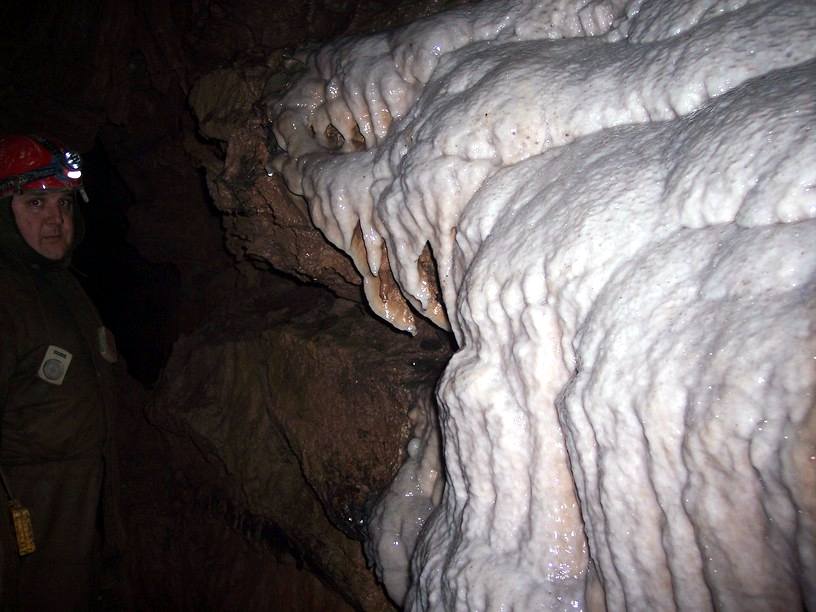
Kevin Keplinger in awe of the white flowstone. Photo by Brian Masney
Subscribe to:
Posts (Atom)

