Kathrine Gurtler, Tom Lilly, Chris Eleyette, and Dave Riggs took a Monday evening trip into Bowden Cave. We drove down from Morgantown, meeting Chris in Elkins, and arrived at the cave around 6:45pm. We took the standard tourist trip in -- up the main trunk passage to the breakdown room, climbed up to see the dome, then headed up the chilly watercourse to the gate. On the way back out, we decided to do a bit of exploring, and followed the stream entirely rather than taking the dry, upper paleo passage. This route is not recommended! We turned around and took the standard way back out.
The wise ones changed clothes in the mouth of the cave, the rest ran for the vehicles and changed in record time -- my cave suit managed to freeze solid before I could peel it off. We had a suprisingly good dinner in Elkins and met a friend of Katherine's who had actually helped build the gate in Bowden and is a family friend of Will White. We made it back to Morgantown at about 12:45, after a very enjoyable caving trip.
Monday, February 05, 2007

Wednesday, January 31, 2007
Ridge walking in the Cheat Canyon
On late Friday afternoon, Jan 19th, 2007, Brian Masney, Mary Schmidt and Dave Riggs went to the Cheat Canyon to do some ridge walking for the Druid/New Years Day Cave system. Dave Riggs has been analyzing the line plots between the Druid and New Years Day Cave systems and something does not look right. It shows the end of the New Years Day Caves and Druid Caves several hundred feet away from each other. We decided to do some ridge walking of our own to see if we could figure out where the problem was.
Brian drove his truck down the Druid Road and parked it right above the cave entrance. We went to the main Druid entrance and got an updated GPS coordinate of the cave entrance. We wanted to make sure that was not the issue. Later on, we found out that the new coordinate matched almost exactly with the original coordinate of the cave. We are also confident with the New Years Day Cave coordinate since it is placed correctly on the topo map.
We hiked across the mountain from the Druid entrance and followed the limestone outcrop. There is a side lead in Druid that has less than a mile of passage in it. Several years ago when Greg Springer and company surveyed the side lead, they found a dead end passage where roots were in the ceiling and some surface debris was nearby. Dave used his GIS program to calculate the GPS coordinate of that location. We hiked around that area in the limestone but we did not find anything interesting. We didn't spend much time on that since that wouldn't help us get any closer to the deeper sections of Druid and New Years Day Caves.
Our next goal was to locate a spot where some surface water goes into New Years Day Cave. This is near the far back of the current survey and it was aptly named the Disney Ride by Dave Riggs. You have to crawl through a small slot near the ceiling where the water just pours onto you from the ceiling. Dave used his GIS program to determine where that should have been on the surface. We hiked to that coordinate and it was located in a stream bed with some water flowing in it. We followed the stream bed slightly downhill and we found a spot where all of the water disappeared underground. There was no viable place to dig. According to the GIS program, we would have to go down about 100' to get to New Years Day Cave.
After that, we hiked over towards New Years Day Cave. One of the GIS maps that Dave has is an elevation model of the state that was generated by a satellite. There is a depression in the main stream further downstream from New Years Day Cave. We wanted to check that out. There are a few waterfalls there and you can see some large cliffs on the other side of the hill. Unfortunately, they are on the opposite side of Lick Run compared to Druid. We did not have time to check these out since we had to be back in Morgantown.
Later that night, Dave looked at the data for New Years Day Cave and Druid Caves. Since we had an accurate elevation of the Druid Cave entrance, Dave was able to enter that data in his GIS program. The vertical line plots between the two caves are still in line with each other, with New Years Day Cave slightly higher than Druid. This is what we want.
The horizontal distance between the end of the two surveys is still pretty far off. New Years Day Cave has over 3,300' of surveyed passage and Druid Cave has 2.31 miles of surveyed passage. There are no loops to close and these are very long surveys. The likelihood of error in the two surveys is very high. A slight error in one survey shot would be compounded in later shots. With that in mind, Dave used the updated elevation of the Druid entrance to determine where the 3D cave passage should lie in the hillside. Our current data shows the end of Druid Cave sticking 70' out of the hillside. If the passage is moved to the left, then it shows the cave passage in the hillside where it should be. This puts it very close to New Years Day Cave.
This is good news. I hope that I have the same enthusiasm the next time I am surveying in New Years Day Cave. I am anxious to get back in there so that we can finish this project.
Brian drove his truck down the Druid Road and parked it right above the cave entrance. We went to the main Druid entrance and got an updated GPS coordinate of the cave entrance. We wanted to make sure that was not the issue. Later on, we found out that the new coordinate matched almost exactly with the original coordinate of the cave. We are also confident with the New Years Day Cave coordinate since it is placed correctly on the topo map.
We hiked across the mountain from the Druid entrance and followed the limestone outcrop. There is a side lead in Druid that has less than a mile of passage in it. Several years ago when Greg Springer and company surveyed the side lead, they found a dead end passage where roots were in the ceiling and some surface debris was nearby. Dave used his GIS program to calculate the GPS coordinate of that location. We hiked around that area in the limestone but we did not find anything interesting. We didn't spend much time on that since that wouldn't help us get any closer to the deeper sections of Druid and New Years Day Caves.
Our next goal was to locate a spot where some surface water goes into New Years Day Cave. This is near the far back of the current survey and it was aptly named the Disney Ride by Dave Riggs. You have to crawl through a small slot near the ceiling where the water just pours onto you from the ceiling. Dave used his GIS program to determine where that should have been on the surface. We hiked to that coordinate and it was located in a stream bed with some water flowing in it. We followed the stream bed slightly downhill and we found a spot where all of the water disappeared underground. There was no viable place to dig. According to the GIS program, we would have to go down about 100' to get to New Years Day Cave.
After that, we hiked over towards New Years Day Cave. One of the GIS maps that Dave has is an elevation model of the state that was generated by a satellite. There is a depression in the main stream further downstream from New Years Day Cave. We wanted to check that out. There are a few waterfalls there and you can see some large cliffs on the other side of the hill. Unfortunately, they are on the opposite side of Lick Run compared to Druid. We did not have time to check these out since we had to be back in Morgantown.
Later that night, Dave looked at the data for New Years Day Cave and Druid Caves. Since we had an accurate elevation of the Druid Cave entrance, Dave was able to enter that data in his GIS program. The vertical line plots between the two caves are still in line with each other, with New Years Day Cave slightly higher than Druid. This is what we want.
The horizontal distance between the end of the two surveys is still pretty far off. New Years Day Cave has over 3,300' of surveyed passage and Druid Cave has 2.31 miles of surveyed passage. There are no loops to close and these are very long surveys. The likelihood of error in the two surveys is very high. A slight error in one survey shot would be compounded in later shots. With that in mind, Dave used the updated elevation of the Druid entrance to determine where the 3D cave passage should lie in the hillside. Our current data shows the end of Druid Cave sticking 70' out of the hillside. If the passage is moved to the left, then it shows the cave passage in the hillside where it should be. This puts it very close to New Years Day Cave.
This is good news. I hope that I have the same enthusiasm the next time I am surveying in New Years Day Cave. I am anxious to get back in there so that we can finish this project.
Saturday, January 27, 2007
[trip] Scott Hollow
On Saturday, Jan 27, 2007, Ben Mirable, Brian Masney, Mary Schmidt, Kyle McMillan, Ryan Ellers, Ashley ??, and Dave Riggs took a tourist trip into Scott Hollow Cave, in Monroe County WV.
Most of us met up on Friday night at beautiful Casa Mirable, near Pipestem Resort State Park. While Ben had plenty of room for everyone, I chose to sleep outside in the freezing cold to escape Kyle's mammoth snoring. In the morning, we caravaned down to Monroe County.
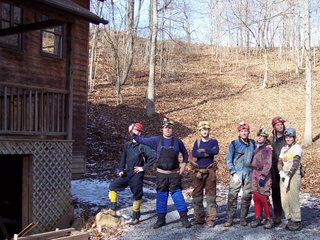
Kyle, Strongman Ben, Dave, Brian, Mary, Ryan, and Ashley outside the entrance house of Scott Hollow Cave.
The entrance to Scott Hollow Cave is located inside a locked house, which is located in the bottom of a giant sinkhole. The owner, Mike Dore, has put a lot of work into the cave since it was discovered in 1984, and also gives paid wild cave tours there. Exploration and surveying are still ongoing, and the cave is currently at almost 30 miles - 3rd longest in WV and 13th longest in the US. A metal culvert with rebar rungs leads about 25' down a windy tunnel into walking stream passage. The limestone dips steeply here, and the passage goes downdip along the Hillsdale Limestone / Maccrady Shale contact, losing over 400' of elevation very quickly.
Within 10 minutes of entering the cave, we somehow managed to become separated from Brian and Mary. Luckily, we managed to cross paths at the Junction Room, where several smaller passages intersect. The group from there continued on until we reached our first destination, Mystic River.
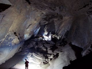
Trunk passage in Scott Hollow's Mystic River. Note the high water mark on the left wall.
Mystic River is a massive trunk passage which appears to be up to 50' wide and up to 75' tall in places, and parallels the strike of the syncline. It appears to be stratigraphically-higher in the Greenbrier (lower Pickaway?), while lower in elevation than the entrance passages (which were in the bottom of the Greenbrier, the blue Sinks Grove and Hillsdale). The water level was in some spots merely inches deep, but for several hundreds of yards we were wading in waist-deep, icy cold water! While the current wasn't terribly strong, the water was deep enough to occlude underwater obstacles like rocks and potholes. The amount of water flowing through there was impressive enough, but to marvel at the amount of water that formed this passage (and hinted at by the high water mark) was mind-blowing! I'm told that this huge passage is itself over 4 miles long, but 1.5 miles are only accessible by sump diving.
We took a left turn at a very large fork and arrived at a beautiful 4' tall double waterfall. As the underground river breaches a layer of chert, it drops abruptly through the limestone; it breaches the chert about 10' upstream as a mid-river sinkhole, with whitewater pouring in from all sides. The sight is quite impressive.
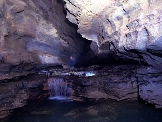
Kyle at the double waterfall.
We continued on to the beginning of a section called Iron City, which consisted of a huge hall floored with breakdown and rubble. Our original plan was to attempt a trip to Kansas, but we'd eaten up too much time on the way. We headed back the way we'd come, wading through the waist-deep water, then climbing up the seemingly-endless breakdown hill as we hiked back updip towards the entrance. The climb back out the access culvert seemed twice as long after 7 hours underground.
It was a pleasant surprise to find warm, autumn-like weather waiting for us on the surface, and we were even treated to a lunar halo. After changing clothes, our filthy group headed to the town of Pickaway for some excellent pizza and dessert at the Pizza Barn - highly recommended if you're in the area!
All photos are ©2007 Brian Masney
Access to Scott Hollow Cave is restricted to experienced cavers, who have been NSS members for over a year, and are at least 18 years old.
Most of us met up on Friday night at beautiful Casa Mirable, near Pipestem Resort State Park. While Ben had plenty of room for everyone, I chose to sleep outside in the freezing cold to escape Kyle's mammoth snoring. In the morning, we caravaned down to Monroe County.
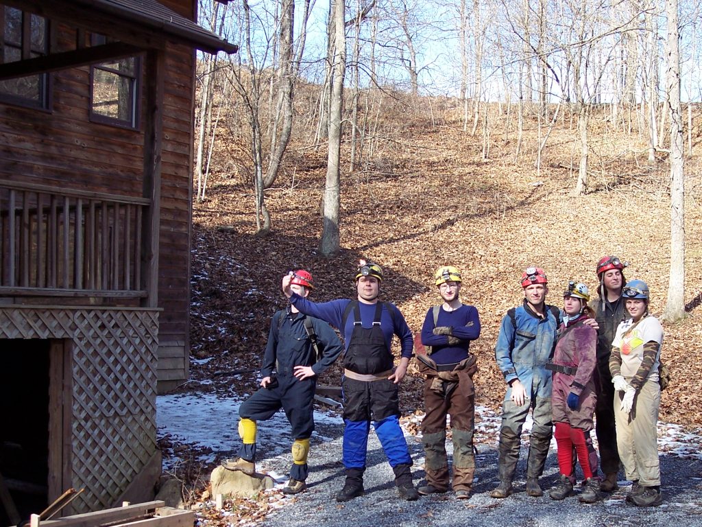
Kyle, Strongman Ben, Dave, Brian, Mary, Ryan, and Ashley outside the entrance house of Scott Hollow Cave.
The entrance to Scott Hollow Cave is located inside a locked house, which is located in the bottom of a giant sinkhole. The owner, Mike Dore, has put a lot of work into the cave since it was discovered in 1984, and also gives paid wild cave tours there. Exploration and surveying are still ongoing, and the cave is currently at almost 30 miles - 3rd longest in WV and 13th longest in the US. A metal culvert with rebar rungs leads about 25' down a windy tunnel into walking stream passage. The limestone dips steeply here, and the passage goes downdip along the Hillsdale Limestone / Maccrady Shale contact, losing over 400' of elevation very quickly.
Within 10 minutes of entering the cave, we somehow managed to become separated from Brian and Mary. Luckily, we managed to cross paths at the Junction Room, where several smaller passages intersect. The group from there continued on until we reached our first destination, Mystic River.
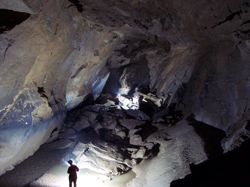
Trunk passage in Scott Hollow's Mystic River. Note the high water mark on the left wall.
Mystic River is a massive trunk passage which appears to be up to 50' wide and up to 75' tall in places, and parallels the strike of the syncline. It appears to be stratigraphically-higher in the Greenbrier (lower Pickaway?), while lower in elevation than the entrance passages (which were in the bottom of the Greenbrier, the blue Sinks Grove and Hillsdale). The water level was in some spots merely inches deep, but for several hundreds of yards we were wading in waist-deep, icy cold water! While the current wasn't terribly strong, the water was deep enough to occlude underwater obstacles like rocks and potholes. The amount of water flowing through there was impressive enough, but to marvel at the amount of water that formed this passage (and hinted at by the high water mark) was mind-blowing! I'm told that this huge passage is itself over 4 miles long, but 1.5 miles are only accessible by sump diving.
We took a left turn at a very large fork and arrived at a beautiful 4' tall double waterfall. As the underground river breaches a layer of chert, it drops abruptly through the limestone; it breaches the chert about 10' upstream as a mid-river sinkhole, with whitewater pouring in from all sides. The sight is quite impressive.

Kyle at the double waterfall.
We continued on to the beginning of a section called Iron City, which consisted of a huge hall floored with breakdown and rubble. Our original plan was to attempt a trip to Kansas, but we'd eaten up too much time on the way. We headed back the way we'd come, wading through the waist-deep water, then climbing up the seemingly-endless breakdown hill as we hiked back updip towards the entrance. The climb back out the access culvert seemed twice as long after 7 hours underground.
It was a pleasant surprise to find warm, autumn-like weather waiting for us on the surface, and we were even treated to a lunar halo. After changing clothes, our filthy group headed to the town of Pickaway for some excellent pizza and dessert at the Pizza Barn - highly recommended if you're in the area!
All photos are ©2007 Brian Masney
Access to Scott Hollow Cave is restricted to experienced cavers, who have been NSS members for over a year, and are at least 18 years old.
Saturday, January 20, 2007
Elklick Ridge Walking
The Tucker County Speleological Survey met and spent a cold day ridge walking along Elklick Valley. We spent a few hours tracking down the landowners for permission, then rediscovered some very cool caves, which we'll re-visit when we're more prepared for a wet and vertical trip.

Jason Thomas looks for cave passage in Elklick Spring.
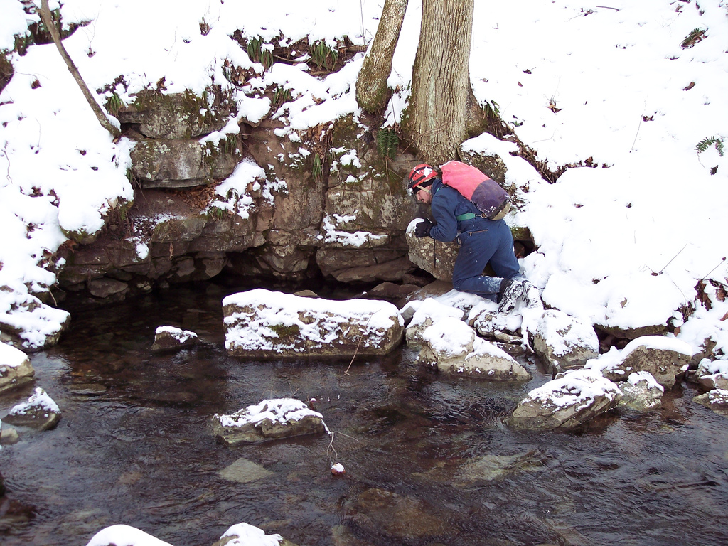
Jason Thomas looks for cave passage in Elklick Spring.
Sunday, January 14, 2007
[trip] 8 Days of TAG Caving
Brian Masney, Garth Dixon, Dave Riggs, Judi Wasilewski, and Mary Schmidt spent part of the week surrounding New Year's caving in TAG.
Tues 26 December: The day after Christmas, I woke at 4 AM to fly home. After arriving, I re-packed for TAG, then met Brian and Dave Riggs for Mexican food. We met Garth at Brian's house, where the three of us spent a few absurd minutes chasing Brian's escaped cat around the parking lot. Cat captured, we finally headed South.
After driving past Wytheville, we started looking at the Gazetteer for possible camping spots near roads dead-ending in National Forest. We set up tents in the snow.
Wed 27 December: In the morning we awoke to bear hunters and their barking dogs. Awakening to hunters was to be a continual theme of our trip... hunting season also influenced our choice of caves, since many TAG caves are on hunting clubs' property and inaccessible during hunting season. After a few more hours of driving, we arrived in TAG. We were hoping to drop Larson's Well; however, the landowner was not home. A neighbor led us to another cave entrance, which had a beautiful sinkhole with a waterfall flowing in. Brian pulled out his laptop to check the GPS coordinates against his database. The cave matched the description of Waterworks cave. We were equipped more for bouncing pits than wet crawls, so we headed instead to South Pittsburg, TN. South Pittsburg Pit was recently purchased and opened by the SCCi. It is a beautiful pit.
We headed to a campsite near Scottsboro, AL, that WV folks have used often for TAG trips: Goose Pond Colony. We set up tents near the lake.
Thurs 28 December:At sunrise, we were awakened by the sounds of World War III (or, duck hunters in close proximity). Later we saw the bumper sticker: "If it flies, it dies."
We headed out in search of 3 pits: Clod Hole, Will Well, and Rhonda Well. We bushwacked for 6 hours without success. Our 1989 directions and GPS coordinates utterly failed us. We were looking for a gully... and an old logging trail. (We found several.) One of Brian's friends had instructed us to find "a grove of cedar trees - but they're common around here"). We stopped at a cave owner's house to inquire about Sawmill Well. He was not home, but his daughter gave us a phone number for future reference. Back at Goose Pond, Dave and Judi soon arrived.
Fri 29 December: A large group of people were planning to camp until New Year's Day at the TAG Cave In site. On the way we stopped at Cemetery Pit. It was pretty, and as evidenced by the elephant tracks and smooth polished rocks inside, quite popular. We wanted to visit the waterfalls (and avoid the map area called "3D maze"), but were thwarted by Ed's Ledge, a 30' drop that required more than a handline. We ran into 2 other cavers at the bottom who told us to look for their caving website; I haven't been able to find it. It would be nice to go back, and also visit Rusty's Pit, located on the same SCCi preserve.
At the TAG site, we met many wonderful TAG cavers, and also ran into Denise and Mike Hopkins, whom Brian met via Flickr.
Sat 30 December: Mike H. took us to Flowing Stone cave, which required a 2-mile, hourlong hike (Brian, as usual, carried the rope the entire time without complaint). Flowing Stone is a beautiful 225' pit. Water flows over a 50' flowstone formation near the top. The floor and walls are also entirely formations.

Dave and Judi at some of the many flowstone formations in Flowing Stone Cave
Originally uploaded by Brian Masney.
Sunday, New Year's Eve: Overnight rain had soaked through our tents and sleeping bags. Wet socks and wet boots were unappealing. We had coughs and chest colds. Dave and Judy headed home. Instead of caving, Garth, Brian, and I spent the morning hiking at Cloudland Canyon. We intended to bounce The Diggings Pit, a 141' pit near the highway. We ended up descending only ~50' to a dry ledge, not wishing to get soaked. The rope was slimed for the rest of the trip. New Year's Eve was spent hanging our wet gear up in a cheap hotel room, doing laundry and listening to trains go by.

Monday, New Year's Day: We had permits for 2 days in Fern Cave, a long beautiful cave system that also includes 404' Surprise Pit. Our plan was to bounce Surprise Pit one day, and spend the next day exploring some heavily decorated horizontal sections. We had difficulty following the trail, thus beginning our daily allowance of bushwacking. We first found the Morgue Entrance (closed), then after more bushwacking, the Twin sinks/Surprise entrance.Surprise Pit was a great rappel, but I'd like to do it in lower water conditions next time. It was extremely foggy so Brian did not bring any photography equipment into the pit.
Do I look pissed in this picture? It's because the cave ate my pack. We rigged in a spot that we had been assured would provide a "completely dry" rappel and ascent away from the 430' waterfall. However, we went during unususally high water conditions. The rope landed at the bottom of a nasty 30' breakdown climb in high winds and spraying water. Brian was the first down and moved the rope so that Garth and I landed at the top of the breakdown pile.
When it was time to ascend, Brian swung out over the pit from the top of the breakdown pile, but his swing was arrested when the rope caught on a rock and jerked him to a halt. Not wanting to slam into the wall when it was his turn to ascend, Garth came up with an elegant solution: I tied myself off to a rock and fed him out on my rack so he could start ascending in the dry part of the pit without having to swing out.
I was the last one up, and had to downclimb the breakdown. It was a tough, sheer climb, complete with "portable handholds" that almost took me with them when they fell. Cavers typically carry garbage bags that can be used as ponchos for water protection -- I tried using one for the first time. It was worse than useless. The wind whipped it up in front of my face, blocking my vision. The climb took forever because I was trying to return the extra ~ 80' of rope slack to its original position at the bottom of the drop (so that it could be pulled up later without snagging on rocks). The rope kept catching on the sharp outcrops of rock and I was continually stopping and backtracking to free the rope.
I started losing my balance while climbing and dropped my pack. It rolled... and kept going and going. I looked for it when I got to the bottom, but it was so coated in mud that earlier in the day, I had been having trouble seeing it from a few feet away. Meanwhile I was getting soaked. The wind was blowing so much water into my eyes that I couldn't keep them open, and I feared losing my contact lenses (I forgot to pack glasses, so I would be screwed for the rest of the week if I lost a contact). I was plenty warm, but ascending in water spray is potentially dangerous, so after fruitlessly searching for a short while, I headed up without the pack. It took less than 50 feet to get out of the water.
If I had to do it over again, I would coil the slack in the rope, attach it to me at the top of the breakdown pile, and swing out into the pit like Tarzan. It would be better to risk a high-speed encounter with the pit wall than do that nasty downclimb again.
I was pleased that I frogged the 404' in 28 minutes -- the tallest pit I have frogged. When we left late that night in the cold and dark, we bushwacked straight down the mountain according to our GPS coordinates.
Tues 2 Jan: We dropped Moses' Tomb, a lovely 230' pit. I used my new Ropewalker system for the first time -- and learned how to downclimb with a Ropewalker after Brian's makeshift flashbulb gun went off in my hand (ouch!) and I had to descend for a new one (a commercial model for smaller bulbs). Unfortunately, the smaller bulbs incompletely lit the pit.
Wed 3 Jan: We obtained permission for Sawmill Well, a nice 155' open air pit. Afterward, we drove home, arriving shortly after midnight. This left us with a few days of vacation to recover from our vacation!
More of Brian's photos are here.
Tues 26 December: The day after Christmas, I woke at 4 AM to fly home. After arriving, I re-packed for TAG, then met Brian and Dave Riggs for Mexican food. We met Garth at Brian's house, where the three of us spent a few absurd minutes chasing Brian's escaped cat around the parking lot. Cat captured, we finally headed South.
After driving past Wytheville, we started looking at the Gazetteer for possible camping spots near roads dead-ending in National Forest. We set up tents in the snow.
Wed 27 December: In the morning we awoke to bear hunters and their barking dogs. Awakening to hunters was to be a continual theme of our trip... hunting season also influenced our choice of caves, since many TAG caves are on hunting clubs' property and inaccessible during hunting season. After a few more hours of driving, we arrived in TAG. We were hoping to drop Larson's Well; however, the landowner was not home. A neighbor led us to another cave entrance, which had a beautiful sinkhole with a waterfall flowing in. Brian pulled out his laptop to check the GPS coordinates against his database. The cave matched the description of Waterworks cave. We were equipped more for bouncing pits than wet crawls, so we headed instead to South Pittsburg, TN. South Pittsburg Pit was recently purchased and opened by the SCCi. It is a beautiful pit.
We headed to a campsite near Scottsboro, AL, that WV folks have used often for TAG trips: Goose Pond Colony. We set up tents near the lake.
Thurs 28 December:At sunrise, we were awakened by the sounds of World War III (or, duck hunters in close proximity). Later we saw the bumper sticker: "If it flies, it dies."
We headed out in search of 3 pits: Clod Hole, Will Well, and Rhonda Well. We bushwacked for 6 hours without success. Our 1989 directions and GPS coordinates utterly failed us. We were looking for a gully... and an old logging trail. (We found several.) One of Brian's friends had instructed us to find "a grove of cedar trees - but they're common around here"). We stopped at a cave owner's house to inquire about Sawmill Well. He was not home, but his daughter gave us a phone number for future reference. Back at Goose Pond, Dave and Judi soon arrived.
Fri 29 December: A large group of people were planning to camp until New Year's Day at the TAG Cave In site. On the way we stopped at Cemetery Pit. It was pretty, and as evidenced by the elephant tracks and smooth polished rocks inside, quite popular. We wanted to visit the waterfalls (and avoid the map area called "3D maze"), but were thwarted by Ed's Ledge, a 30' drop that required more than a handline. We ran into 2 other cavers at the bottom who told us to look for their caving website; I haven't been able to find it. It would be nice to go back, and also visit Rusty's Pit, located on the same SCCi preserve.
At the TAG site, we met many wonderful TAG cavers, and also ran into Denise and Mike Hopkins, whom Brian met via Flickr.
Sat 30 December: Mike H. took us to Flowing Stone cave, which required a 2-mile, hourlong hike (Brian, as usual, carried the rope the entire time without complaint). Flowing Stone is a beautiful 225' pit. Water flows over a 50' flowstone formation near the top. The floor and walls are also entirely formations.
Dave and Judi at some of the many flowstone formations in Flowing Stone Cave
Originally uploaded by Brian Masney.
Sunday, New Year's Eve: Overnight rain had soaked through our tents and sleeping bags. Wet socks and wet boots were unappealing. We had coughs and chest colds. Dave and Judy headed home. Instead of caving, Garth, Brian, and I spent the morning hiking at Cloudland Canyon. We intended to bounce The Diggings Pit, a 141' pit near the highway. We ended up descending only ~50' to a dry ledge, not wishing to get soaked. The rope was slimed for the rest of the trip. New Year's Eve was spent hanging our wet gear up in a cheap hotel room, doing laundry and listening to trains go by.
Monday, New Year's Day: We had permits for 2 days in Fern Cave, a long beautiful cave system that also includes 404' Surprise Pit. Our plan was to bounce Surprise Pit one day, and spend the next day exploring some heavily decorated horizontal sections. We had difficulty following the trail, thus beginning our daily allowance of bushwacking. We first found the Morgue Entrance (closed), then after more bushwacking, the Twin sinks/Surprise entrance.Surprise Pit was a great rappel, but I'd like to do it in lower water conditions next time. It was extremely foggy so Brian did not bring any photography equipment into the pit.
Do I look pissed in this picture? It's because the cave ate my pack. We rigged in a spot that we had been assured would provide a "completely dry" rappel and ascent away from the 430' waterfall. However, we went during unususally high water conditions. The rope landed at the bottom of a nasty 30' breakdown climb in high winds and spraying water. Brian was the first down and moved the rope so that Garth and I landed at the top of the breakdown pile.

When it was time to ascend, Brian swung out over the pit from the top of the breakdown pile, but his swing was arrested when the rope caught on a rock and jerked him to a halt. Not wanting to slam into the wall when it was his turn to ascend, Garth came up with an elegant solution: I tied myself off to a rock and fed him out on my rack so he could start ascending in the dry part of the pit without having to swing out.
I was the last one up, and had to downclimb the breakdown. It was a tough, sheer climb, complete with "portable handholds" that almost took me with them when they fell. Cavers typically carry garbage bags that can be used as ponchos for water protection -- I tried using one for the first time. It was worse than useless. The wind whipped it up in front of my face, blocking my vision. The climb took forever because I was trying to return the extra ~ 80' of rope slack to its original position at the bottom of the drop (so that it could be pulled up later without snagging on rocks). The rope kept catching on the sharp outcrops of rock and I was continually stopping and backtracking to free the rope.
I started losing my balance while climbing and dropped my pack. It rolled... and kept going and going. I looked for it when I got to the bottom, but it was so coated in mud that earlier in the day, I had been having trouble seeing it from a few feet away. Meanwhile I was getting soaked. The wind was blowing so much water into my eyes that I couldn't keep them open, and I feared losing my contact lenses (I forgot to pack glasses, so I would be screwed for the rest of the week if I lost a contact). I was plenty warm, but ascending in water spray is potentially dangerous, so after fruitlessly searching for a short while, I headed up without the pack. It took less than 50 feet to get out of the water.
If I had to do it over again, I would coil the slack in the rope, attach it to me at the top of the breakdown pile, and swing out into the pit like Tarzan. It would be better to risk a high-speed encounter with the pit wall than do that nasty downclimb again.
I was pleased that I frogged the 404' in 28 minutes -- the tallest pit I have frogged. When we left late that night in the cold and dark, we bushwacked straight down the mountain according to our GPS coordinates.
Tues 2 Jan: We dropped Moses' Tomb, a lovely 230' pit. I used my new Ropewalker system for the first time -- and learned how to downclimb with a Ropewalker after Brian's makeshift flashbulb gun went off in my hand (ouch!) and I had to descend for a new one (a commercial model for smaller bulbs). Unfortunately, the smaller bulbs incompletely lit the pit.
Wed 3 Jan: We obtained permission for Sawmill Well, a nice 155' open air pit. Afterward, we drove home, arriving shortly after midnight. This left us with a few days of vacation to recover from our vacation!

More of Brian's photos are here.
Sunday, December 31, 2006
[trip] Cass Cave
Brian Masney, Mary Schmidt, Jason Thomas, and Dave Riggs took a trip into Cass Cave, one of WV's most amazing (and infamous) vertical caves. We met Saturday night and spent a chilly night camping at Oildrum Falls. In the morning, we grabbed some breakfast at Snowshoe, then headed to Cass. We packed up a ton of photography gear, and a large "emergency pack" in case a sudden weather change caused an extended trip. We hiked up the valley to the cave entrance, geared up, and headed in cave around 11:30am.
Brian and Jason headed in first to haul gear and rig the drop. Mary and I followed with the remainder of the gear. The entrance passage was relatively dry, but we still managed to get our arms and legs wet in the stream crawl. We met back up at the climb to the belay loft, passed our gear up to the top, and climbed into the windy upper passage. Brian chimneyed out and picked the two best of the available four bolts, and backed up with a safety traverse line back on solid ground. To get one rope, one must slide out across a slick ledge for about 8', and then shimmy down into a narrow canyon where the bolts will keep rappellers safely out of the spray from Suicide Falls.
The 180' rappel takes you down about 30' against walls and ledges, then it's a free rappel into a huge room... Suicide Falls crashes down on one side, the other overlooks a giant mountain of breakdown with an enormous boulder wedged between both walls, frozen in mid-tumble. After you climb the breakdown pile, the enormous borehole passage stretches as far forward as you can possibly see. We set up the gear for some photography of this amazing passage.
Brian, while incredibly skilled in photography, is not nearly as well known for his electronics skills... and for good reason. Brian constructed several flash guns using radio shack parts, duct tape, and cardboard. He handed these fine units out to his unwitting sherpas and sent us all out into the borehole passage to try and light it up. As I screwed my first flashbulb into the untested flash gun, I heard a loud pop, my vision went completely white, and felt a sharp pain in my ungloved fingers as they were singed by the magnesium flashbulb. Brian helpfully recommended that I "make sure that I'm not pressing the button" on the gun, and then suggested that I contribute to the photo by screwing the next bulb in on the count of "three" (to which I very politely replied "NO.") I made him screw the next bulb in, and it worked correctly, giving me a false sense of security. I tried another and was rewarded with yet another pop and the stench of melted neoprene glove.
We headed further on into the cave to check out some amazing rimstone dams and the birdbath formation, as well as lots of great bacon and flowstone on the walls. A lower passage leads to a pristine lake surrounded by formations, which we didn't go near for fear of messing it up with our filthy boots.
 Cass Cave "big room", photo by Brian Masney.
Brian and Jason headed in first to haul gear and rig the drop. Mary and I followed with the remainder of the gear. The entrance passage was relatively dry, but we still managed to get our arms and legs wet in the stream crawl. We met back up at the climb to the belay loft, passed our gear up to the top, and climbed into the windy upper passage. Brian chimneyed out and picked the two best of the available four bolts, and backed up with a safety traverse line back on solid ground. To get one rope, one must slide out across a slick ledge for about 8', and then shimmy down into a narrow canyon where the bolts will keep rappellers safely out of the spray from Suicide Falls.
The 180' rappel takes you down about 30' against walls and ledges, then it's a free rappel into a huge room... Suicide Falls crashes down on one side, the other overlooks a giant mountain of breakdown with an enormous boulder wedged between both walls, frozen in mid-tumble. After you climb the breakdown pile, the enormous borehole passage stretches as far forward as you can possibly see. We set up the gear for some photography of this amazing passage.
Brian, while incredibly skilled in photography, is not nearly as well known for his electronics skills... and for good reason. Brian constructed several flash guns using radio shack parts, duct tape, and cardboard. He handed these fine units out to his unwitting sherpas and sent us all out into the borehole passage to try and light it up. As I screwed my first flashbulb into the untested flash gun, I heard a loud pop, my vision went completely white, and felt a sharp pain in my ungloved fingers as they were singed by the magnesium flashbulb. Brian helpfully recommended that I "make sure that I'm not pressing the button" on the gun, and then suggested that I contribute to the photo by screwing the next bulb in on the count of "three" (to which I very politely replied "NO.") I made him screw the next bulb in, and it worked correctly, giving me a false sense of security. I tried another and was rewarded with yet another pop and the stench of melted neoprene glove.
We headed further on into the cave to check out some amazing rimstone dams and the birdbath formation, as well as lots of great bacon and flowstone on the walls. A lower passage leads to a pristine lake surrounded by formations, which we didn't go near for fear of messing it up with our filthy boots.

William E. Davies
Unless you just crawled out from under a rock, you've most certainly heard of William E. Davies. Davies authored Caverns of West Virginia for the West Virginia Geological and Economic Survey, published in 1949. This book has been the most popular title ever put out by the WVGES. The WVGES received so many requests after it had sold out that the book was revised and re-issued in 1958, this volume completely selling out within 6 years. Demand was still so high that the book was again re-issued, along with a supplement, in 1965. The work that Davies did for Caverns was the inspiration for WVaSS. That's probably the extent that most West Virginia cavers know about Bill Davies.

W. E. Davies, photo from the National Cave and Karst Research Institute's Davies biography
Davies (NSS 345) was President of the National Speleological Society from 1954-56, and served as Science Vice President from 1951-53. He was chairman of NSS Research Advisory from 1951-53, and the editor for the Bulletin (precursor to the Journal of Cave and Karst Studies from 1957-63. He is listed as one of the original three of the board of directors and one of the original seven of the board of trustees from the NSS articles of incorporation. He was awarded Certificate of Merit in 1950, became an Honorary Member in 1960, and an NSS Fellow.
W. E. Davies passed away in 1990, but the efforts he helped put in motion live on today.
http://www2.nature.nps.gov/nckri/map/maps/engineering_aspects/davies.htm
http://www2.nature.nps.gov/nckri/map/maps/engineering_aspects/text.htm
http://water.usgs.gov/ogw/karst/kigconference/rco_proposedmap.htm
http://www.caves.org/nss-business/bog/app-c.html
http://www.caves.org/nss-business/bog/table-4e.html
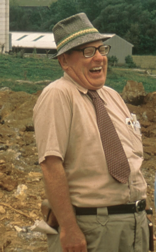
W. E. Davies, photo from the National Cave and Karst Research Institute's Davies biography
Davies (NSS 345) was President of the National Speleological Society from 1954-56, and served as Science Vice President from 1951-53. He was chairman of NSS Research Advisory from 1951-53, and the editor for the Bulletin (precursor to the Journal of Cave and Karst Studies from 1957-63. He is listed as one of the original three of the board of directors and one of the original seven of the board of trustees from the NSS articles of incorporation. He was awarded Certificate of Merit in 1950, became an Honorary Member in 1960, and an NSS Fellow.
W. E. Davies passed away in 1990, but the efforts he helped put in motion live on today.
http://www2.nature.nps.gov/nckri/map/maps/engineering_aspects/davies.htm
http://www2.nature.nps.gov/nckri/map/maps/engineering_aspects/text.htm
http://water.usgs.gov/ogw/karst/kigconference/rco_proposedmap.htm
http://www.caves.org/nss-business/bog/app-c.html
http://www.caves.org/nss-business/bog/table-4e.html
Sunday, December 10, 2006
[gis] GIS Data For Cavers
This posting is an index of places to find GIS data relevant to cavers. The following location-specific depots should have topographic, geologic, hydrologic, etc. data in some usable raster or vector format, and the data should be available for free. I'll try and keep this list up to date as I become aware of more relevant sources.
West Virginia:
Tennessee:
Alabama:
Georgia:
Virginia:
Kentucky:
Canada:
General:
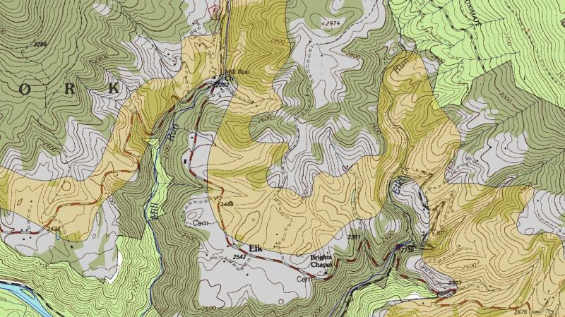
West Virginia:
- WV GIS Data Clearinghouse - The place for WV data. If you're getting topographic maps, I recommend the USFS maps over the USGS maps if available, as they're of higher quality.
- WVDEP GIS Server
Tennessee:
Alabama:
Georgia:
- GA GIS Clearinghouse - Login required (no fee)
- Center for Spatial Analysis Technologies - Topo maps, no login required
Virginia:
- Radford U's GIS Spatial Data Server - note that many VA sites have outdated (broken) links to Radford's GIS site, this is their new URL
- Hoakie Library GIS Data
- VA Dept. of Forestry
- VA Division of Mineral Resources - Data not available for download?
Kentucky:
- KGS Geospatial Data Library
- KY Division of Geographic Information
- Kentucky.gov - lots of great interactive GIS mapping utilities
Canada:
General:
- David Doyle's GIS Links - very comprehensive, state-by-state listing of GIS data resources
Wednesday, November 22, 2006
[trip] New Years Day Cave Survey
Ben Franklin is often attributed to saying:
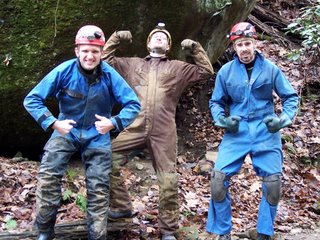
Brian Masney, Dave Riggs, and Jason Thomas are insane. On Saturday, Nov. 18, we headed back into New Years Day Cave again with the hopes of making the elusive connection with Druid Cave. Once again we hoped that this time would be different, and once again the cave got the best of us.
Druid Cave, with over 2.3 surveyed miles of crumbling, muddy passage, has a much-deserved reputation as one of the nastiest caves in West Virginia. In fact, some would consider it an evil cave. When the 8+ hour travel time for survey trips finally became too taxing, the Druid surveyors began looking for an upstream entrance to the cave to make their lives easier. What they found was New Years Day Cave, which has proven to be anything but easier. If Druid was the frying pan, NYDC is the fire.
The three of us met Saturday morning at the rim of the Cheat Canyon. We packed all our gear and started the hike down into the gorge. A weeklong rain had Lick Run roaring with more water than I'd ever seen it move. We suited up into wetsuits and our caving coveralls, packed extra fleece polypro underwear, heating pads, candles, and emergency gear. We not only prepared for the worst, we expected it.
We were in cave before 11am, and were relieved to find the cave stream in the first part of the cave to be at a reasonable level. We moved fast and tried our best to stay dry on the way in. Our goal was to reach some "large" paleo-passage discovered on the last survey trip, in the deepest depths of the cave, where NYDC is known to be at its closest point to Druid Cave. We stormed through the beach crawl, down through a horrible wet crawl, squeezed through the rock-on-rock, dropped down into the sawtooth-lined Whack-A-Mole™ Way, squirmed through Jason's wormhole, dragged ourselves across a wet bedding plane parting, and made our way into another horrible canyon passage. The black rock in this section of the cave will crumble without warning beneath an unsuspecting caver's feet. Water pours in from the ceiling onto your head while the passage meanders into such contortions that it seems to be trying to evade you.

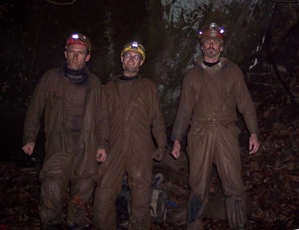
Jason's cave suit, literally shredded by the sawtooth walls before we'd even reached our destination.
After several hundred feet of this hellish passage, we climbed up to the ceiling and crawled through a very nondescript, nearly overlooked squeeze to a parallel passage with a decent-sized, dry, open room. I was amazed. Even more amazing was that this room led to hundreds and hundreds of feet of more dry, open, large passage! We had made our way into a parallel grid of joint-controlled passages, sometimes as wide as 20' with a 20' canyon incision. There were flowstone and drapery formations, the floors and walls were coated with a thin film of mud, but there was no moving water in sight. A cobble-lined stream bed lies in the canyon floor, and very large slabs of breakdown have tumbled down in places. Unfortunately, there was no air movement in this section. We pushed in the upstream direction until our first joint squeezed out, then followed a 90° connector over to the next parallel joint and pushed it for a bit, finding a 30' high dome and lots more mud. Still, no air.
We exited this beautiful passage and crawled back into our stream canyon to follow the air. At this point, the canyon follows the straight-line path and direction of its neighbor passages, as a part of this master joint set. The canyon tightens up, leaving a 12" by 18" tunnel up towards the ceiling, with 10' of narrow, terrifying canyon reaching down below. With no way to go at the bottom, the top was our only way forward. This crawl was certainly too narrow to turn around in, and the canyon below with the crumbling rock walls and floor made it especially dangerous.
I reluctantly volunteered to go in, on the condition that Brian follow me. We started in, pulling our bodies with our fingers and pushing with our toes. The canyon in the floor kept sucking in feet and kneepads, the passage was so narrow that I couldn't turn my head or put my arms back at my side. I crawled for perhaps 50' in the hopes of finding a slightly wider spot, but the passage maintained its torturous dimensions. I shined my StenLight forward and saw nothing but blackness far ahead -- if this passage parallels the larger joint-controlled passages to the side, it could stretch for hundreds and hundreds of feet. More than a bit spooked by the confinement and the thought that a rescue this deep into the cave would be nearly impossible, I decided that I would not go any further. We started the arduous task of backing out, pulling with toes and ankles, pushing with fingertips attached to helpless outstretched arms. It was a long, tiring haul back to passage of kneeling height.
Disappointed with this failure, we opted to survey for a bit in the large, dry passages. We took some time to eat and rest, changed into warmer clothes, and surveyed some nice long shots. Due to how physically exhausted we were, along with time constraints, we surveyed only about 250', leaving many hundreds of feet more to be surveyed and explored in this network of passages. These tall canyons could lead us to a more promising upper or lower level, or they could somehow bypass the nasty canyon crawl that kept us from following the Druid Winds.
On the way out, we no longer cared about trying to stay dry. We barreled out of the cave at record speed while the cave did its best to slow us down. We reached the surface one hour and forty-five brutal minutes later, but New Years Day Cave had the last laugh. The Druid Spirits were especially tough on Jason, his cave suit was literally ripped in half, StenLight was out, his carbide lamp working only in fits. My suit was torn in the shoulders, legs, and knees. All of us were physically beat, we were soaking wet and coated from head to toe with mud, and the temperature outside was in the upper 30°'s. We still had to hike up and out of the Cheat Canyon.
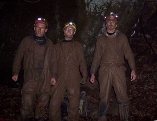
To say that the trip was exhausting would be an understatement. We were in cave for about 11 hours, New Years Day Cave time; this probably equates to days in "lesser" caves. The Druid connection eluded us again, NYDC proved to be every bit as horrid as it has in the past, and everyone involved was ready to swear off caving for good... but we know that next time will be different.
All photos by Brian Masney
"The definition of insanity is doing the same thing over and over and expecting different results."

Brian Masney, Dave Riggs, and Jason Thomas are insane. On Saturday, Nov. 18, we headed back into New Years Day Cave again with the hopes of making the elusive connection with Druid Cave. Once again we hoped that this time would be different, and once again the cave got the best of us.
Druid Cave, with over 2.3 surveyed miles of crumbling, muddy passage, has a much-deserved reputation as one of the nastiest caves in West Virginia. In fact, some would consider it an evil cave. When the 8+ hour travel time for survey trips finally became too taxing, the Druid surveyors began looking for an upstream entrance to the cave to make their lives easier. What they found was New Years Day Cave, which has proven to be anything but easier. If Druid was the frying pan, NYDC is the fire.
The three of us met Saturday morning at the rim of the Cheat Canyon. We packed all our gear and started the hike down into the gorge. A weeklong rain had Lick Run roaring with more water than I'd ever seen it move. We suited up into wetsuits and our caving coveralls, packed extra fleece polypro underwear, heating pads, candles, and emergency gear. We not only prepared for the worst, we expected it.
We were in cave before 11am, and were relieved to find the cave stream in the first part of the cave to be at a reasonable level. We moved fast and tried our best to stay dry on the way in. Our goal was to reach some "large" paleo-passage discovered on the last survey trip, in the deepest depths of the cave, where NYDC is known to be at its closest point to Druid Cave. We stormed through the beach crawl, down through a horrible wet crawl, squeezed through the rock-on-rock, dropped down into the sawtooth-lined Whack-A-Mole™ Way, squirmed through Jason's wormhole, dragged ourselves across a wet bedding plane parting, and made our way into another horrible canyon passage. The black rock in this section of the cave will crumble without warning beneath an unsuspecting caver's feet. Water pours in from the ceiling onto your head while the passage meanders into such contortions that it seems to be trying to evade you.
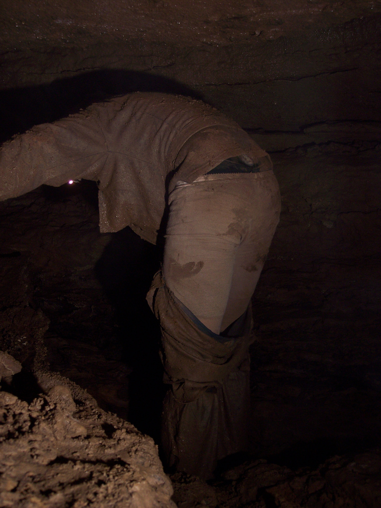
Jason's cave suit, literally shredded by the sawtooth walls before we'd even reached our destination.
After several hundred feet of this hellish passage, we climbed up to the ceiling and crawled through a very nondescript, nearly overlooked squeeze to a parallel passage with a decent-sized, dry, open room. I was amazed. Even more amazing was that this room led to hundreds and hundreds of feet of more dry, open, large passage! We had made our way into a parallel grid of joint-controlled passages, sometimes as wide as 20' with a 20' canyon incision. There were flowstone and drapery formations, the floors and walls were coated with a thin film of mud, but there was no moving water in sight. A cobble-lined stream bed lies in the canyon floor, and very large slabs of breakdown have tumbled down in places. Unfortunately, there was no air movement in this section. We pushed in the upstream direction until our first joint squeezed out, then followed a 90° connector over to the next parallel joint and pushed it for a bit, finding a 30' high dome and lots more mud. Still, no air.
We exited this beautiful passage and crawled back into our stream canyon to follow the air. At this point, the canyon follows the straight-line path and direction of its neighbor passages, as a part of this master joint set. The canyon tightens up, leaving a 12" by 18" tunnel up towards the ceiling, with 10' of narrow, terrifying canyon reaching down below. With no way to go at the bottom, the top was our only way forward. This crawl was certainly too narrow to turn around in, and the canyon below with the crumbling rock walls and floor made it especially dangerous.
I reluctantly volunteered to go in, on the condition that Brian follow me. We started in, pulling our bodies with our fingers and pushing with our toes. The canyon in the floor kept sucking in feet and kneepads, the passage was so narrow that I couldn't turn my head or put my arms back at my side. I crawled for perhaps 50' in the hopes of finding a slightly wider spot, but the passage maintained its torturous dimensions. I shined my StenLight forward and saw nothing but blackness far ahead -- if this passage parallels the larger joint-controlled passages to the side, it could stretch for hundreds and hundreds of feet. More than a bit spooked by the confinement and the thought that a rescue this deep into the cave would be nearly impossible, I decided that I would not go any further. We started the arduous task of backing out, pulling with toes and ankles, pushing with fingertips attached to helpless outstretched arms. It was a long, tiring haul back to passage of kneeling height.
Disappointed with this failure, we opted to survey for a bit in the large, dry passages. We took some time to eat and rest, changed into warmer clothes, and surveyed some nice long shots. Due to how physically exhausted we were, along with time constraints, we surveyed only about 250', leaving many hundreds of feet more to be surveyed and explored in this network of passages. These tall canyons could lead us to a more promising upper or lower level, or they could somehow bypass the nasty canyon crawl that kept us from following the Druid Winds.
On the way out, we no longer cared about trying to stay dry. We barreled out of the cave at record speed while the cave did its best to slow us down. We reached the surface one hour and forty-five brutal minutes later, but New Years Day Cave had the last laugh. The Druid Spirits were especially tough on Jason, his cave suit was literally ripped in half, StenLight was out, his carbide lamp working only in fits. My suit was torn in the shoulders, legs, and knees. All of us were physically beat, we were soaking wet and coated from head to toe with mud, and the temperature outside was in the upper 30°'s. We still had to hike up and out of the Cheat Canyon.
To say that the trip was exhausting would be an understatement. We were in cave for about 11 hours, New Years Day Cave time; this probably equates to days in "lesser" caves. The Druid connection eluded us again, NYDC proved to be every bit as horrid as it has in the past, and everyone involved was ready to swear off caving for good... but we know that next time will be different.
All photos by Brian Masney
Wednesday, November 08, 2006
[trip] Beaverhole Upper
After a day of brutal ridge walking in the Cheat Canyon, I met up with John Cunningham, John Tudek, and first-time caver Nicole Bodkin at 5pm. We drove down through Pisgah and into the Cheat Canyon, geared up and headed into Beaverhole Upper Cave. There was no shortage of water flowing through the cave this evening; the back passages had insurging water pouring down from the ceiling and infeeder crevices, the back side was full of leaves and sticks. On the way out, I discovered a brand new room which John T noted as looking suspiciously identical to the previous room.
Afterward, noting all the washed-in debris in the back of the cave, we tried to find the insurgence point in the stream down the road, but the dark and the abundance of leaves on the ground kept it hidden from us. We were back home at 9:30pm. Everyone had a good time and Nicole is eager to go caving again soon.
Afterward, noting all the washed-in debris in the back of the cave, we tried to find the insurgence point in the stream down the road, but the dark and the abundance of leaves on the ground kept it hidden from us. We were back home at 9:30pm. Everyone had a good time and Nicole is eager to go caving again soon.
Ridge Walking in the Cheat Canyon
Kyle McMillan, Gayle Suppa, and myself -- Dave Riggs -- did some ridge walking down in the Cheat Canyon on Election Day. We met at 10am at Coopers Rock, then hiked the trail out to Raven Rock. From there, we followed the power line cutaway straight down into the gorge. This canyon is incredibly steep! Though the forecast called for rain all day, we had a beautiful day with nothing more than a few sprinkles.
After somehow passing right over the limestone outcrop, we continued down to a sheer vertical drop just a few hundred feet from the river itself. We'd gone too far, and started hiking over to a stream falling over a sandstone shelter cave.
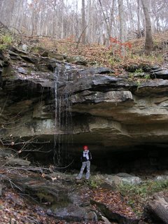
Gayle under the shelter cave. The stream flows down from Beaverhole Lower Cave.
We followed this stream straight up the hill and, as expected, found it to be the stream resurgence of Beaverhole Lower Cave. We spent about 45 minutes in Beaverhole Lower, traveling back in it's single straight-line passage until we were sufficiently bored. Some of the walls are polished smooth from all the caver traffic back in the 60's and 70's, as evidenced by the old signatures back there. Hard to believe that so many people made this brutal hike down for such a boring cave. If nothing else, the cave is interesting in that there are no side leads or tributaries, it's just a single passage extending at least 1300' straight into the mountain.

Kyle and Gayle at the entrance to Beaverhole Lower Cave
Then we followed the limestone outcrop, hoping to find something new and exciting. Travel was very slow as the terrain was extremely steep and slippery, at some points bordering on dangerous. We found a 40' high limestone cliff with a 2' - 4' diameter cave passage up in the cliff, but weren't able to safely get close enough to check it out. Vert gear will be required to investigate it.
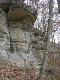
Limestone cliff with small cave passage visible up towards the top/middle
We traveled a bit farther, just enough to spot a very large valley and an 80' tall waterfall over a limestone cliff in the distance. It's enough to make me want to brave the brutal hike through the canyon again to check it out. We were back to Morgantown by just after 4pm and had a well-deserved meal at IHOP. We then met the WVUSG at 5pm and I went with them to Beaverhole Upper.
See: My Photos
After somehow passing right over the limestone outcrop, we continued down to a sheer vertical drop just a few hundred feet from the river itself. We'd gone too far, and started hiking over to a stream falling over a sandstone shelter cave.

Gayle under the shelter cave. The stream flows down from Beaverhole Lower Cave.
We followed this stream straight up the hill and, as expected, found it to be the stream resurgence of Beaverhole Lower Cave. We spent about 45 minutes in Beaverhole Lower, traveling back in it's single straight-line passage until we were sufficiently bored. Some of the walls are polished smooth from all the caver traffic back in the 60's and 70's, as evidenced by the old signatures back there. Hard to believe that so many people made this brutal hike down for such a boring cave. If nothing else, the cave is interesting in that there are no side leads or tributaries, it's just a single passage extending at least 1300' straight into the mountain.
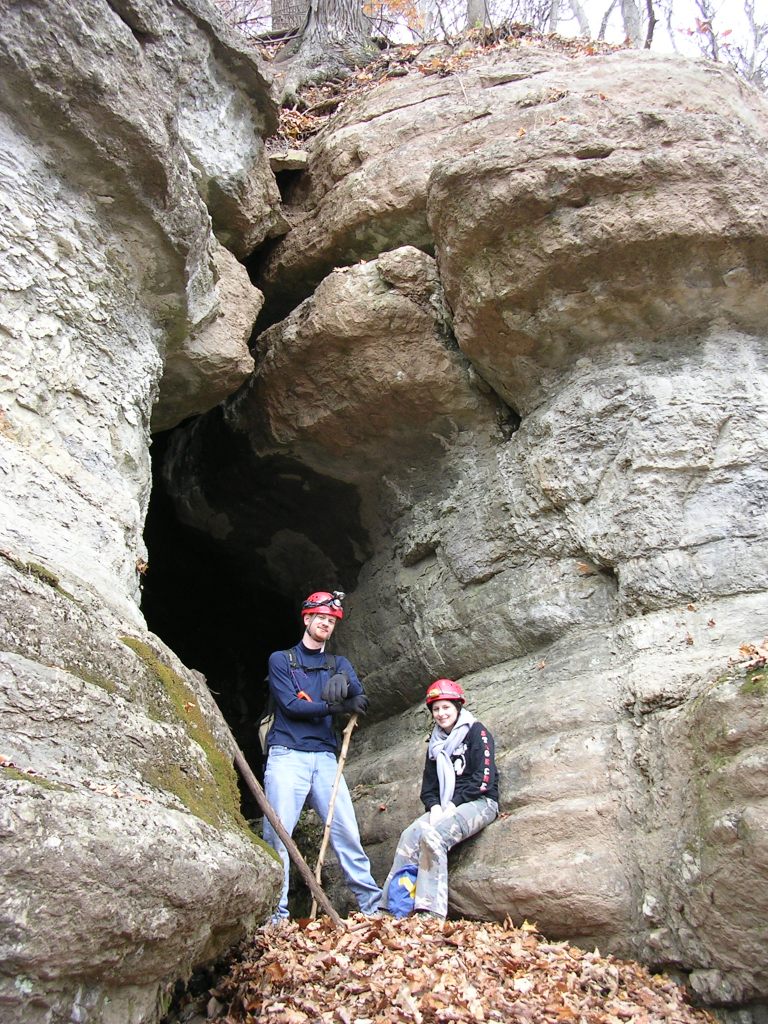
Kyle and Gayle at the entrance to Beaverhole Lower Cave
Then we followed the limestone outcrop, hoping to find something new and exciting. Travel was very slow as the terrain was extremely steep and slippery, at some points bordering on dangerous. We found a 40' high limestone cliff with a 2' - 4' diameter cave passage up in the cliff, but weren't able to safely get close enough to check it out. Vert gear will be required to investigate it.
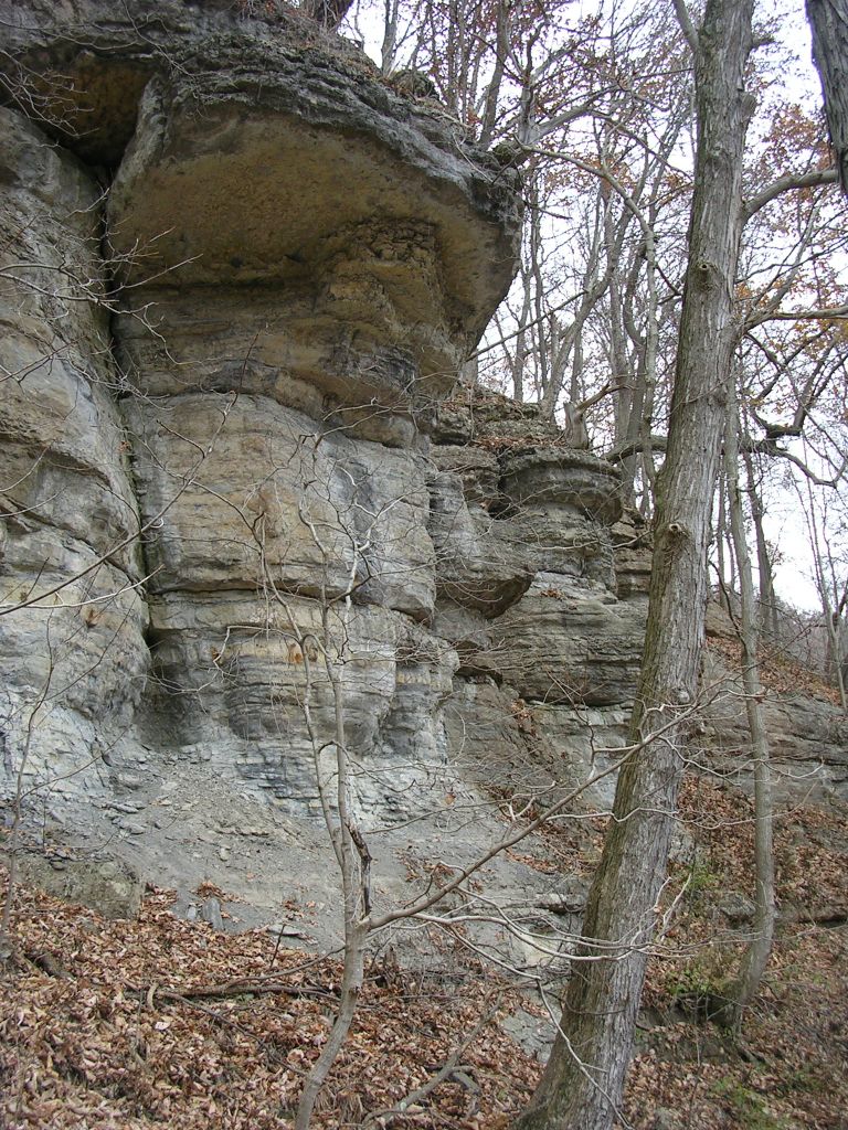
Limestone cliff with small cave passage visible up towards the top/middle
We traveled a bit farther, just enough to spot a very large valley and an 80' tall waterfall over a limestone cliff in the distance. It's enough to make me want to brave the brutal hike through the canyon again to check it out. We were back to Morgantown by just after 4pm and had a well-deserved meal at IHOP. We then met the WVUSG at 5pm and I went with them to Beaverhole Upper.
See: My Photos
Thursday, November 02, 2006
Raese on Vampire Bats
Republican WV Senate candidate John Raese was interviewed on PBS's Outlook show on Oct. 12. Raese is CEO of Greer Industries, the only group of people who get more excited about limestone than cavers do. The following excerpt from the interview is Raese talking about the sorts of government regulation he'd like to do away for the benefit of small business (like his own):
He is likely referring to those pesky endangered "vampire" bats in that derned Hellhole Cave (15th longest cave in the US, home to 45% of the world's population of Virginia Big-Eared Bats). The entire interview is full of great quotes, and I recommend that all West Virginians of voting age read the transcript in full. More info on the issue with Greer and Hellhole is available here.
Update: Raese lost.
I sit around and battle the endangered species act when I have to sit around and follow how many vampire bats are in a quarry that I have -- send two people down to see how many vampire bats we have. Is that a good law?
He is likely referring to those pesky endangered "vampire" bats in that derned Hellhole Cave (15th longest cave in the US, home to 45% of the world's population of Virginia Big-Eared Bats). The entire interview is full of great quotes, and I recommend that all West Virginians of voting age read the transcript in full. More info on the issue with Greer and Hellhole is available here.
Update: Raese lost.
Thursday, October 26, 2006
2006 Bridge Day Rappel
Monongahela Grotto Team Photo Gallery from the 2006 Bridge Day rappel.

Jason Thomas rappels off the New River Gorge Bridge. Photo by Don Ferguson.
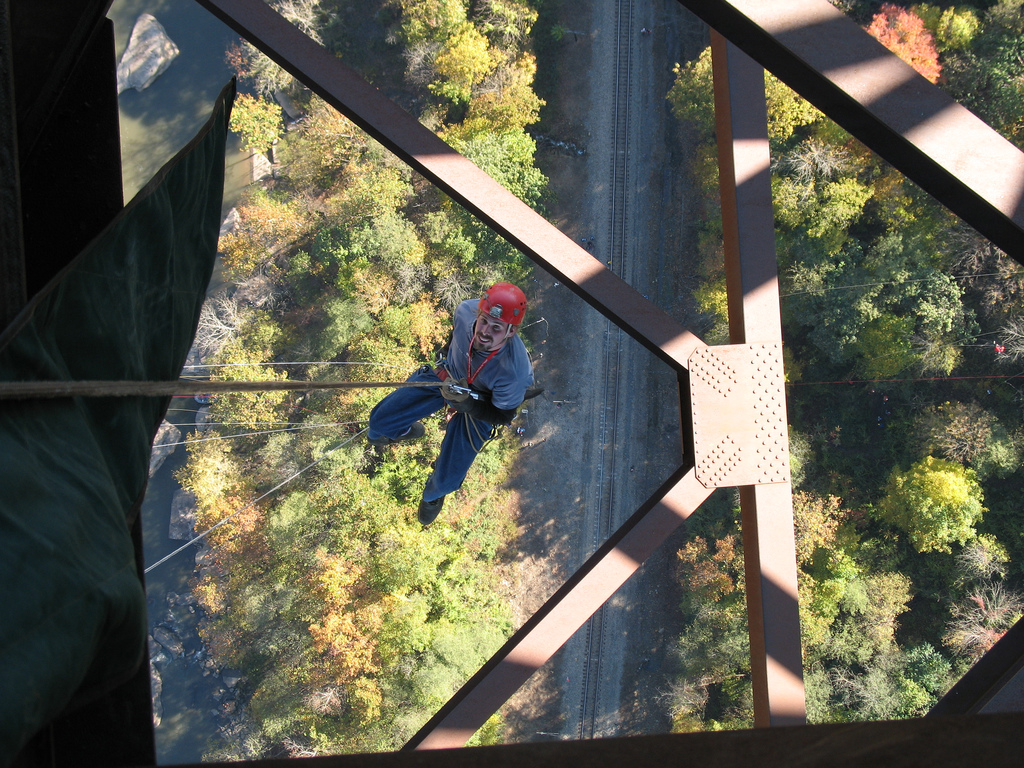
Jason Thomas rappels off the New River Gorge Bridge. Photo by Don Ferguson.
Thursday, October 12, 2006
[trip] Caving in TAG
On Oct. 5 - 8, Brian Masney, Mary Schmidt, Judi Wasilewski, and Dave Riggs took a trip down to TAG to drop some classic pits. Our original plan was to photograph Fantastic Pit then head to the TAG Fall Cave-In, but we decided to skip the Cave-In entirely and squeeze in as much caving as possible instead.
We hit the road from Morgantown at about 2pm on Thursday and headed South. We met Judi in VA, and then headed down to the tip of Georgia. We finally pulled into the Crockford Pigeon Mountain Wildlife Reserve just after midnight, set up camp and went to bed.
Day 1: Ellison's Cave
We woke up early Friday morning and gathered up all our caving gear. A second, larger caving group showed up as we were getting ready to leave, but they were a bit less organized than we were. The trail up to Ellison's Cave starts down at Blue Hole, the cave's resurgence. The hike is over a mile uphill, and this hike is exhausting when you're loaded down with gear and rope.
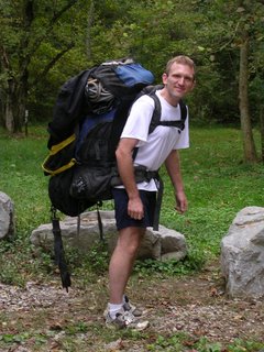
Brian ready to hike up Pigeon Mountain with 900' of rope in tow
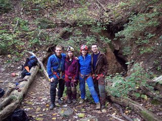
Brian, Mary, Judi, and Dave at the entrance to Ellison's Cave
We reached the unimpressive crack-in-the-ground which is the preferred entrance to do Fantastic Pit and got dressed. After a climb-down, the cave consists of nice walking stream passage (very dry this day) called The Ecstasy, which leads to the 120' Warm-Up Pit. We rigged from a couple bolts in the ceiling and ran our rope through some deep rope grooves worn into the rock, no rope pad necessary -- hooray for PMI. From the Warm-Up Pit, you head up a few nuisance climbs, then to a 20' ascent. From here, it's a short path to a traverse line under a short ledge to The Attic, looking out over Fantastic Pit.
Fantastic Pit is the deepest known pit in the Continental US, a 586' free rappel down a beautiful vertical-walled shaft. We rigged our 900' rope to a massive boulder, tied a knot in the end, then lowered most of it down using a rack to keep it at a safe speed. Brian repelled down first, occasionally shouting or whistling to hear the amazing echo. All of a sudden we heard him shout "F@#%!" and everything went quiet as we all felt our stomachs sink... Brian radioed up that he was hanging 40' off the floor but had reached the knot at the end of the rope. We'd just barely short-rigged the pit. Rather than risk being lowered from above, he changed over and ascended back up. Even though his foot ascender broke on the way, he still made it to the top in what seemed like record time.
We re-rigged the rope, and this time I was the guinea pig to try it out. The ride down seemed to take forever, and the amazing reverberating echo from the pit was absolutely haunting. I finally reached the bottom of the shaft, got off rope, and discovered that my cheap radio no longer worked. Communication from top to bottom is practically impossible without one, and Judi was halfway to the bottom before I knew for sure that she was on rope! One by one, the rest of our team made it to the bottom and got ready for a long wait and a long ascent. I was the first to ascend back out, and was admittedly nervous about it. Not only would I be the first one up our only rope, the biggest ascent I'd ever attempted, but I'd be also be helping Brian photograph the pit by firing off several flashes on the way up.
Brian gave me a quick lesson in the operation of a flashbulb. I was to screw the bulb into the trigger without looking at it, wait for the signal, then look the other way with my eyes closed and fire the unit away from me to ensure that I didn't lose my sight. Oh, and I should also be careful since they sometimes explode if they come in contact with water. Great. I started frogging up at a very slow pace -- the rope would bounce more than 10' with each stride. Every 30 or 40 strides I'd stop and dig through my duffel bag trying to find a fresh flashbulb, arm it, and fire off a shot for the camera. Even with all the breaks, I managed to get incredibly hot and dehydrated. The climb seemed like it took hours.
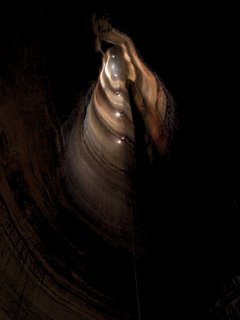
A composite of 10 different individual photos and the result of hours and hours of cave photography, Brian's photo of Fantastic still can't do justice to how enormous this pit is.
Judi headed up next, also armed with a few flashbulbs to light up the rest of the pit. She and Mary flew to the top with their ropewalkers, then Brian frogged back up a second time loaded with all his photography gear! Pulling the rope back up was a huge effort, as was hauling the damn thing back out of the cave -- it's amazing how much your rope and gear expands when you're trying to get back out of a cave. Back down the nuisance drop with that monster rope, and then back up the Warm-Up pit, and then derigging the Warm-Up pit, and then hauling everything back out... we were exhausted, and not looking forward to the hike back down the mountain. We opted to dump our ropes at the cave entrance and hike down lightly, a hike that seemed to have doubled in length since the previous morning. We finally made it back to camp at 4am, after a long but incredible day of caving. After a good breakfast in the morning, the hike to retrieve our ropes seemed like a piece of cake. We found a fraction of the other caving group getting ready to go back in, they had showed up to finally rappel Fantastic -- they'd run out of time the previous day and half of their group had abandoned the trip; the poor remaining three cavers would have to haul the entire party's gear and ropes back out on their own!
Day 2: Neversink Pit
We left Georgia that afternoon and headed to Alabama to drop another TAG classic, the 162' Neversink Pit. We took a quick detour to check out the nearby rock zoo, then parked and geared up. Everyone hiked up the hill and found over a dozen cavers there -- TAG Fall Cave-In traffic.
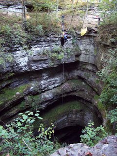
Beautiful view of Neversink Pit
We waited for a good rigging spot to open up, rigged to a tree and waited some more. Finally enough people were out of the way that we could rappel down with our rope. This pit is gorgeous. It's an open-air pit where the sun shines down in, the layered walls are covered with moss and ferns and small waterfalls. We were all able to get to the bottom before the sun set and were treated to an incredible view. This pit seemed tiny after doing Fantastic the day before! After Neversink, we headed to a nearby camping site, complete with bathrooms and hot showers.
Day 3: Cagles Chasm
Sunday we opted to squeeze in one more pit before heading home; we drove to Tennessee for Cagles Chasm. We parked next to a kennel full of barking beagles and got geared up. Time for another hike up another hill, but at least this one was an easy one.
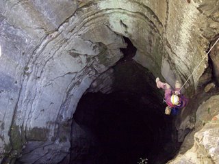
Mary Schmidt rapells into Cagles Chasm
Cagles Chasm is another open-air pit, a 186' vertical shaft which intersects a maze of cave passages on the way down. The view from the bottom looking up is spectacular, especially if you're a geology fan (you are, right?). With no traffic to contend with this time, we bounced the pit quickly and were ready for the drive back home by late afternoon.
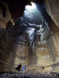
Judi and Dave at the bottom of Cagles Chasm
We made it back to Morgantown by 2am Sunday, after a great weekend full of amazing pits. Everyone was glad that we'd opted to skip the Cave-In to squeeze in more actual caving. After visiting these TAG classics, it's easy to see why this area is the best vertical caving in the country!
All photos by Brian Masney
See: Brian's trip photos
See: My trip photos
We hit the road from Morgantown at about 2pm on Thursday and headed South. We met Judi in VA, and then headed down to the tip of Georgia. We finally pulled into the Crockford Pigeon Mountain Wildlife Reserve just after midnight, set up camp and went to bed.
Day 1: Ellison's Cave
We woke up early Friday morning and gathered up all our caving gear. A second, larger caving group showed up as we were getting ready to leave, but they were a bit less organized than we were. The trail up to Ellison's Cave starts down at Blue Hole, the cave's resurgence. The hike is over a mile uphill, and this hike is exhausting when you're loaded down with gear and rope.
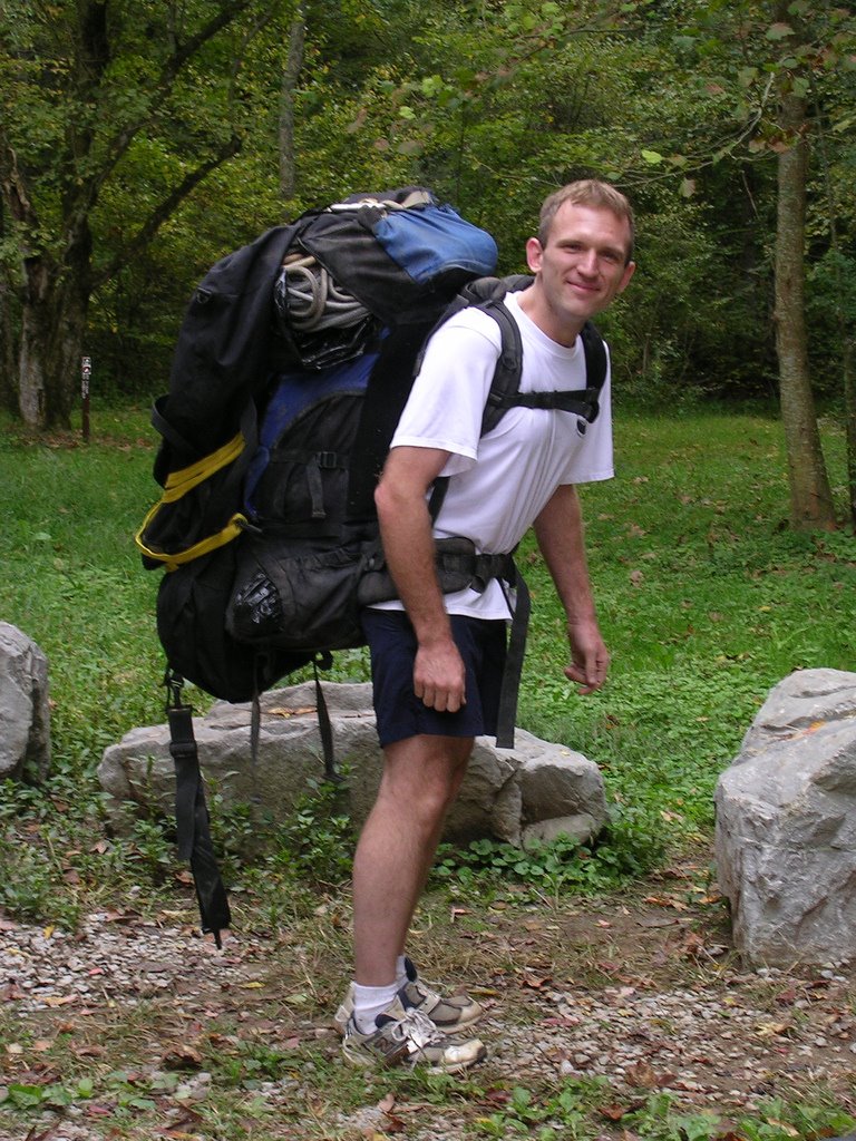
Brian ready to hike up Pigeon Mountain with 900' of rope in tow
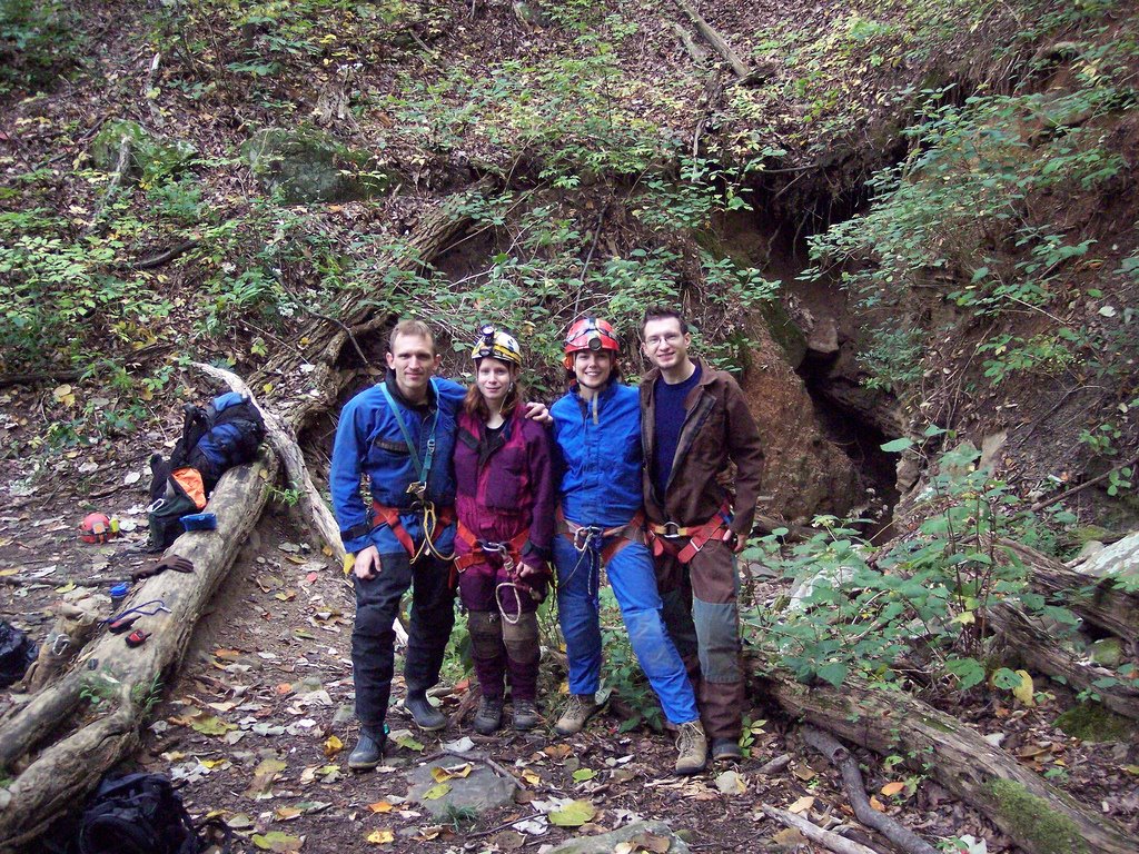
Brian, Mary, Judi, and Dave at the entrance to Ellison's Cave
We reached the unimpressive crack-in-the-ground which is the preferred entrance to do Fantastic Pit and got dressed. After a climb-down, the cave consists of nice walking stream passage (very dry this day) called The Ecstasy, which leads to the 120' Warm-Up Pit. We rigged from a couple bolts in the ceiling and ran our rope through some deep rope grooves worn into the rock, no rope pad necessary -- hooray for PMI. From the Warm-Up Pit, you head up a few nuisance climbs, then to a 20' ascent. From here, it's a short path to a traverse line under a short ledge to The Attic, looking out over Fantastic Pit.
Fantastic Pit is the deepest known pit in the Continental US, a 586' free rappel down a beautiful vertical-walled shaft. We rigged our 900' rope to a massive boulder, tied a knot in the end, then lowered most of it down using a rack to keep it at a safe speed. Brian repelled down first, occasionally shouting or whistling to hear the amazing echo. All of a sudden we heard him shout "F@#%!" and everything went quiet as we all felt our stomachs sink... Brian radioed up that he was hanging 40' off the floor but had reached the knot at the end of the rope. We'd just barely short-rigged the pit. Rather than risk being lowered from above, he changed over and ascended back up. Even though his foot ascender broke on the way, he still made it to the top in what seemed like record time.
We re-rigged the rope, and this time I was the guinea pig to try it out. The ride down seemed to take forever, and the amazing reverberating echo from the pit was absolutely haunting. I finally reached the bottom of the shaft, got off rope, and discovered that my cheap radio no longer worked. Communication from top to bottom is practically impossible without one, and Judi was halfway to the bottom before I knew for sure that she was on rope! One by one, the rest of our team made it to the bottom and got ready for a long wait and a long ascent. I was the first to ascend back out, and was admittedly nervous about it. Not only would I be the first one up our only rope, the biggest ascent I'd ever attempted, but I'd be also be helping Brian photograph the pit by firing off several flashes on the way up.
Brian gave me a quick lesson in the operation of a flashbulb. I was to screw the bulb into the trigger without looking at it, wait for the signal, then look the other way with my eyes closed and fire the unit away from me to ensure that I didn't lose my sight. Oh, and I should also be careful since they sometimes explode if they come in contact with water. Great. I started frogging up at a very slow pace -- the rope would bounce more than 10' with each stride. Every 30 or 40 strides I'd stop and dig through my duffel bag trying to find a fresh flashbulb, arm it, and fire off a shot for the camera. Even with all the breaks, I managed to get incredibly hot and dehydrated. The climb seemed like it took hours.
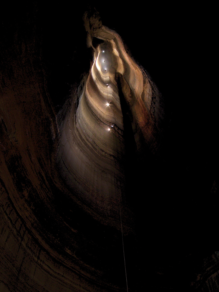
A composite of 10 different individual photos and the result of hours and hours of cave photography, Brian's photo of Fantastic still can't do justice to how enormous this pit is.
Judi headed up next, also armed with a few flashbulbs to light up the rest of the pit. She and Mary flew to the top with their ropewalkers, then Brian frogged back up a second time loaded with all his photography gear! Pulling the rope back up was a huge effort, as was hauling the damn thing back out of the cave -- it's amazing how much your rope and gear expands when you're trying to get back out of a cave. Back down the nuisance drop with that monster rope, and then back up the Warm-Up pit, and then derigging the Warm-Up pit, and then hauling everything back out... we were exhausted, and not looking forward to the hike back down the mountain. We opted to dump our ropes at the cave entrance and hike down lightly, a hike that seemed to have doubled in length since the previous morning. We finally made it back to camp at 4am, after a long but incredible day of caving. After a good breakfast in the morning, the hike to retrieve our ropes seemed like a piece of cake. We found a fraction of the other caving group getting ready to go back in, they had showed up to finally rappel Fantastic -- they'd run out of time the previous day and half of their group had abandoned the trip; the poor remaining three cavers would have to haul the entire party's gear and ropes back out on their own!
Day 2: Neversink Pit
We left Georgia that afternoon and headed to Alabama to drop another TAG classic, the 162' Neversink Pit. We took a quick detour to check out the nearby rock zoo, then parked and geared up. Everyone hiked up the hill and found over a dozen cavers there -- TAG Fall Cave-In traffic.
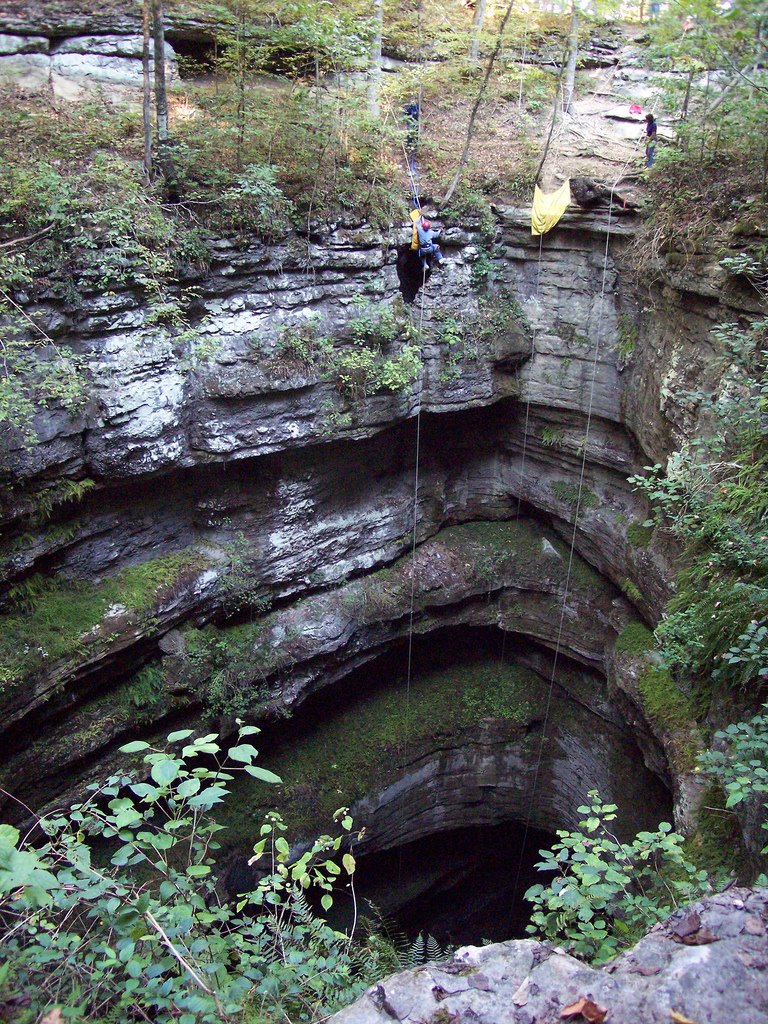
Beautiful view of Neversink Pit
We waited for a good rigging spot to open up, rigged to a tree and waited some more. Finally enough people were out of the way that we could rappel down with our rope. This pit is gorgeous. It's an open-air pit where the sun shines down in, the layered walls are covered with moss and ferns and small waterfalls. We were all able to get to the bottom before the sun set and were treated to an incredible view. This pit seemed tiny after doing Fantastic the day before! After Neversink, we headed to a nearby camping site, complete with bathrooms and hot showers.
Day 3: Cagles Chasm
Sunday we opted to squeeze in one more pit before heading home; we drove to Tennessee for Cagles Chasm. We parked next to a kennel full of barking beagles and got geared up. Time for another hike up another hill, but at least this one was an easy one.
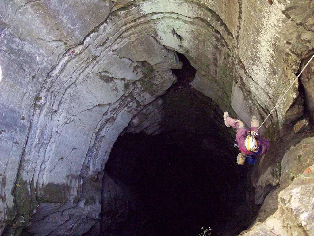
Mary Schmidt rapells into Cagles Chasm
Cagles Chasm is another open-air pit, a 186' vertical shaft which intersects a maze of cave passages on the way down. The view from the bottom looking up is spectacular, especially if you're a geology fan (you are, right?). With no traffic to contend with this time, we bounced the pit quickly and were ready for the drive back home by late afternoon.

Judi and Dave at the bottom of Cagles Chasm
We made it back to Morgantown by 2am Sunday, after a great weekend full of amazing pits. Everyone was glad that we'd opted to skip the Cave-In to squeeze in more actual caving. After visiting these TAG classics, it's easy to see why this area is the best vertical caving in the country!
All photos by Brian Masney
See: Brian's trip photos
See: My trip photos
Wednesday, October 04, 2006
[trip] Geology Field Trip to Bowden
On Sunday October 1, Dr. Henry Rauch took our Karst Geology class on a field trip into Bowden Cave in Randolph County. We took the class in the main entrance, up the main trunk to the breakdown room, up into the shower room, then through the water course to the gate. It's amazing how many solutional features, structural and lithologic controls, and evidence of paleo-flow you find when you're actually looking for them.

2006 WVU Karst Geology class in the entrance of Bowden Cave. Photo by John Tudek
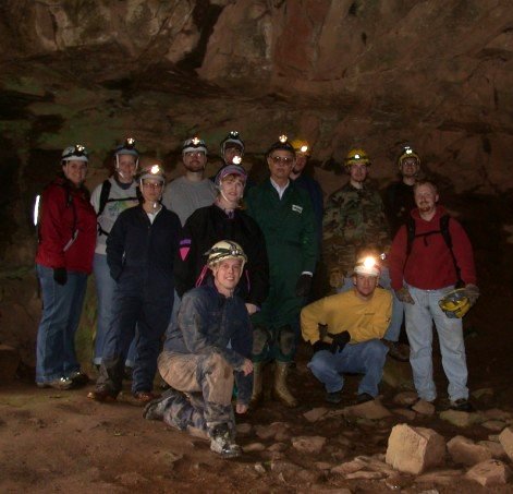
2006 WVU Karst Geology class in the entrance of Bowden Cave. Photo by John Tudek
Subscribe to:
Posts (Atom)


