I visited the
West Virginia Geological and Economic Survey (WVGES) at
Mont Chateau today. I picked up an electronic copy of the
1923 Geological Survey of
Tucker County, which consists of a PDF scan of the survey's text (550 pages, unfortunately
scanned as images so you're not able to
search it), and scans of the geologic and topographic maps (scanned 400dpi and broken up into two giant
.tif files each). They actually still have some dusty, mildewed original paper copies of Tucker County, but it's one of the last ones left. They told me that someone is currently converting W.E. Davies
Caverns of West Virginia to electronic format, and of all their publications, that book has been their
Freebird.
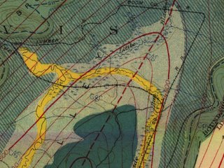 Tiny detail view of the 1921 Tucker County geological map by the West Virginia Geological and Economic SurveyEdit
 - Doug McCarty points out that the geological maps are available from the
WV GIS Tech Center and from the
PSC Grotto. They're compressed as
MrSID files, a proprietary format that I
can't view, but you
probably can. I don't know of any other source for the text of the survey except from the CD that I purchased.


No comments:
Post a Comment