Monday, June 12, 2006

[trip] Biology Study

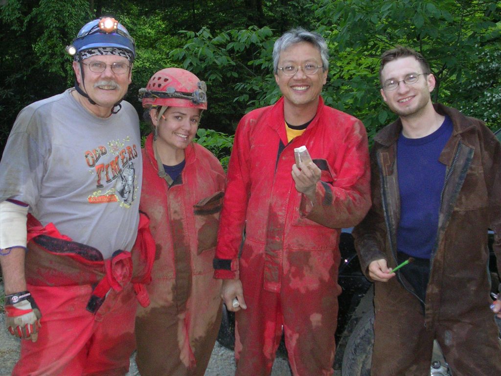
Bob Griffith and I helped Dr. Daniel Fong and Dr. Horton Hobbs on a biology study this week, cataloguing invertebrate cave fauna. We took them to Beaverhole Upper, Maiden Run #2, and Maiden Run #1 on Monday, then to Beaverhole Lower on Tuesday. I'm now an honorary vertical biologist.


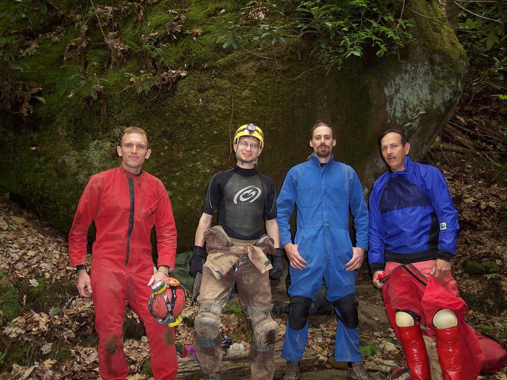
Horton Hobbs, Katie Schneider, Dan Fong, Dave Riggs

[trip] New Years Day Cave Survey

Aaron Bird, Brian Masney, Jason Thomas, and myself (Dave Riggs) made another trip back into New Years Day Cave this weekend (June 10). We first surveyed from the bedrock-on-bedrock crawl, through the Whack-A-Mole™ Way, to the last dig. We then broke up into two teams, and together surveyed through Jason's wormhole, past the dome, past the low/wide stuff, and into the crumbly canyon passage that we last turned around in.

We were in cave about 9 hours and surveyed about 1010', which brings New Years Day Cave to a whopping 2499' length - now the longest cave in Monongalia County (topping Maiden Run Cave #1 at 1800')!


Amazingly, we do this for fun.


The line plot shows NYDC heading directly for the end of Druid Cave, with about 400' straight-line distance between their surveys. We turned around in canyon passage that requires a hammer to continue forward, and the Druid wind is still very strong in this far end of the cave.

Photo by Brian Masney

Saturday, June 03, 2006

Hiking Maiden Run

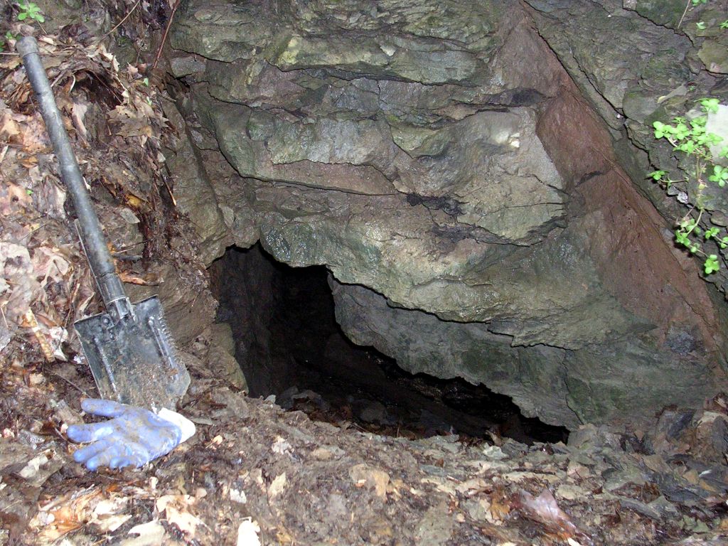
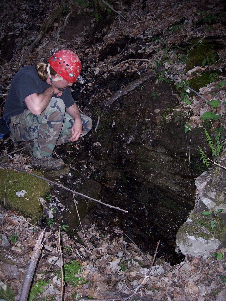
I went for a nice hike along Maiden Run this afternoon. I took some photos of Maiden Run #2, Maiden Run #1, a FRO above Maiden Run #1, and a small opening that may be Maiden Run #3 (see better photo from last visit). I also tried to find a sinkhole that the Mon Grotto dug in 1975 (see email discussion), but didn't have any luck.


Entrance to Maiden Run #2 is a down-sloping crawl to stooping passage with a cave stream. This cave lightly blows cool air.

Thursday, June 01, 2006

[trip] Caving in Tennessee

We had a large turnout at TAG this past weekend: Rich Finley, Jill Pile, Jason Thomas, Melissa Parker, Dave Riggs, Judi Wasilewski, Bob Griffith, Mary Davis (both showed up on Monday), Ryan Ellers, Garth Dixon and myself (Brian Masney).

We camped in Fall Creek Falls State Park in Central Tennessee on Friday, Saturday and Sunday nights.

On Saturday, we went into Rumbling Falls Cave. We split into two teams: Jason, Brian, Dave and Judi comprised the first team that went in to get everything rigged. Later in the day, the derigging team (Rich, Garth and Ryan) came into the cave. Rumbling Falls has a 70' entrance drop. You continue upstream through walking passage. There are two 20' up climbs along the way. You continue upstream and the passage eventually becomes a hands and knees crawl and then it becomes a belly crawl in the stream. At this point, I thought: "Why did we come here? We have this kind of stuff back home in Morgantown!" It eventually opens up a little bit and it requires several climbs, crawls, chimneys, cussing, etc. to continue through the passage. You eventually cross a drainage divide. At this point, the passage slowly starts to get a little bigger. You walk a short distance and you come to the Rumble Room. It is 5 acres in size and there is a 201' rappel to the top of the breakdown. This is the biggest known underground room in TN and it is big enough to fit the Lousiana Superdome in there.


Judi at the top of the Rumble Room.


The 5 acre Rumble Room in Rumbling Falls Cave. Thanks to Jason Thomas and Dave Riggs for helping light up the room with their Sten Lights while I did a time exposure with my camera.

On Sunday, everyone went to Conley Hole. The cave is about 9/10 of a mile from the parking area. The first half mile is easy walking through a field. The rest of the hike requires bush whacking through the woods to find the cave. There isn't a trail to the cave. Luckily I had good GPS coordinates to the pit or else we wouldn't have found it. The entrance to the pit is 20' in diameter and it really opens up about 50' from the top. The pit is about 186' deep.


Judi at the entrance to Conley Hole. Photo by Dave Riggs.


The entrance to Conley Hole from the bottom. Notice the rappeller on rope.


Ryan and Dave standing under some formations in Conley Hole.

On Monday, everyone went to Mystery Falls Cave. This pit is 286' deep and it is the deepest known pit in Tennessee. The cave is gated and it requires a permit to visit the cave. There is about 100'+ of horizontal passage that leads you to the top of the 286' pit. The pit is highly decorated and it really bells as you get closer to the bottom.


Dave at the top of the 286' drop in Mystery Falls Cave.


Mary at the bottom of the 286' drop in Mystery Falls Cave.

All in all, the entire trip went really well. We had too many people in the pits though. This made some of the trips really long. Next time, we need to split up into smaller groups.

I uploaded photos from the trip to my Flickr account. Special thanks to everyone who helped out with the photos. See also Dave's photos from Conley Hole.

Photos by Brian Masney unless otherwise noted.

Wednesday, May 17, 2006

[trip] New Years Day Cave Push

This past Saturday, May 13, Brian Masney, Jason Thomas, Bob Kirk, and myself (Dave Riggs) made another trek into New Years Day Cave. NYDC is believed to be the still-unconnected upstream trunk of Druid Cave. The goal of this push trip was to get past a boulder blocking further progress into the cave - Bob had helped us past similar obstacles at the downstream dig, and was making his first trip into NYDC to help us continue forward.

We met in Morgantown around 9am, drove up to the lip of the Cheat Canyon, and started the trek downhill. All four of us suited up in wetsuits with warm layers over top, carried spare layers sealed up in dry packs, and packed in hand warmers, candles, and a heat tent. Armed for battle with a brutal cave, we headed underground at just after 10:30am.
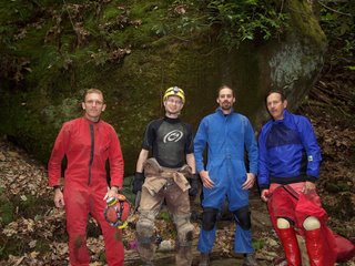


Brian Masney, Dave Riggs, Jason Thomas, Bob Kirk prepare for another relaxing day in New Years Day Cave

Luck seemed to be with us; the water level was low and the moderate temperature outside meant that the cave air was relatively still. Because we were able to stay dry, we actually had to stop and cool off halfway through the sandy "beach" crawl - a wide silt stream bank with a very low ceiling. Everyone was soon soaked after trekking through the cave stream and going headfirst down into a much-loathed water crawl. From here, we did a short jog through the Mon County Borehole and made it to the rock-on-rock-slab crawl at the end of the current survey.

We went ahead and to the Whack-A-Mole™ passage, so named because the finger-like protruding shelves needed whacked with a hammer to comfortably walk through. This was my first time past the last survey station, and I was honestly impressed with the size, the speed we were able to travel, and the distance that this passage covers. For New Years Day Cave, being able to stand upright and walk forward for more than a hundred feet is a welcome treat. I expect the next survey trip to add a good bit of distance because of this passage. Notable here was a large number of shell fossils embedded in several of the limestone beds along the walls.

Finally, after close to two hours(?), we reached our destination: a narrow trench going down from an upper passage to the stream level below, blocked at the very bottom by a boulder just barely larger than the opening it guarded. Jason, Bob, and I started to work on it immediately. Jason and I each drilled a hole, but progress was slow. The passage was apparently blocked with the only sandstone boulder in the entire limestone cave - it would quickly crumble and fill any hole we drilled, while the edges would crumble under the pressure. Meanwhile, Brian suited up, grabbed a shovel, and pushed a parallel lower path in the stream. He made it forward almost to where our boulder was, but was obstructed by more breakdown.

After unsuccessfully trying to tug the boulder out of the way with webbing, it was decided that our best bet against the unwilling rock was to simply pulverize it with the hammer. We easily rounded all the corners, but it was extremely difficult to swing powerful blows in the bottom of the 18" wide slot - progress was again slow. In addition, we were very weary of some sketchy breakdown seemingly balanced on the rocks adjacent to our sandstone foe. We took turns pounding on it, gradually chipping it smaller and smaller, and keeping us from becoming too chilled.

Near 4:30pm we succeeded in rolling the deflated boulder out of the way, leaving a huge mound of powdered rock behind in its place. I squeezed through the opening, being careful not to touch the breakdown on my side, and crawled forward in the stream passage. I shouted back, "It goes... but it sucks!". I went about a body length in and could see that the tunnel shrunk up ahead to painful proportions, with no visible place to turn around. Worse still was the backside view of the sketchy breakdown... the protruding bottom rock itself appeared to be held in place just by the weight of the piles of rock above it. I squirmed out and Jason popped in to confirm that this was at best an obstacle to tackle another day, and given how unstable the adjacent wall seemed, could at worst be the end of the line for New Years Day Cave.

Everyone huddled up above to discuss the situation. Frustrated that this nasty cave could defeat us after all the trips in and out over the past two years, Jason decided to prove to NYDC who was in charge. He went head-first into the sketchy upper "passage", a pile of breakdown supported by breakdown with a roof made of... breakdown. He started pushing and shoving rocks aside, and inching his way forward - head-first, downhill, without room to turn himself around. And after at least 15 grueling minutes of this...
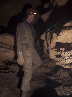


Jason Thomas triumphs over NYDC


...Jason had broken into a virgin room.

We clamored one after one through his wormhole, each of us prying or tossing aside a rock or three so we could fit. The room is about a dozen feet tall, one side frighteningly walled by a mudslide. You drop down to stream level, follow the stream forward a bit and the ceiling becomes lower, to stoop height. A dome, 15 - 20' high awaits, with the first real formation I've seen in New Years Day Cave. From here the stream meanders a bit, the ceiling gets lower and lower, the passage gets very very wide - probably 40' at its widest width, 2.5' at its lowest height.

A couple-hundred feet in, there is a boulder intersection, which we went around and followed the wind down a crawl. Here the passage becomes very different - fingery canyon passage, narrow but 6 - 8' tall, meandering with the water. The "limestone" has a black coating and the fingers can be easily broken off, as if composed of some rotten mud-rock. The Druid winds continued, but we turned back to save the booty for another survey trip.
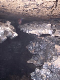


Jason in the virgin canyon passage, note the rotten limestone walls

The trip back out was exhausting. The pointed shelves in the Whack-A-Mole™ passage are shaped such that they poke and grab at every piece of your suit and pack on the way out. We were all coated with sandy mud, and our packs were filled with gear (Bob measured his with a fishing scale afterwards - 50lbs). We finally exited, before dark, scrubbed ourselves off in Lick Run, then hiked back up the brutal hill with mixed emotions. Brian summed everyone's feelings up by saying "Jason, I don't know whether to hug you or kick you!"

Photos by Brian Masney
Tuesday, May 02, 2006

2006 Spring VAR

This is not a trip report! Brian and I drove down to VAR in Grottoes VA this weekend. They went into Grand Caverns, I didn't. We went to the Devil's Marble Yard in the Jefferson National Forest, which was awesome. I picked up an original printing of WVaSS Bulletin 5, Caves of North Central West Virginia from Speleobooks. On the way home, Brian and I hiked to the top of Seneca Rocks.


Brian Masney, Carrie Blankenship, Sam ???, John Tudek, Judi Wasilewski, Dave Riggs at the Devil's Marble Yard

See Brian's photos for more of a trip report than this posting is.

Friday, April 28, 2006

[trip] Ridge Walking Rt. 7 Part 2

Brian, Jason, and I did some poking around Rt. 7 this evening. We checked out the entrance to Maiden Run #1, found the entrance to Maiden Run #2, and checked out a resurgance and FRO between the two. Both Maiden Run #1 and #2 were blowing cool air.

We then drove down the road a bit and found Nuttinbuttawett Pit, a 20' deep crevice that completely swallows a small stream. The water resurges a few dozen yards down the hill, and looks like it might drop underground again on one side. This area is also peppered with springs and lots of weathered limestone outcrops.


Jason Thomas checks out an interesting karst feature between Maiden Run #1 and #2


Me descending Mon County's deepest pit by hand, Nuttinbuttawett Pit

All photos by Brian Masney

Tuesday, April 25, 2006

[trip] VPI Picnic / Newberry Cave

I spent this past weekend in Bland County VA with the VPI Cave Club for their annual Picnic weekend. Their campsite is in a beautiful karst valley, apparently filled with vertical caves. The VPI folks know how to throw an event - there was lots of good food and drink, plenty of great people, and an enormous bonfire roaring all weekend.

I went on a trip led by John Deighan into Newberry Cave. A small party went in before us and rigged the cave, then our party of 5 followed shortly after. The entrance to Newberry is a vertical crevice, at first about a foot wide then opening up a bit towards the bottom. It's about a 60' rappel down the crevice into a small entrance room.

From the entrance, we followed a stair-stepped passage down, then crossed a ledge with a bit of exposure, to a second rappel - this one only about 30'. A cable ladder was rigged here for the ascent back out. Just below this nuisance drop was a beautiful 180' pit, Bill's rappel. We dropped it to the room below, then followed some twisting passage down, eventually taking us to the bottom of triple wells - an amazing 220' perfectly-vertical pit.

From here, we headed back up and followed the "devil's staircase", a series of winding hand climbs that brings you back above the 180' drop without ascending rope. Two spots were a bit hairy, but everyone made it up without incident. We derigged the big drop, then ascended the 30' one - some of us opting to frog it out rather than deal with a cable ladder. After derigging, we took a slightly different path back, which brought us up to within 25' of the entrance slot. We handclimbed/chimneyed up the remainder of the entrance crevice with ascender backup.

We arrived at the surface to sunny weather and had just a 2 minute hike back to the campsite where dinner was just about ready. It was an enjoyable cave trip, a beautiful cave, and an all-around excellent weekend.


The author picnic-ing with VPI's cutest girl

See also photos by Richard Cobb

Friday, April 21, 2006

Rappelling At Iron Furnace

WVUSG went rappelling near the Iron Furnace at Coopers Rock on Thursday evening. Brian rigged a static line for rappellers, and Cara rigged a top rope for climbers. It turns out that the Iron Furnace really is as creepy as people say...


Jessica Morning frogging up the cliff. Photo by Brian Masney.

See also: more photos by Brian Masney and by Dave Olsen.

Thursday, April 06, 2006

Rappelling at Army Rock

Ryan, Brian, Rich, Jill, Jason (fireman-Jason, not Jason-Jason), and I went rappelling at Army Rock this evening. Army Rock is much quicker to get to and from than Cheat View (if you're in Morgantown), but it's only about 60' high. I got some practice in with 5 bars of my 6-bar rack (eh) and with a foot ascender (awesome!).

Time to pack for a weekend at the Bat Ranch.

Monday, April 03, 2006

[trip] YTR / Bone-Norman

This past weekend was my first Young Timers' Reunion, and I had a really great time. Friday afternoon's weather was 72° and sunny, but as soon as Ryan Ellers, John Cunningham and I met up, the sky turned black and rain started pouring down. Mother nature didn't let up on us the entire drive down to Greenbriar County; the combination of foul weather and several stops along the way (including almost getting lost in the Tamarack parking lot) kept us from arriving at the campground until about 9:30pm. That night remained damp and dreary, but a nice fire kept everyone warm.

Saturday morning we woke up to a beautiful clear sky and sunshine, definitely a welcome sight after the previous evening's crappy weather. At around 10am, David C. of the VPI Grotto (and without shoes) led a large group of 15 ("no wait, how many people do we have?") cavers from WVU, VPI, JMU, and Maryland on a through-trip of the Bone-Norman Cave system.


The entrance to Bone Cave is on the face of this old quarry, obscured by trees. Note me in the bottom right for scale, and several other cave passages higher up along the limestone face.

The entrance to the Bone Cave side is at the ground level of an old, large limestone quarry. The first part of the cave is mostly large walking passage, then consists of a series of alternating low phreatic tunnels and smaller rooms. The Bone side is dry. Really, really dry. Its floor consists entirely of fine dust, so deep that it feels like you're walking on a beach. As you can probably imagine, with 15 people trudging through dust like this, and with wind whipping through the smaller tunnels, it wasn't long before everyone had filled their mouths, noses and eyes with cave grit.


Carrie Blankenship of VPI models her sweet new Howie's Harnesses cave pack in some Bone Cave canyon passage.

Eventually, Bone gets lower and lower, until you spend a lot of time on your belly. We made it to The Devil's Pinch, and everyone squeezed through the 7" slot without incident. After a bit more crawling, then down a large dusty slide, everyone dove headfirst through a slot 4' off the floor (except for a couple crazies who went feet-first).

From here, we headed left down a few dusty corridors and finally came to some deep, damp canyon passage - Norman Cave. This side definitely has a different character than does the Bone side - the former still feels live while the latter is dead and "bone dry". Our group got split in two after a bit of miscommunication, but with some sharp thinking and teamwork, everyone was quickly reunited and headed back on our way.

We generally followed a decent-sized meandering stream through the Norman side. Our path continually crossed back and forth over the stream, which occasionally ducked underground, leading us over a lot of extremely slippery silt banks and some very wide rooms. We next spent a lot of time climbing over a very long stretch of breakdown, which necessitated several rest stops. After more breakdown than I cared for, we headed into the stream for a very cool, very long watercourse. The ceiling was of stoop-height for a large part of it, and the swift water has cut some great potholes throughout the course - some were easily waist deep, thus making this an official "wet cave". The banks of the stream for a large part of this water passage are formed entirely of flowstone, and there are many sections where the limestone has been corroded to the density of a giant Swiss cheese.

Finally the watercourse leads you to a roaring waterfall that crashes down through the ceiling probably 40' or more. It's quite a sight, and was a treat after trudging through the not-quite-high-enough stream passage for so long. From there, a nuisance climb led to a waiting room, which led to a nuisance climb, which led to.. a real nuisance climb. I was the last one up, and I'm glad there was no one below to see my ungraceful ascent.

From here, we climbed up to an absolutely enormous room, floored by a massive breakdown hill. Some large, dead columns stared down from the top of this humbling room. Starting to really feel tired, I trudged up the underground hillside until I finally saw a tree root jutting up from the ground. I pondered this for entirely too long until a dim light bulb lit, and I quickly looked up to see a speck of moonlight at the very top of the room. Everyone bolted for the exit, hopped out of the mole-hole and we were greeted with a beautiful, clear, night sky full of stars - an excellent ending to an excellent cave trip.

I believe we made it back to camp around 9pm. In contrast to the previous night, Saturday night was excellent - warm weather, a clear sky, live guitar with upright bass, and lots of great people. Door prizes were handed out to everyone - I walked away with a VAR hat and a roll of primo duct tape. Most importantly, WVU spanked JMU and VPI by number of attendees, winning the trophy for a 2nd year in a row.

So, in not nearly as many words, YTR was excellent - thanks to everyone who made it great (you know who you are).

All photos by Brian Masney
Wednesday, March 29, 2006

WVGES

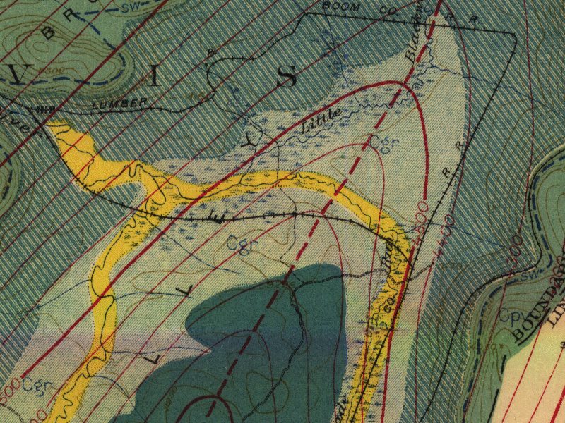
I visited the West Virginia Geological and Economic Survey (WVGES) at Mont Chateau today. I picked up an electronic copy of the 1923 Geological Survey of Tucker County, which consists of a PDF scan of the survey's text (550 pages, unfortunately scanned as images so you're not able to search it), and scans of the geologic and topographic maps (scanned 400dpi and broken up into two giant .tif files each). They actually still have some dusty, mildewed original paper copies of Tucker County, but it's one of the last ones left. They told me that someone is currently converting W.E. Davies Caverns of West Virginia to electronic format, and of all their publications, that book has been their Freebird.


Tiny detail view of the 1921 Tucker County geological map by the West Virginia Geological and Economic Survey

Edit - Doug McCarty points out that the geological maps are available from the WV GIS Tech Center and from the PSC Grotto. They're compressed as MrSID files, a proprietary format that I can't view, but you probably can. I don't know of any other source for the text of the survey except from the CD that I purchased.

Monday, March 27, 2006

[trip] Tucker Co. Mar. 25, 2006

Brian Masney, Doug McCarty and I surveyed in the back of M*R cave this Saturday. We were in cave by 10am, and took probably close to 2 hours to get back to the end of the survey. We surveyed past the farthest point I'd previously been back in, past the end of the 1955 survey, and stayed close to the floor for longer straight shots rather than high and dry. The cave amazingly opened up into tall, 4' wide passage for probably 175' - a big relief after spending most of the day on our bellies in the water. We surveyed 420' of passage, then conveniently hit some low passage that inspired us to call it a day. Doug booked it out and had already changed clothes by the time Brian and I made it out of the cave around 9pm!


Doug McCarty sketching, photo by Brian Masney

Alternate trip report: Doug McCarty (includes excellent working lineplot of M*R)

Sunday, March 12, 2006

Rainy Vertical Practice

The weather has been beautiful the last 4 days, but this morning it rained and rained. Naturally, we decided that it'd be a great day for vertical practice. Some fellow crazies met up at 9am in Fairmont and went to some great property near Valley Falls.

Doug McCarty placed a couple bolts and rigged a rebelay and a redirect. We spent 3 or 4 hours practicing in the rain. I definitely didn't perfect the technique, but I know enough now to practice on my own.

Sunday, February 26, 2006

[trip] Sharps Cave

The Mon Grotto took an enjoyable trip to Sharps Cave Sat. Feb 25, 2006. Three ladies from the Parkersburg Area Grotto joined us, as well as a few beginners - two were students from my high school alma mater.

Brian and I got there early and went looking for Pinnacle Cave. Since I forgot to bring the coordinates with me, we went from my memory... in other words, we couldn't find it. We followed the limestone outcrops along the ridge for a bit and found several interesting spots that could use some digging.

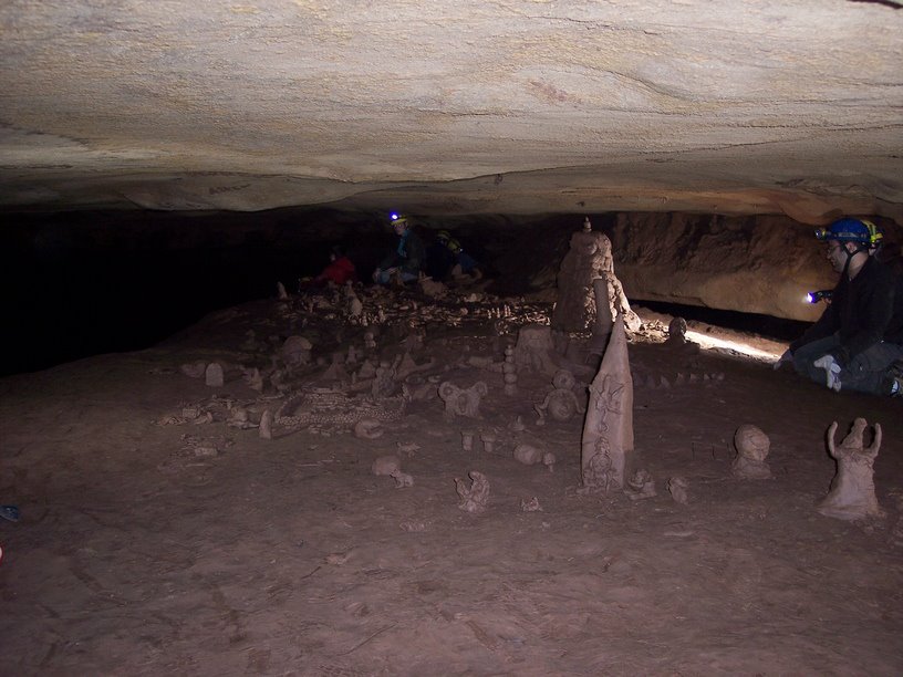
Our group of 12 cavers suited up, descended the entrance slot, and met up in the first big room. Brian brought three slave flash units, so we spent a lot of time setting up and taking photos in this cave. We took some more photos in Halloween Hall, then headed over the breakdown area to the left and went to the mud sculpture room where we rested for a bit.


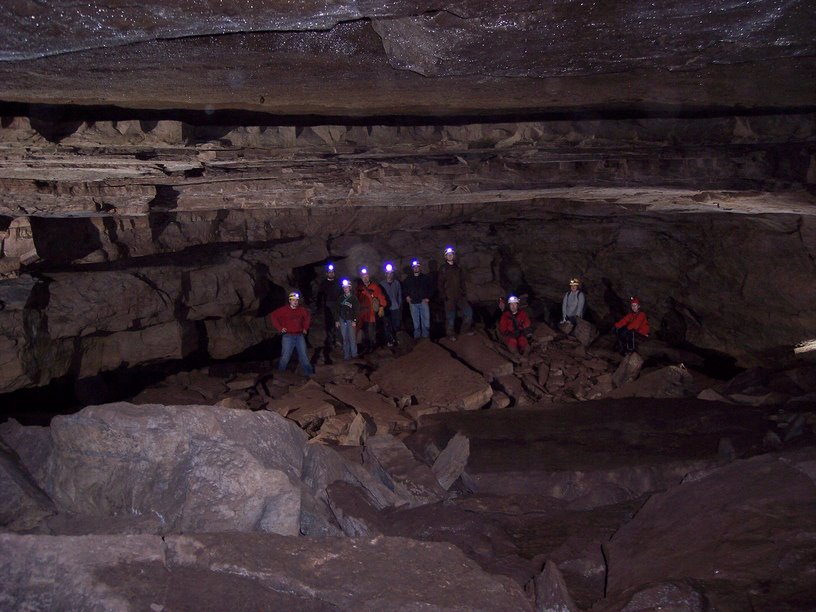
A nice group photo in the entrance room


Checking out the mud sculptures

Afterwards, we headed below to the stream passage and walked upstream to the double waterfall, which was moving a good bit of water. We took some more photos, and a few people went up the lefthand stream tunnel to check it out. The group headed back downstream, and eventually back to Halloween Hall... for some more photos.


Climbing Sharps waterfall

Since it was still early, we decided to check out the other half of the cave. We dropped down into the canyon passage to the right of Halloween Hall. This passage is an abandoned stream passage, but shortly exposes in a few small pits where the active stream is flowing directly beneath it. The stream flows from here, under the canyon passage, and eventually reappears as the top stream at the waterfall. Moving forward, you are eventually walking in the stream, but it's mostly dry travel.

After about 15 minutes, the passage opens up into a large room, Catfish Hall. As I cleared the breakdown and looked up into it, I saw a dozen lights pointed at me - I was completely surprised and couldn't figure out how our entire party had passed me and was now staring at me from the next room. It turned out to be the Pittsburgh Grotto, 11 strong, waiting there to surprise us! We mingled for a few minutes, then couldn't turn down the chance for another photo.

We're a happy family

We're a happy family - Mon Grotto, Pittsburgh Grotto meet underground

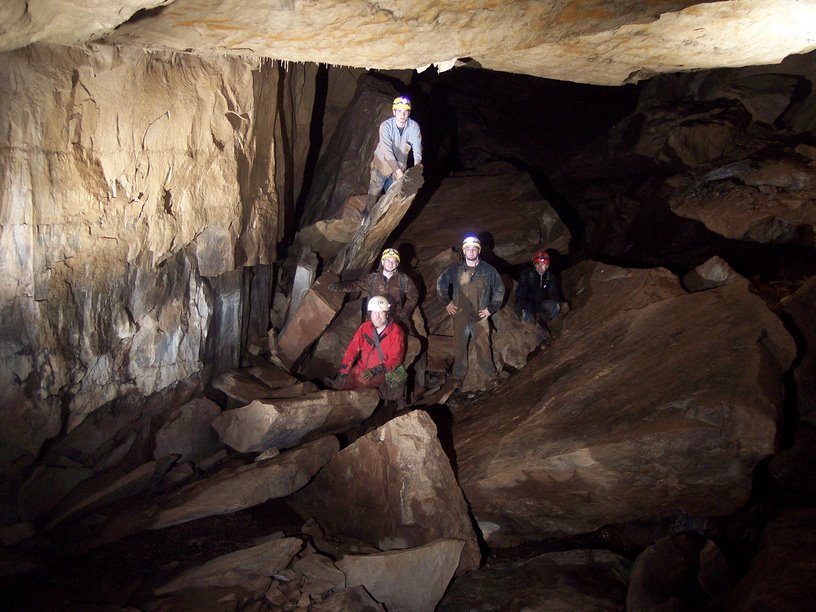
The Pittsburgh group headed back the way we'd just come, and some of our party headed out of the cave. The rest went forward, over some more very large breakdown, to find another impressively-sized room, the Z Room. Brian and I stayed here to take some more photos, while Doug and the remainder of the group explored for a bit beyond.


Lighting up the last big room

We headed back out, exited the cave to find daylight and very nice weather waiting for us.

All photos by Brian Masney

Alternate trip report: Doug McCarty, Additional photos: Mon Grotto Sharps page