Monday, June 04, 2007

[trip] More Virgin Cave in the Cheat Canyon

Nearly 30 years ago, Allen Peterson and his band of "druids" did some ridge walking on the South side of the Cheat River canyon and discovered an interesting karst spring below an old logging road. They very briefly dug on the spring before following its water downhill, leading to the discovery of Druid Cave. As Druid grew over the years to 2.3 miles in length, the spring above its entrance was forgotten... until dye tracing in 2007 showed that this spring plays a very interesting hydrological role in the Druid Cave system: it appears to be the downstream resurgence of New Years Day Cave, which appears to be hydrologically distinct from Druid Cave until this spring water flows into the Druid Cave entrance on the surface.

Today, Brian Masney and I met up with Allen Peterson and revisited this karst spring for the first time since the discovery of Druid Cave. Allen, in the area for a business trip, met me at the Pittsburgh airport and drove us down to Morgantown. After meeting up with Brian, shuttling vehicles around, and fighting with car problems, we were off to Masontown and started hiking down into the canyon at around 2:30pm.

On arrival, we immediately started digging in to the spring, which fanned out both horizontally and vertically along the hillside below a limestone headwall. I prodded at a small conduit with a crowbar, while Brian and Allen poked around some large moss-covered breakdown with water flowing from within. Allen moved several rocks aside and felt a strong, cool breeze - paydirt! We went at the area with our hand tools and found that this part of the hillside was completely composed of breakdown blocks, small rocks, and easily movable fill. Over the next several hours, we easily moved close to a ton of rock - exposing more airflow and a cave stream, and destabilizing some of the sketchier rocks on the hillside.

The cave passage visible inside was low and very wet; working conditions required sliding downhill and pulling rocks out while someone else tugged you out by your own boots. We spent some time stabilizing the lining rocks and removing most of the entrance slope. The only remaining barrier was the icy-cold soaking in very low, unknown passage. We all took turns trying to push the nasty entrance, but none of us made it on first attempt. Brian and I played rock paper scissors, and I lost, so I took a deep breath and scooped some nasty, wet, virgin cave.


Dave Riggs emerges soaked from the low, wet, newly dug cave above Druid Cave. Photo by Brian Masney.

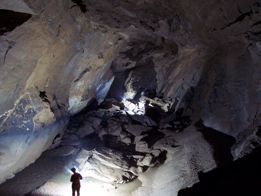
The entrance pool is a six foot wide chamber where the swiftly-moving cave stream is between two and six inches deep, and air space is one foot at the highest point. A wetsuit is needed from the very start, as the water is extremely cold and one is entirely soaked immediately.

Following the cave stream to the right, one travels parallel to the Cheat River, and distinctly up-dip in a nearly-straight line. The cave passage is never more than three feet high or wide, and is a semi-circular arching stream passage. The cave stream, while only an inch or two deep, takes up the entirety of the width of the passage in most spots, and is perched on a layer of etched black shale. I continued for what seemed like seventy-five feet, until the cave passage became small enough that I'd have had to exert real effort to continue, but the airflow and water ensure more cave beyond - so long as one has a wetsuit.


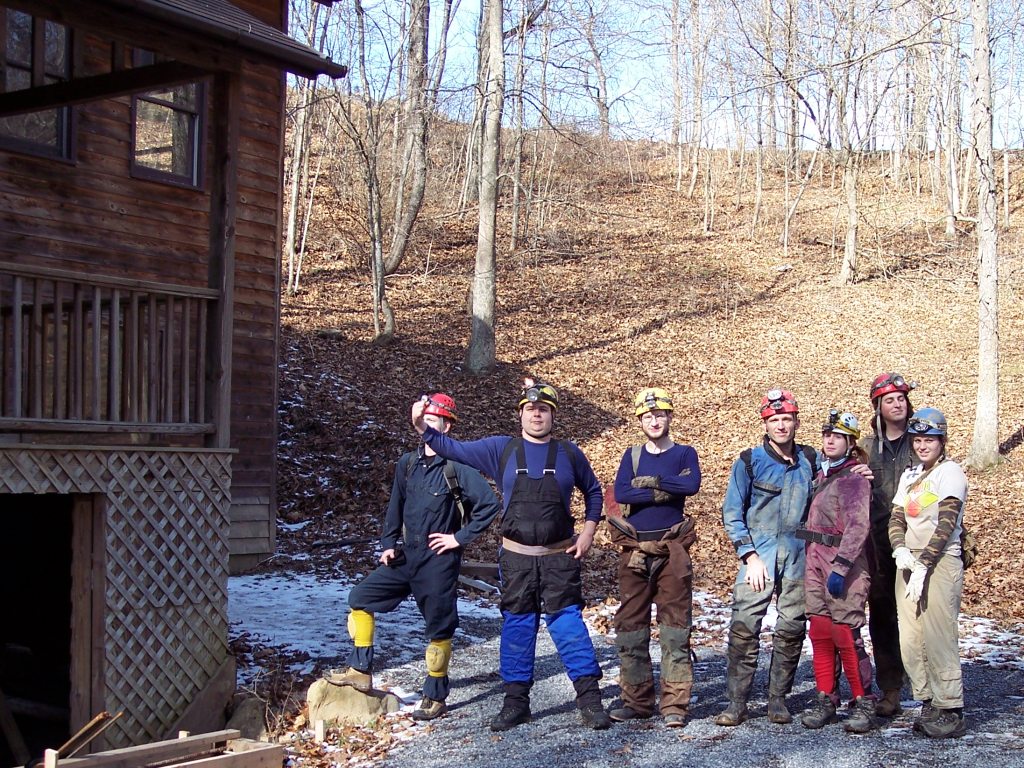
Brian Masney, Dave Riggs, and Allen Peterson at the newly dug cave entrance above Druid Cave. Photo by Brian Masney.

After all these years, the very first karst feature discovered by Druid Cave explorers finally yields virgin cave to one of its original discoverers. The dye tracing results show that this new cave should be the hydrological downstream resurgence to New Years Day Cave, and the fact that it appears to be perched on a shale bed reinforces the implication that New Years Day Cave and Druid Cave are hydrologically distinct, parallel caves.

The Druid Cave saga continues...

Saturday, May 19, 2007

[trip] Bennett Cave Survey Part 3

This month at Tucker County, we had only one survey team in Bennett Cave. Brian Masney, Josh Flaugher, and I (Dave Riggs) first surveyed the remainder of the downstream trunk passage. It meanders a bit, and the main stream juts in and out from under the wall a couple times. The ceiling gets very low - about 12 - 18 inches - and you must crawl for a few feet in the wide, shallow stream to pass it... but then it opens back up to 12 foot high trunk passage with high sediment walls. This big passage abruptly ends at a big sump pool with very slowly swirling water, depth unknown. Given the massive mounds of sediment around the pool, I suspect that even in low water (the water was relatively high today) the sump is impassable by lunged cavers. We did encounter two very large frogs here at the sump pool, hence it's dubbed name, the "Frog Pond".

We then headed back upstream to the waterfall room to knock out the lower two leads. We started from the red painted station on the ceiling under the waterfall and surveyed the left passage. This low, winding passage starts out small but opens up to crawling height shortly. Dry at first, a small stream is encountered, then old cans and bottles, a large salamander, followed by... a beautiful 15 foot high domepit. Brian did a sketchy climbup and checked a lead to the right, which he said was too tight. The water was coming from the left, and his view made it appear that attempting to push the low, wet lead would be torturous (so we didn't even try). My ability to survey backwards through this lead earned a name in my honor (which will not be uttered here).

Finally, we surveyed the right lead under the waterfall. This lead is never higher than 3 feet, but is extremely wide. It is fed by two infeeders, a too tight stream on the left, and a waterfall over frightening sandstone breakdown and surface debris from the ceiling on the right. I suspect that this right passage is fed directly from the surface stream above, while the left lead is fed from further upstream, closer to (or directly from) the garbage-filled FRO.


Bennett Cave lineplot as of May 2007

We netted about 400 feet of survey, the last of the major survey effort with the exception of the passage above the big waterfall. Several very small sections need mopped up, but these are trivial. If we can muster two survey groups next month, we should be able to complete the survey of Bennett Cave.

After meeting up with Doug McCarty and Kevin Keplinger, who had just finished surveying the small new cave on the Bennett property (which while only 35 foot long, apparently got them soaked with dripping water), we headed to CJ's for pizza. Brian and I then drove to Dolly Sods, which supposedly got a large amount of snow the previous night. We didn't find any snow, but the wind was absolutely incredible! I tested out my new Hennessy Hammock, which did an excellent job of keeping me dry in the rain and wind. In the morning, Brian and I hiked around 8 beautiful miles in excellent weather.

Monday, April 30, 2007

[trip] Spring VAR 2007

Spring VAR 2007 was in Durbin, WV, and hosted by the Frontroyal Grotto. I arrived Friday and set up camp with the WVU Student Grotto. We were celebrating the grotto's 30th birthday, having become an official grotto of the NSS in April, 1977.

Saturday morning, a group of us headed to the Elk River and planned to do Bradshaw Run Cave, but the Elk was up way too high to even bother going to the entrance. Instead, we headed over to check out Just Cave and Justrite Cave, neither of which were very interesting (Just looked too sketchy to rig). I managed to forget my real glasses, so I spent the day caving in my prescription sunglasses - with StenLight on "turbo", I never knew the difference!


Group in the sloping entrance to Just Cave. L-R: Jason Thomas, Cullen Hencke, Josh Flaugher, Dave Riggs, John Tudek. Photo by John Harman

We then headed over to Dreen Cave, rigged to a sturdy chockstone, and rappelled down to check out the lower level. While there wasn't a lot to check out where we rappelled, it was very nice looking arching passage about 30 feet tall, which led to a very nice domepit with waterfall. Everyone ascended up, then we checked out the rest of Dreen. For an easy, mainly horizontal and dry cave, Dreen is quite enjoyable.


Cullen Hencke descends into lower Dreen Cave. Photo by John Harman

We all headed back to Durbin just in time for dinner. Thanks to the Frontroyal Grotto for providing a vegetarian dinner option! After dinner, I gave a short, nervous speech, and presented our faculty advisor of 30 years, Dr. Henry Rauch, a plaque on behalf of the WVU Student Grotto. Afterward, current and alumni members from every generation mingled, told old war stories, and ate birthday cake provided by Frontroyal - thanks again!


The plaque that we presented to Dr. Rauch. Photo by John Harman


WVU Student Grotto alumni celebrating our 30th birthday. Front: L-R: Melissa Parker, Quincy, Jason Thomas, Kirby, Tom Hay, Katherine Gurtler, Jessica Morning; Middle: L-R: Greg Adamson?, Bob Livingston?, Henry Rauch, John Harman, Dr. Garth Dixon, Scott Maphis, John Tudek, Dave Riggs, Jeff Bray, Mary Schmidt, Bill Balfour, ?; Back: L-R: Cullen Hencke, Josh Flaugher, Ryan Ellers, Kristen Matak, Brian Masney; Photo by Tim Bleech

On Sunday, everyone packed up, then went caving with Grotto alumni Scott Maphis and Tom Hay. We visited Tub Cave, which is located in an absolutely enormous sinkhole, and consists of one giant room. It was impressive to see, and the area is very beautiful. On the way back to the car, the local landowner stopped us and asked if we'd like to visit a small cave on his property. We crossed the street and popped into McKeever's Cellar, a cave perhaps 40 feet long with two entrances, and wooden bins where a farmer used to literally use the cave as a cellar.


Great shot of the big room in Tub Cave by John Harman


Tom's daughter Beryl in McKeevers Cellar. Photo by John Harman

It was one of the best VARs that I've attended, many thanks to the Frontroyal Grotto and to the members and alumni of the WVU Student Grotto for making it a great time!

See also: John Harman's photos of Spring VAR, Just, Justrite, and Dreen Caves, Tub Cave and McKeever's Cellar; Brian Masney's photos of Spring VAR 2007

Monday, April 23, 2007

[trip] Simmons-Mingo Rescue

At 4:40AM, the morning of Monday, April 23, 2007, I got a call from Doug Moore that there was a cave rescue callout at Simmons-Mingo Cave. Brian Masney, Josh Flaugher, and I rounded up our gear and headed South. We arrived at the historic entrance and were instructed to go to the Zarathrusa entrance and do a through trip, sweeping the cave for 5 lost cavers who had attempted a through trip from the same entrance on Saturday morning.

We arrived at the Zarathrusa entrance where Jason Thomas was waiting, but no one else was present. As we got geared up, a group of cavers and a communication team arrived and prepared to lay down telephone line behind us. We were in cave by about 10:30am and started doing whistle calls and checking side leads as we headed in the direction of the other end of the cave.

Eventually we made it to a steep muddy slope leading to an enormous lake. We were unable to find a way around, and the map that we were provided offered no help. We decided that the most prudent action would be to head back to the comm team as fast as possible for better directions. We made it all the way back to the entrance without encountering them - a hint that something was up.

Everyone climbed out the nasty Zarathrusa entrance, and there was nobody topside on the Dry Branch. We jumped in our vehicle and drove to the historic entrance, where we were very happily greeted. The lost cavers had been found within 1000 feet of the historic entrance, less than half an hour after we'd gone underground. Four of the cavers were already topside under their own power, and the fifth was currently being hauled out on a litter. The rescue crew was elated to see us because they'd expected that they'd have to wait there for us to complete the through trip.

By afternoon, the rescue operation had become extremely organized and more than 60 people had showed up to volunteer help. Three of the rescued cavers were taken to a hospital via ambulance, and another was flown via helicopter to be treated for mild hypothermia. All five returned home safely that night.

See also: Simmons-Mingo rescue on the NSS discussion forum, photos by Brian Masney

Saturday, April 21, 2007

[trip] Bennett Cave Survey Part 2

Tucker County Speleological Survey headed back into Bennett Cave this month. Our team - Dave Riggs, Brian Masney, John Harman, and Josh Flaugher - headed in to survey above the waterfall. I scaled the questionably-old rope first, getting soaked in the process. One bye one, everyone climbed the 20ft waterfall, each being drenched with cold water in the process. At the top, we found a small chamber with a sketchy 15ft chimney rigged with a length of webbing. Brian scaled up it and examined the passage above - another waterfall climb. Already chilled, we decided to abort the waterfall survey until next month (with wetsuits and extra dry polypro).

We then headed downstream and surveyed about 150ft of muddy passage, (almost) killing the left side lead. Doug McCarty's team surveyed from the big room into the waterfall room, then under and towards the left.


Bennett Cave lineplot as of April, 2007.

After exiting the cave, a local took us to a "hole" which had recently opened on the property. We walked over with him, and I went in to check out this new virgin cave. It consists of a single 40ft gothic-shaped passage, with nice vertical fluting. The ceiling is between 10 and 20ft tall, but the cave is never more than 4ft wide. With a bit of digging in the floor, it may be pushed further - but no air movement was noted.


Dave Riggs exiting the small new Tucker County cave. Photo by Brian Masney.

Finally, John, Josh, and I did a surface survey from the trash-filled FRO to an insurgance point where the stream drops 10ft down enlarged joints, to the Bennett Cave entrance.

Bennett Cave is now just over 800ft long. Remaining leads are the downstream main passage, under waterfall right passage (low and wide), and whatever wet passage exists above the waterfall.

Bennett Cave is located on private property and is CLOSED for recreational caving. The Tucker County Speleological Survey has been granted permission explicitly to survey this cave.

See also: Brian Masney's photos

Tuesday, March 27, 2007

[trip] Pendleton Caving - Sinnett, Sites

In celebration of Spring Break, John Harman, Josh Flaugher, Cullen Hencke, and Dave Riggs spent a few days caving in Pendleton County, WV.

On Tuesday, March 27, we met up at John's house in Germany Valley (Schoolhouse Cave is literally in his front yard) and were joined by Chris Eleyette. The five of us took a trip into Sinnett-Thorn Mountain Cave, which is gated and requires access through the Sinnett-Thorn Cave Conservancy. John, Josh, and Cullen have recently made several trips into Sinnett-Thorn, but it was Chris's and my first visit.

We went into the gated Sinnett Cave entrance and followed the main passage, which mostly consisted of very dry canyon passage. We then climbed up the spiraling Silo into the massive, strike-oriented big room. The big room is completely floored with breakdown, and has a steeply sloping ceiling following the dip of the limestone. The walls of the big room are lined with fossil brachiopods, meaning that it is likely formed in the Corriganville member of the Helderberg (similar to Cave Mountain Cave). This long room has a very impressive volume, which hints at some large passage hidden beneath the breakdown.


CMI-sponsored professional caver Cullen Hencke climbs The Silo in Sinnett Cave. Photo: John Harman.

After playing around in the big room for a bit, we attempted the Thorn Mountain Cave connection. A climb up from the big room leads to a wet and muddy uphill crawl - which some kind soul has floored with plastic - with the most powerful cave wind that I've ever felt. A low and wide, upsloping room leads to a tiny triangular crawlway about 15 feet long. This passage supposedly leads to the Sinnett Annex, but neither John nor I could fit, thus nixing our Thorn Mountain connection attempt.

We attempted to push two other tight passages near the big room, looking for a rumoured "lost" connection to the waterfall, but were unsuccessful. We then climbed back down the silo and hopped down into a stream canyon, going upstream to the waterfall room. After much searching, we located the passage up at waterfall level, which requires a very low crawl after a sketchy climb. After a full day caving, we headed back out through more crawls than I remembered on the way in.


Josh, Cullen, Chris, John, and Dave outside the gated entrance to Sinnett-Thorn Mountain Cave. Photo: John Harman.

After a warm dinner in the sprawling metropolis of Franklin (home of CMI!), we headed back to John's and camped on his beautiful property in Germany Valley. We did a bit of covert rappelling that night, and on Wednesday morning got a tour of some of the incredible sinkholes and karst features of Germany Valley.


Midnight rappelling in a secret Germany Valley pit. Photo: John Harman.

We headed back to Franklin and met up with Jessica Morning, then headed to Sites Cave. A brisk hike up the mountain on a well-marked trail leads to the gaping entrance to Sites Cave, a very popular vertical cave since the 1950's. We rigged from a tree high up on the hill, which gave a nice free drop down the entrance pit. I rappelled down first, with rope bag in tow - it repeatedly twisted around the rope on the way down, causing much fumbling and cursing. While Sites is nearly 300 foot deep, the rappel is about 180 feet interrupted several times by sloping dirt ledges - the deepest purely vertical drop is just over 100 feet. The sloping passages appear to roughly follow the steep dip of the Helderberg.


Dave Riggs on rappel at Sites Cave. Photo: John Harman.

At the bottom is a nice strike-oriented chamber with lots of formations and many sleeping bats. We had heard that a dead deer at the bottom was cause for alarm, but the smell had worked its way out by the time we visited the cave. The climb back out took plenty of time, and the weather turned slightly worse - occasionally spitting light rain on those waiting at the top. The dreaded "finger" only grabbed the rope once or twice, but nobody got stuck by it. It turned out to be a great trip, and we followed it up with another (better) meal in Franklin, then parted ways. I made it back to Morgantown by midnight and slept like a brick after two full days of caving.


Cullen Hencke and Jessica Morning in the decorated lower room of Sites Cave. Photo: John Harman.

Saturday, March 24, 2007

[trip] Cook Pot

On Saturday, March 24, I headed down to southern Pocahontas County to help John Chenger on a bat project. We were to find and descend Cook Pot, recording temperature and humidity data while looking for evidence of past bat roosting in the cave.

Doug Medville's description of the cave entrance didn't help us much - it took over an hour to find the cave, which was just a few hundred feet from the road. The entrance to Cook Pot is located where a small spring-fed blind valley meets the main stream. The spring's water flows down over a small limestone waterfall, and the cave's entrance is located in the outcropping. The narrow, sloping entrance crevice opens to a narrow pit about 30 foot deep, with a smaller 10 foot pit offset from a ledge. Continuing through an opening at floor level, a 20 foot pit is reached. A 150 foot rope may be used to drop this entrance series by using a bolt which is placed at the top of this lower pit. The remains of old wooden ladders are still located in these entrance pits, presumably from the early 1970's.

From the next room, a low stream crawl for about 100 feet leads to the top of a waterfall going into a 45 foot pit. Here one chimneys out over narrow canyon passage at ceiling level for about 30 feet to a platform where rigging allows a free drop into the middle of the beautiful pit. The slot at the top of this drop can be a bit tight.


Dave Riggs ascends Cook Pot's big pit.

From the bottom of the big pit, we headed downstream following a wildly meandering cave stream until it dropped out from under us at the 15 foot Fork Falls. Continuing forward for a few tens of feet, the passage intersects another cave stream flowing down from another waterfall, Spoon Falls. We followed this stream downstream as 40 foot tall canyon passage intersected with many domepits and interrupted with several huge breakdown blocks.


Dave Riggs posing in front of Spoon Falls.

After returning to the big pit, we went upstream for a few hundred feet, where the passage consists of very tall, dry, gothic arched hallways. We then headed back to the surface, and were surprised to find that we'd spent 5.5 hours in cave. Cook Pot has over a mile of surveyed passage, and we only saw a small amount of it - despite being off the beaten path, it was a very enjoyable vertical cave.

See also: more of John Chenger's Cook Pot photos.

All photos copyright John Chenger.

Saturday, March 17, 2007

[trip] Bennett Cave Survey

This month, the Tucker County Speleological Survey had a huge turnout - Kevin Keplinger, Brian Masney, Dave Riggs, Justin Keplinger, Doug Bell, Jesse Miller, Josh Flaugher, John Harman and Doug McCarty all showed up even though the roads were covered with snow and ice. Thanks to the incredible hospitality of the landowners, we were permitted to survey Bennett Cave, and were given a warm, dry place to change clothes - thanks very much!

The entrance to Bennett Cave is a six foot deep crevice opening in a small limestone outcrop in the middle of a valley wall. A muddy talus slope leads down into a large entrance room with dimensions roughly 45x25 feet, and a height of up to 20 feet. A free-climbable twisted pit leads down to a lower room of about 10 foot in diameter with a 15 foot ceiling. The entrance slope and climbdown are both littered with broken glass, discarded small appliances, and animal remains. A 100' rope rigged outside the entrance serves as a useful handline for exploring the cave.


Josh Flaugher in the entrance to Bennett Cave. Photo by Brian Masney.

From this lower room, a very tight pinch in the floor leads to a low, wide crawl, which then opens up into breakdown into another large room. This breakdown-floored room is 45x35 feet, and up to 25 feet tall. To the right, one may climb down through breakdown to a chamber featuring a pair of 20 foot tall waterfalls. One waterfall is rigged with rope, and has going passage at the top. The waterfall room appears to be formed along a small fault or angular unconformity. To the left, one may follow the trunk stream passage, up to 8 foot in diameter, for over 200 feet. The floor is lined with large cobbles and the stream meanders back and forth, eventually disappearing under the right wall. Two high leads go in opposite directions at the end of the dry stream passage, as another small infeeder joins the passage.


Brian Masney, Johsh Flaugher, John Harman, and Jesse Miller at the base of the left waterfall. Photo by John Harman.


Right waterfall showing possible fault from upper left to lower right. Photo by John Harman.

We split up into two survey teams, with one team surveying the upper passages, and my team starting below. Our (lower) team thought that we had gotten the short end of the stick as we surveyed through a steep, tight pinch and into very low passage. However, as soon as we broke into the lower big room and saw the two waterfalls and booming trunk passage, we were all completely elated! Combined, our groups surveyed over 400 feet of passage in the two levels of the cave. We will return next month to complete the survey, mopping up the two leads at the end of the stream passage and the lead atop the waterfall.


Josh Flaugher in the lower stream trunk. Photo by Brian Masney.

Bennett Cave is located on private property and is CLOSED for recreational caving. The Tucker County Speleological Survey has been granted permission explicitly to survey this cave.

See also: Brian Masney's photos, John Harman's photos.

Wednesday, March 14, 2007

[trip] Beaverhole Upper

Rather than suffer through another grotto meeting on a perfectly good Wednesday night, the WVU Student Grotto opted to go caving instead. Gayle Suppa, Jessica Powell, John Neubert, Tom Lilly, Chris Eleyette, John Harman, Kyle McMillan, and Dave Riggs met at 5:30pm and carpooled down into the North side of the Cheat Canyon. John Harman seemed disappointed that the old logging road didn't give his Jeep enough of a workout.

We had excellent weather, and thanks to the new daylight savings change, we had plenty of daylight. After gearing up and hiking a bit down the road, we snapped some obligatory photos and then headed into Beaverhole Upper Cave. Half the group decided to take the high-and-dry big upper passages, while the other half preferred the low-and-wet nasty sewer passage instead - to each his own, I suppose. After exploring the back half of the cave, our groups finally met back up in one of the larger junction rooms.

Making its debut on this trip was Kyle's new "cave radio", a low frequency wireless radio from the mining industry. This beast is the size of a full backpack, weighs probably 25lbs, and has a 4 foot long PVC antenna which needs to be carried with it. Several poor souls got volunteered to help carry this radio into the cave for its maiden broadcast. Unfortunately, we were never able to successfully carry a transmission from within the cave, and then Kyle made a "terminal adjustment" to the antenna, abruptly ending the experiment.

We headed back outside, collected a bag of trash from around the cave, and then climbed back up to the road. On our way back up, a sketchy-looking Jeep came down the road at us - Rich Finley and Jason Thomas had arrived just in time for dinner. Rich tried to impress us by doing a terrifying hill climb, but John one-upped him by doing the climb in reverse! We made it back to Morgantown by 10:30pm and had a pancake feast at IHOP. It was a very fun evening trip - much better than a grotto meeting!

Monday, March 12, 2007

Bowden Breakdown

According to Kevin Frick and Jesse Miller, there's some new breakdown in the entrance room of Bowden Cave, one of the most frequently-visited caves in the state. Thanks to Jesse for the following photos. Note for scale that he is 6' 4" tall.


All photos by Jesse Miller

Sunday, March 11, 2007

Cheat Canyon Dye Retrieval Pt. 2

Today John Tudek, Tom Lilly, and Dave Riggs hiked into the Cheat Canyon to pull dye traps and examine some interesting karst features along the way. We met at 10:30am in Morgantown, then drove out to the NYDC-area landowner's house. We immediately set out for what would be a beautiful day - "warm" temperatures in the high 40's, and not a single cloud in the sky all day. The sun had nearly melted all the snow in the canyon by midday.

We hiked down from his farm, then headed upstream all the way to the Downstream Dig, stopping only briefly for a few photos on the way. The cave itself was still iced shut, so we quickly retrieved and replaced the dye trap in the spring and moved on.


Tom and John examine Hanging Falls, upstream from the Downstream Dig.

The next stop was the twin springs at river level. When we finally arrived, the springs themselves were completely underwater and not visible from the shore. Unfortunately, the Cheat was much higher during the last two weeks - at least three feet higher than normal level, as evidenced by debris lodged in trees and shrubbery close to the shore. Among the debris were our two dye traps - one left up on the shoreline, one was tangled and hanging up in the trees! We retrieved and replaced the traps, this time tying rocks to the string to serve as anchors. Hopefully they were in the water when (if) the dye passed through the springs.


Dye trap suspended about three feet in the air after a flood event.

We also spent some time enlarging the sucking hole located about 30 feet above these springs. We made short work of several hundred pounds of fractured limestone, exposing a larger hole which still howls air into it. This hole may have some serious promise. We hope to return soon when the ground is less frozen and digging is easier.


The enlarged sucking hole with glove for scale.

We then made the long hike back out of the canyon, arriving at the rim of the gorge at 4:30pm. Now that all the dye traps have been collected, we're all waiting impatiently for the results - hopefully we'll prove a hydrological connection between New Years Day Cave and Druid Cave!

See also: more photos by Dave Riggs

Friday, March 09, 2007

[trip] Druid Cave Dye Retrieval

To take advantage of the 50-degree heatwave today, Brian Masney and I decided that we'd head into Druid Cave to recover the dye traps place there just two weeks ago. We met at about 2:30pm on Friday afternoon, then carpooled in Brian's truck to the Cheat Canyon. Morgantown was very recently hit with a sudden blast of snow, so we were worried about the amount remaining in the canyon despite the temporary warm temperatures.

Brian drove his truck down the start of the Druid road, and we slid down the entire length of the first hill - yikes! Brian hopped out, quickly installed chains on his front tires, then tested things out by running back up and down the hill - a huge improvement! Despite several inches of snow, he drove us all the way down to the cave without incident.

We geared up and made it to the Druid Cave entrance at about 4pm. We were "greeted" by an odd bat, who flew out the main entrance and did some laps around the area for a bit, before we'd even entered the cave. The two of us headed into the cave, rigged the main drop, and rappelled the first drop with the welcome help of a webbing etrier.

Not wanting to make an expedition of the trip, we wasted no time in moving through the cave. We barreled through the high & dry canyon passage, then rappelled the second drop. Both armed with foot ascenders, we made short work of the waterfall ascent (which did not seem to have increased in flow at all, even with a large amount of snow melt this week) and the climb-ups.

At the walking stream passage, Brian stayed behind to try and photograph the sleeping bats, while I headed forward to the Big Nasty to retrieve the dye traps. I made sure not to handle the dye traps themselves, but rather only the strings, and I individually double-bagged and labeled each one. They were hauled out of the cave in a hard plastic container. Like the previous waterfall, the Big Nasty did not appear to have a higher water level than it did two weeks prior.

The trip back out was business-like and without incident. Except for the "special" bat when we arrived, none of the others were disturbed by our visit. Amazingly, we managed to do the entire trip in just under 2.5 hours, catching a glimpse of daylight as we exited the cave. Brian hauled us back up and out of the canyon, and we were back in town and eating a great dinner at Black Bear by 8:15pm.

We plan to hike back into the canyon this Sunday to pull the rest of the dye traps and investigate some interesting new karst features that were discovered recently.

Monday, February 05, 2007

[trip] Bowden Cave

Kathrine Gurtler, Tom Lilly, Chris Eleyette, and Dave Riggs took a Monday evening trip into Bowden Cave. We drove down from Morgantown, meeting Chris in Elkins, and arrived at the cave around 6:45pm. We took the standard tourist trip in -- up the main trunk passage to the breakdown room, climbed up to see the dome, then headed up the chilly watercourse to the gate. On the way back out, we decided to do a bit of exploring, and followed the stream entirely rather than taking the dry, upper paleo passage. This route is not recommended! We turned around and took the standard way back out.

The wise ones changed clothes in the mouth of the cave, the rest ran for the vehicles and changed in record time -- my cave suit managed to freeze solid before I could peel it off. We had a suprisingly good dinner in Elkins and met a friend of Katherine's who had actually helped build the gate in Bowden and is a family friend of Will White. We made it back to Morgantown at about 12:45, after a very enjoyable caving trip.

Wednesday, January 31, 2007

Ridge walking in the Cheat Canyon

On late Friday afternoon, Jan 19th, 2007, Brian Masney, Mary Schmidt and Dave Riggs went to the Cheat Canyon to do some ridge walking for the Druid/New Years Day Cave system. Dave Riggs has been analyzing the line plots between the Druid and New Years Day Cave systems and something does not look right. It shows the end of the New Years Day Caves and Druid Caves several hundred feet away from each other. We decided to do some ridge walking of our own to see if we could figure out where the problem was.

Brian drove his truck down the Druid Road and parked it right above the cave entrance. We went to the main Druid entrance and got an updated GPS coordinate of the cave entrance. We wanted to make sure that was not the issue. Later on, we found out that the new coordinate matched almost exactly with the original coordinate of the cave. We are also confident with the New Years Day Cave coordinate since it is placed correctly on the topo map.

We hiked across the mountain from the Druid entrance and followed the limestone outcrop. There is a side lead in Druid that has less than a mile of passage in it. Several years ago when Greg Springer and company surveyed the side lead, they found a dead end passage where roots were in the ceiling and some surface debris was nearby. Dave used his GIS program to calculate the GPS coordinate of that location. We hiked around that area in the limestone but we did not find anything interesting. We didn't spend much time on that since that wouldn't help us get any closer to the deeper sections of Druid and New Years Day Caves.

Our next goal was to locate a spot where some surface water goes into New Years Day Cave. This is near the far back of the current survey and it was aptly named the Disney Ride by Dave Riggs. You have to crawl through a small slot near the ceiling where the water just pours onto you from the ceiling. Dave used his GIS program to determine where that should have been on the surface. We hiked to that coordinate and it was located in a stream bed with some water flowing in it. We followed the stream bed slightly downhill and we found a spot where all of the water disappeared underground. There was no viable place to dig. According to the GIS program, we would have to go down about 100' to get to New Years Day Cave.

After that, we hiked over towards New Years Day Cave. One of the GIS maps that Dave has is an elevation model of the state that was generated by a satellite. There is a depression in the main stream further downstream from New Years Day Cave. We wanted to check that out. There are a few waterfalls there and you can see some large cliffs on the other side of the hill. Unfortunately, they are on the opposite side of Lick Run compared to Druid. We did not have time to check these out since we had to be back in Morgantown.

Later that night, Dave looked at the data for New Years Day Cave and Druid Caves. Since we had an accurate elevation of the Druid Cave entrance, Dave was able to enter that data in his GIS program. The vertical line plots between the two caves are still in line with each other, with New Years Day Cave slightly higher than Druid. This is what we want.

The horizontal distance between the end of the two surveys is still pretty far off. New Years Day Cave has over 3,300' of surveyed passage and Druid Cave has 2.31 miles of surveyed passage. There are no loops to close and these are very long surveys. The likelihood of error in the two surveys is very high. A slight error in one survey shot would be compounded in later shots. With that in mind, Dave used the updated elevation of the Druid entrance to determine where the 3D cave passage should lie in the hillside. Our current data shows the end of Druid Cave sticking 70' out of the hillside. If the passage is moved to the left, then it shows the cave passage in the hillside where it should be. This puts it very close to New Years Day Cave.

This is good news. I hope that I have the same enthusiasm the next time I am surveying in New Years Day Cave. I am anxious to get back in there so that we can finish this project.

Saturday, January 27, 2007

[trip] Scott Hollow

On Saturday, Jan 27, 2007, Ben Mirable, Brian Masney, Mary Schmidt, Kyle McMillan, Ryan Ellers, Ashley ??, and Dave Riggs took a tourist trip into Scott Hollow Cave, in Monroe County WV.

Most of us met up on Friday night at beautiful Casa Mirable, near Pipestem Resort State Park. While Ben had plenty of room for everyone, I chose to sleep outside in the freezing cold to escape Kyle's mammoth snoring. In the morning, we caravaned down to Monroe County.


Kyle, Strongman Ben, Dave, Brian, Mary, Ryan, and Ashley outside the entrance house of Scott Hollow Cave.

The entrance to Scott Hollow Cave is located inside a locked house, which is located in the bottom of a giant sinkhole. The owner, Mike Dore, has put a lot of work into the cave since it was discovered in 1984, and also gives paid wild cave tours there. Exploration and surveying are still ongoing, and the cave is currently at almost 30 miles - 3rd longest in WV and 13th longest in the US. A metal culvert with rebar rungs leads about 25' down a windy tunnel into walking stream passage. The limestone dips steeply here, and the passage goes downdip along the Hillsdale Limestone / Maccrady Shale contact, losing over 400' of elevation very quickly.

Within 10 minutes of entering the cave, we somehow managed to become separated from Brian and Mary. Luckily, we managed to cross paths at the Junction Room, where several smaller passages intersect. The group from there continued on until we reached our first destination, Mystic River.


Trunk passage in Scott Hollow's Mystic River. Note the high water mark on the left wall.

Mystic River is a massive trunk passage which appears to be up to 50' wide and up to 75' tall in places, and parallels the strike of the syncline. It appears to be stratigraphically-higher in the Greenbrier (lower Pickaway?), while lower in elevation than the entrance passages (which were in the bottom of the Greenbrier, the blue Sinks Grove and Hillsdale). The water level was in some spots merely inches deep, but for several hundreds of yards we were wading in waist-deep, icy cold water! While the current wasn't terribly strong, the water was deep enough to occlude underwater obstacles like rocks and potholes. The amount of water flowing through there was impressive enough, but to marvel at the amount of water that formed this passage (and hinted at by the high water mark) was mind-blowing! I'm told that this huge passage is itself over 4 miles long, but 1.5 miles are only accessible by sump diving.

We took a left turn at a very large fork and arrived at a beautiful 4' tall double waterfall. As the underground river breaches a layer of chert, it drops abruptly through the limestone; it breaches the chert about 10' upstream as a mid-river sinkhole, with whitewater pouring in from all sides. The sight is quite impressive.


Kyle at the double waterfall.

We continued on to the beginning of a section called Iron City, which consisted of a huge hall floored with breakdown and rubble. Our original plan was to attempt a trip to Kansas, but we'd eaten up too much time on the way. We headed back the way we'd come, wading through the waist-deep water, then climbing up the seemingly-endless breakdown hill as we hiked back updip towards the entrance. The climb back out the access culvert seemed twice as long after 7 hours underground.

It was a pleasant surprise to find warm, autumn-like weather waiting for us on the surface, and we were even treated to a lunar halo. After changing clothes, our filthy group headed to the town of Pickaway for some excellent pizza and dessert at the Pizza Barn - highly recommended if you're in the area!

All photos are ©2007 Brian Masney

Access to Scott Hollow Cave is restricted to experienced cavers, who have been NSS members for over a year, and are at least 18 years old.